Sunday, 05 August 2007 Jefferson-Clay Loop, New Hampshire
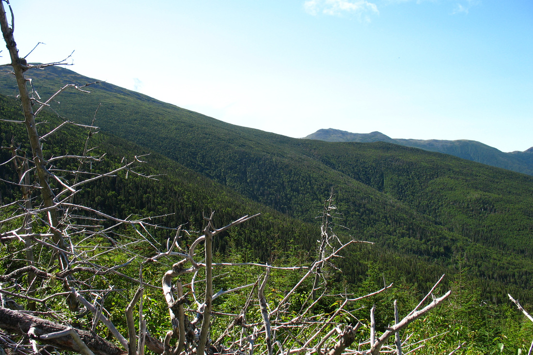
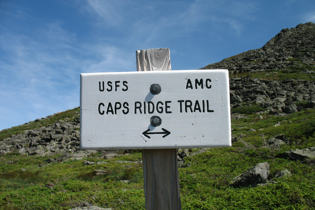
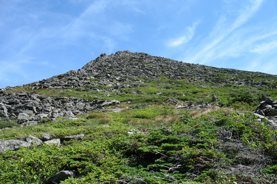
After a long stretch of hot, humid, and generally manky weather I was surprised on Saturday afternoon the next day's forecast was for clear skies, dry air, and high temps in the lower 70s. It was a day that I would need to get high early and stay high as long as possible. The plan was obvious: a trip up the Ridge of the Caps to the northern Presidentials. This route would get me above tree line in an hour's hiking and once up there I would have numerous options for open ridge walking. I'd been up the Caps Ridge several times before and it is one of my most favourite trails
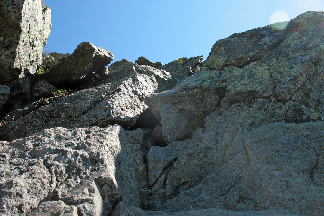
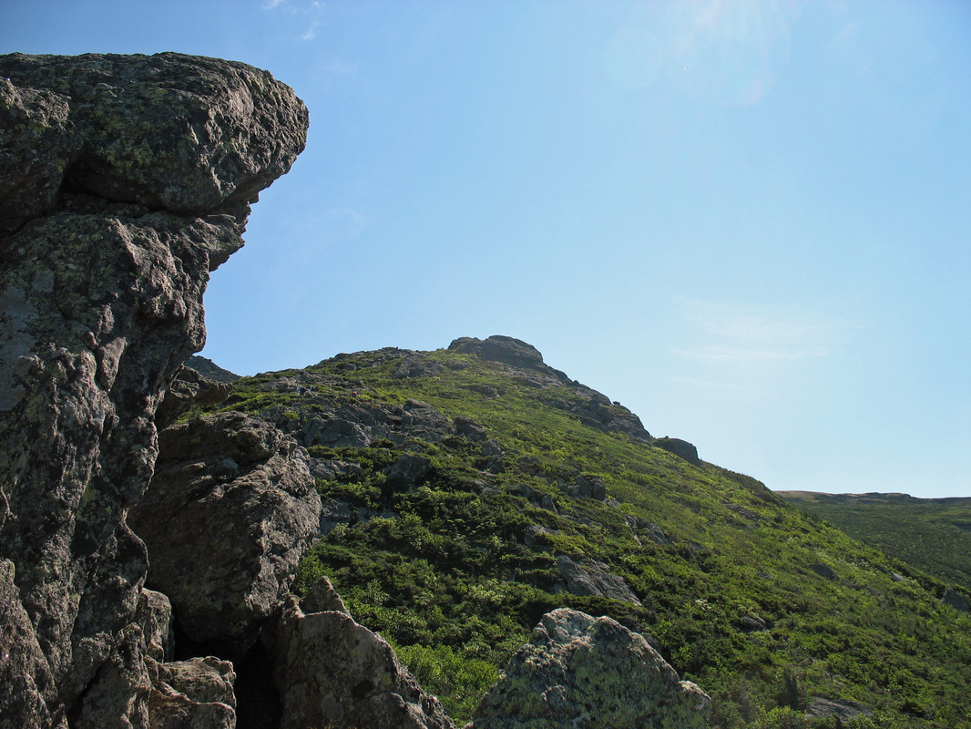
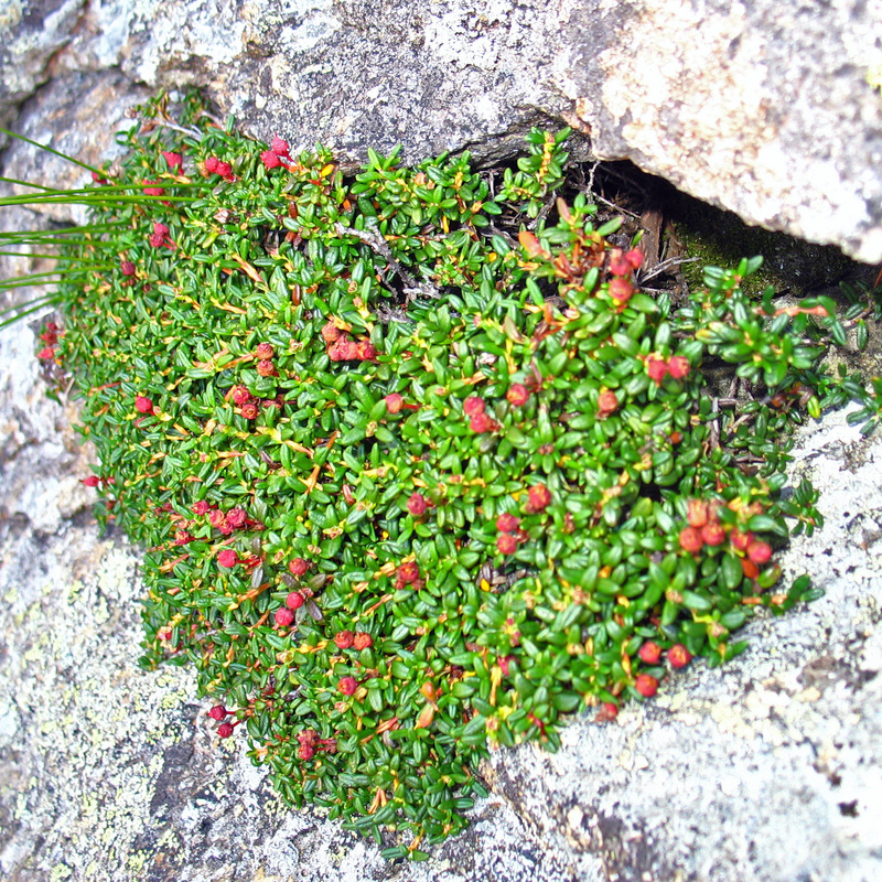
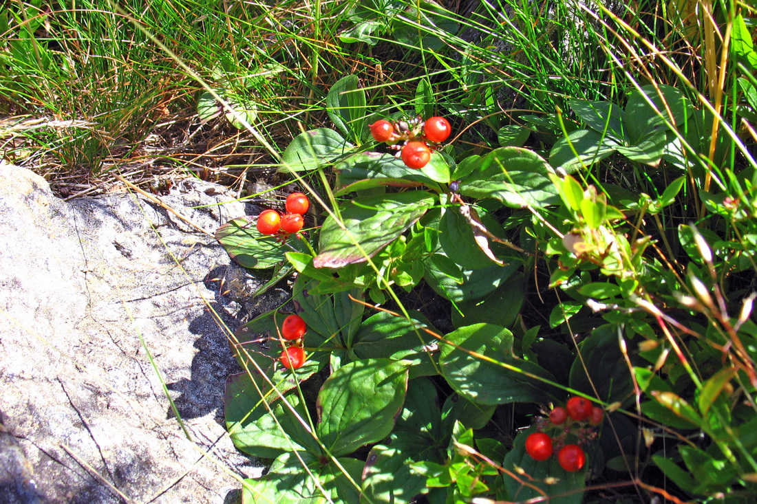
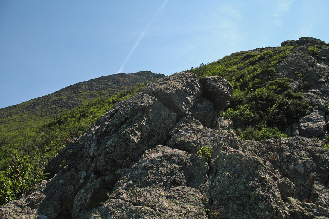
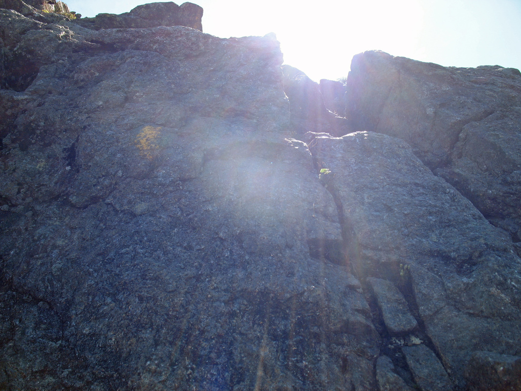
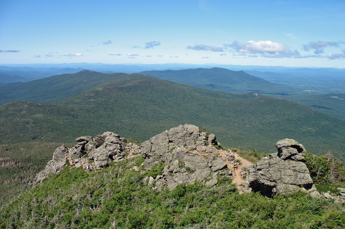
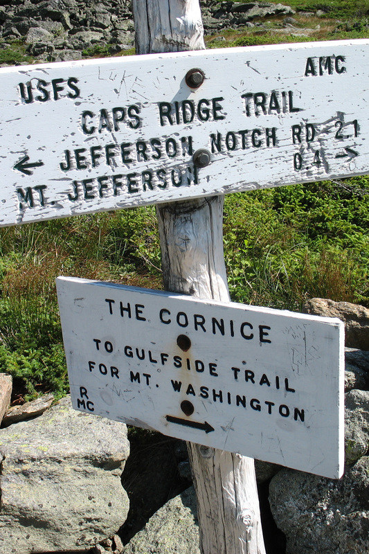
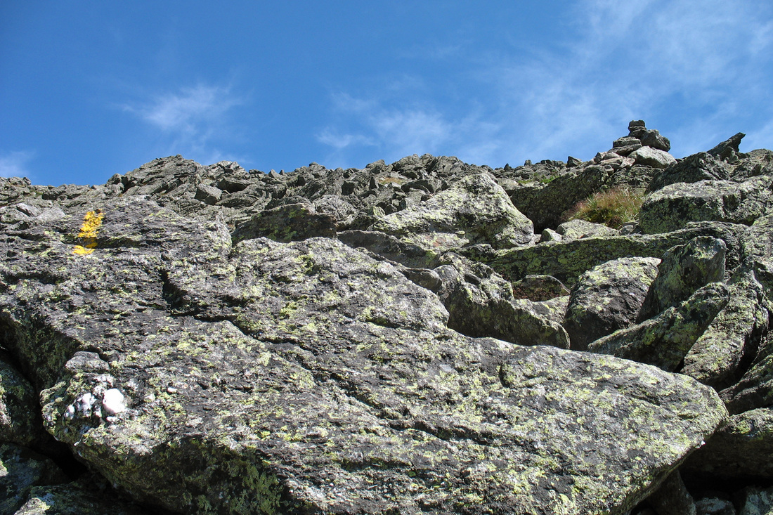
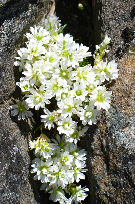
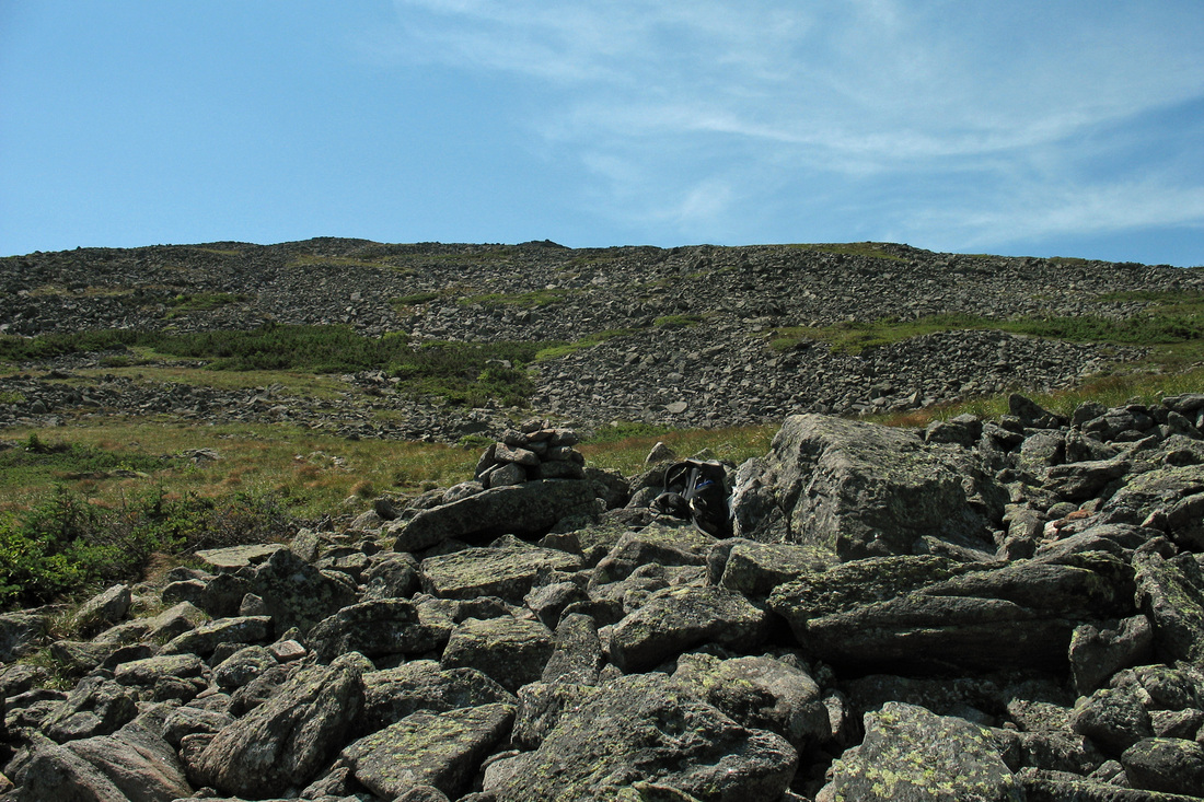
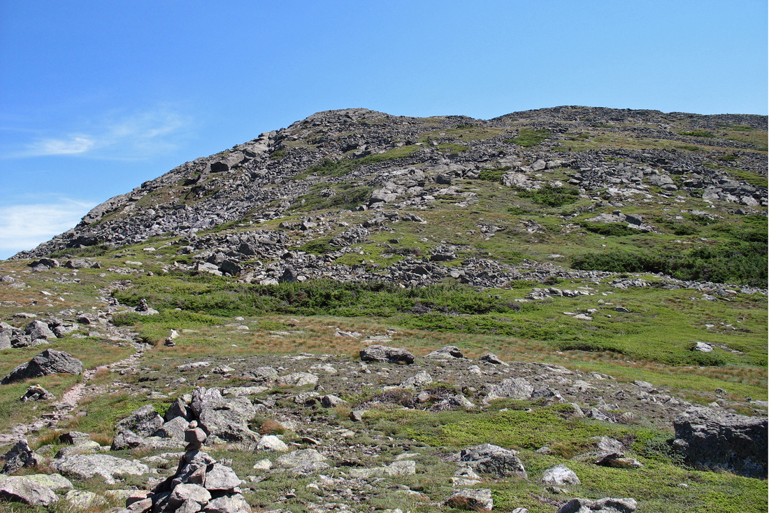
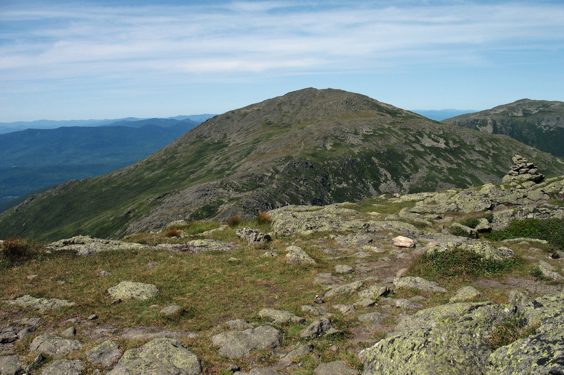
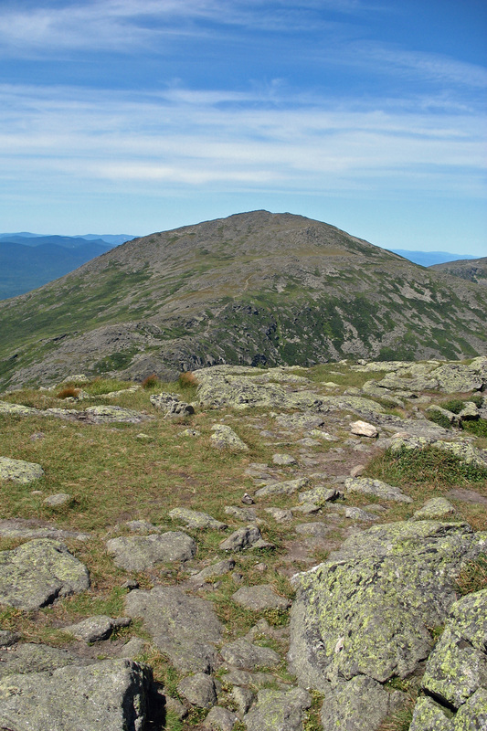
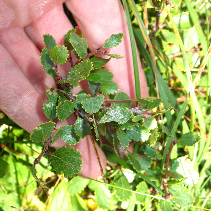
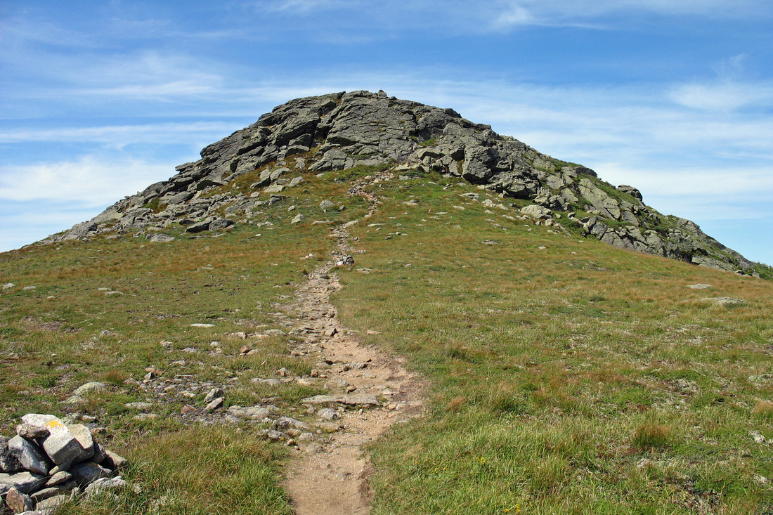
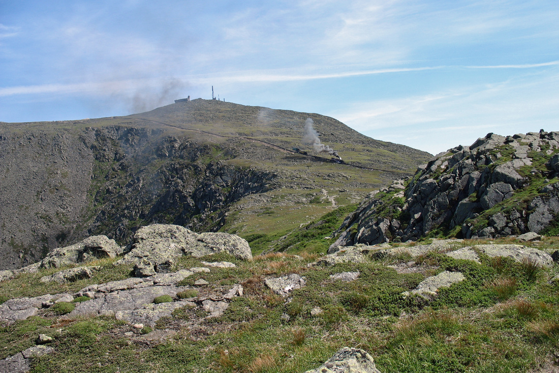
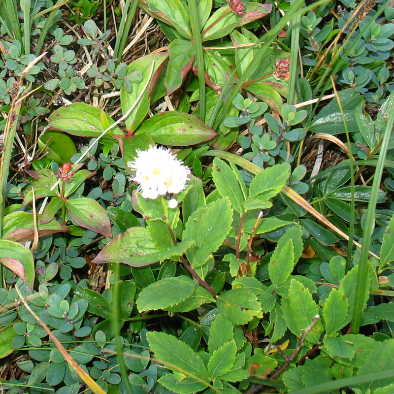
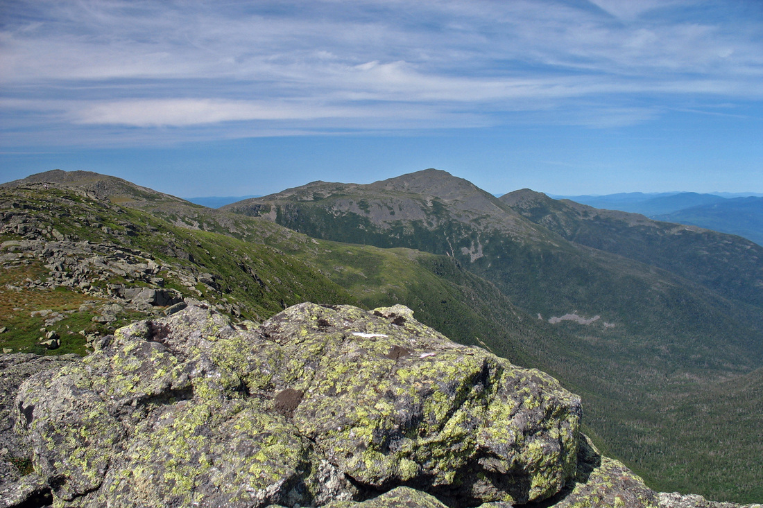
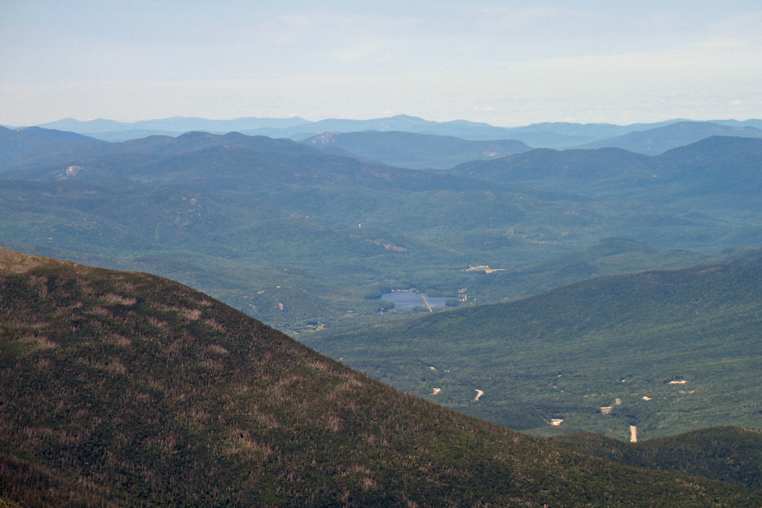
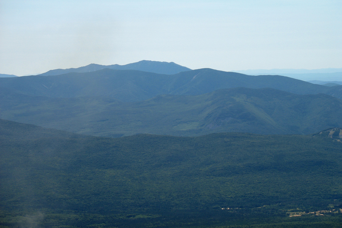
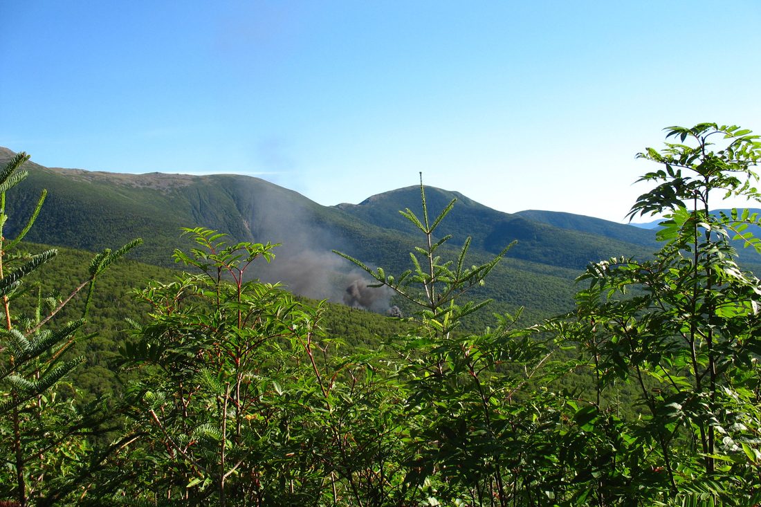
I set out from Jefferson Notch at 9:15 with the plan of bypassing Jefferson since I'd visited it many times before. I would take the Cornice north to the Ridge and head over to Mt. Clay which is reputed to have outstanding views and, because it is not a "list peak", not much in the way of crowds. The first mile of the Caps Ridge Trail rises easily through the woods and opens at an outcrop with great views where I'd planned to take my first break. Unfortunately some butt-smoking slob had already stationed himself there and was polluting the air. I told him what I thought of his cigarettes as I pushed on, back into the scrub. I passed the junction with The Link almost immediately after and knew the trail would soon be opening up for good. Indeed, within minutes I was at another small clearing where I could take a drink while surveying the southern Presidentials. I didn't linger too long because I was looking forward to the Caps, a series of ledgy knobs that involve some hand-over-foot scrambling and are generally a lot of fun. Arriving at the first, I stowed my hiking poles on my pack in order to free up my hands, and clabbered on up. From the top of this Cap I enjoyed my first 360-degree view. I looked back over the low ridge I'd ascended so far, and then up ahead at what I'd be climbing in the next few minutes. Nestled among the many rocks were a variety of plants. Many, like Alpine Azalea and Bunchberry, had already flowered and were showing their fruit. As I gained elevation I got ever-improving views of Mt. Clay and the summit of Jefferson began to be visible. I continued climbing into the morning sun, stopping frequently to admire the scenery and look back over the progress I'd made. After a time I came to the junction of the Cornice and the Caps Ridge Trail. It was here that I had expected to pick up the Cornice as it slabs south around Jefferson, bringing me closer to Mt. Clay. But Jefferson looked so close, and I could think of no good reason not to take the scenic route on this day. So I remained on the Caps Ridge, although the Caps were behind me now. The trail proceeded up a rocky slope and its precise route was hard to determine in some places. As I approached the summit the wind picked up and I started to get chilly. I encountered an interesting little plant growing in a gap between boulders. It's probably a Mountain Sandwort but the flowers seemed to have way too many petals. I gained the peak 2.5 hours after I began my hike and found a couple dozen other folks enjoying the rewards of their climb. I found an unoccupied rock out of the wind to eat some lunch. After sufficiently topping off the fuel tank and resting I packed up. Conditions hadn't deteriorated in the least and seemed, in fact, to be getting even better. In the interest of maximising my tree line experience I decided to head south to Mt. Clay by going north. As soon as I stepped out from behind my rocky windbreak, however, it was clear I needed my sweater.
Pack back off. Dig sweater out from very bottom of pack. Sweater on. Pack back on.
Feeling cozier I followed the Jefferson Loop toward Mt. Adams. The rocky descent took some time and I rewarmed quickly. Sweater off.
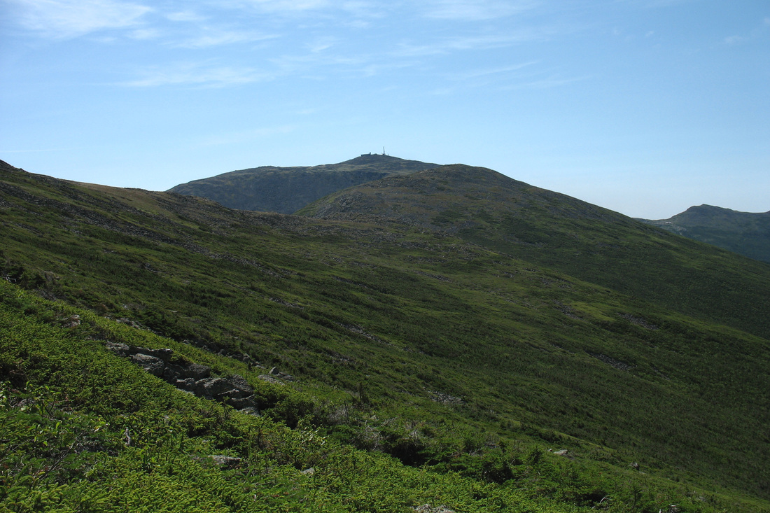
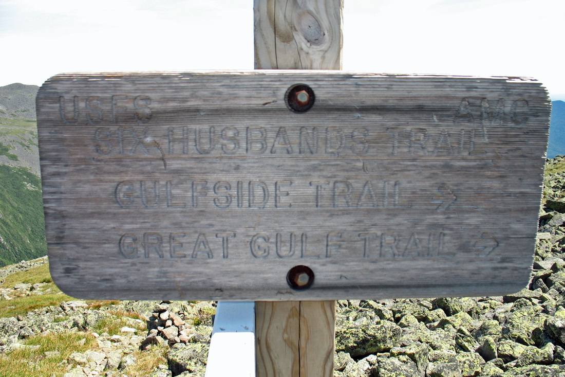
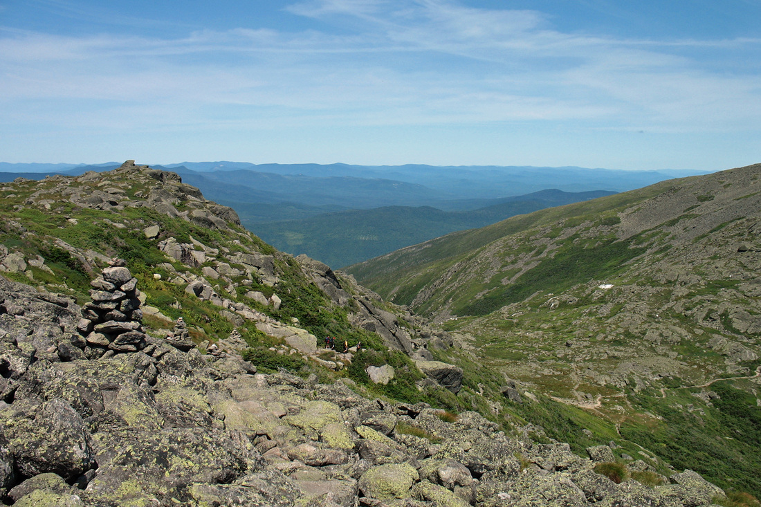
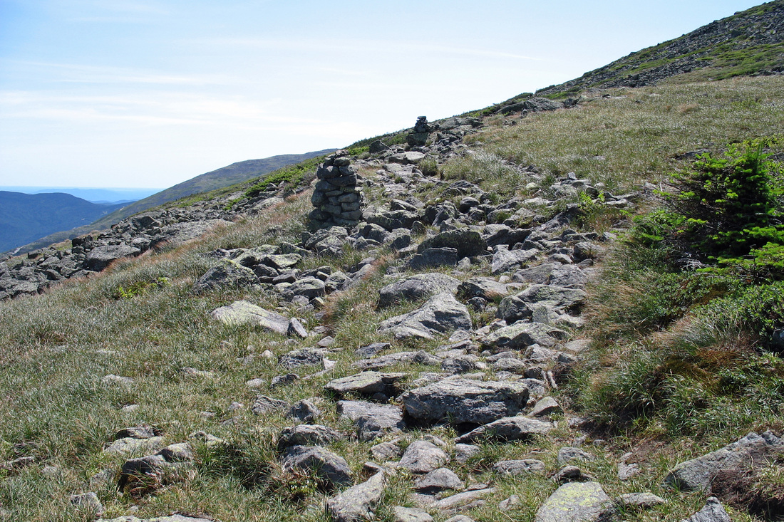
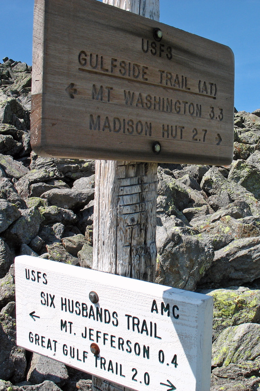
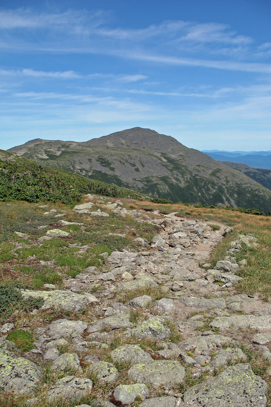
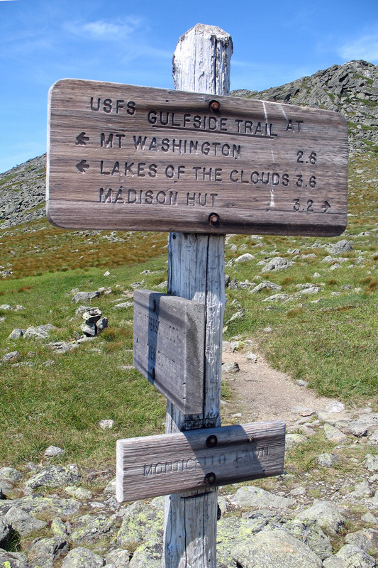
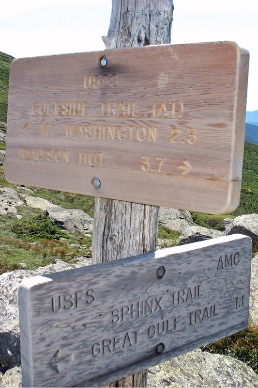
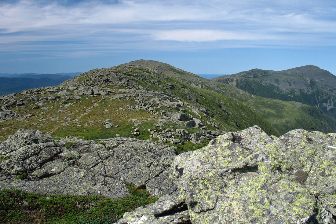
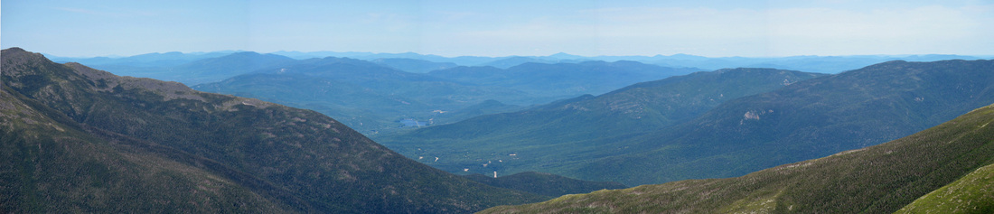
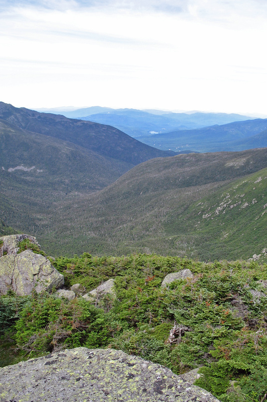
I eventually reached the junction with the Gulfside Trail which runs the ridge of the northern Pressies. From here I had interesting views back up to Mt. Jefferson, north to Edmands Col and Mt. Adams, and east to the Carters. I headed south on the Gulfside, roughly following a contour around Jefferson. Shortly I crossed at the Six Husbands Trail, a steepity steep route ascending a "knee" of Jefferson from the Great Gulf. The trail has quite a reputation which was supported by some young boys I met at the junction who had just come up that way. They had tales of a "scary" trail with ladders that didn't just go up...they hung back into thin air. Sounds like a trail I'm game to try, but perhaps not solo, and definitely not going down. An hour after leaving the summit I arrived at one of my favourite places: Monticello Lawn. This sunny, grassy plateau lies south of and just below the summit of Jeff. Mt. Adams was growing more distant as I continued south along the Gulfside Trail. Nearing Sphinx Col some good views of the Carters and Ball Crag were available over the Great Gulf and the wind picked up as it was funneled through the gap between Mt's Jefferson and Clay. The Sphinx Trail branched east passing between two ledges before dropping into the Gulf. Sweater on.
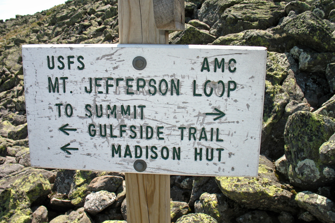
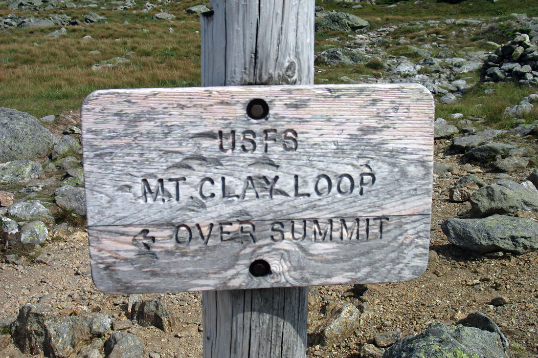
Within minutes I reached the Clay Loop junction. This loop runs up and over Mt. Clay while the Gulfside runs along its western flank. The two rejoin just north of the Clay summit. The Loop climbed steadily southward over solid footing, requiring a little more exertion on my part. Sweater off.
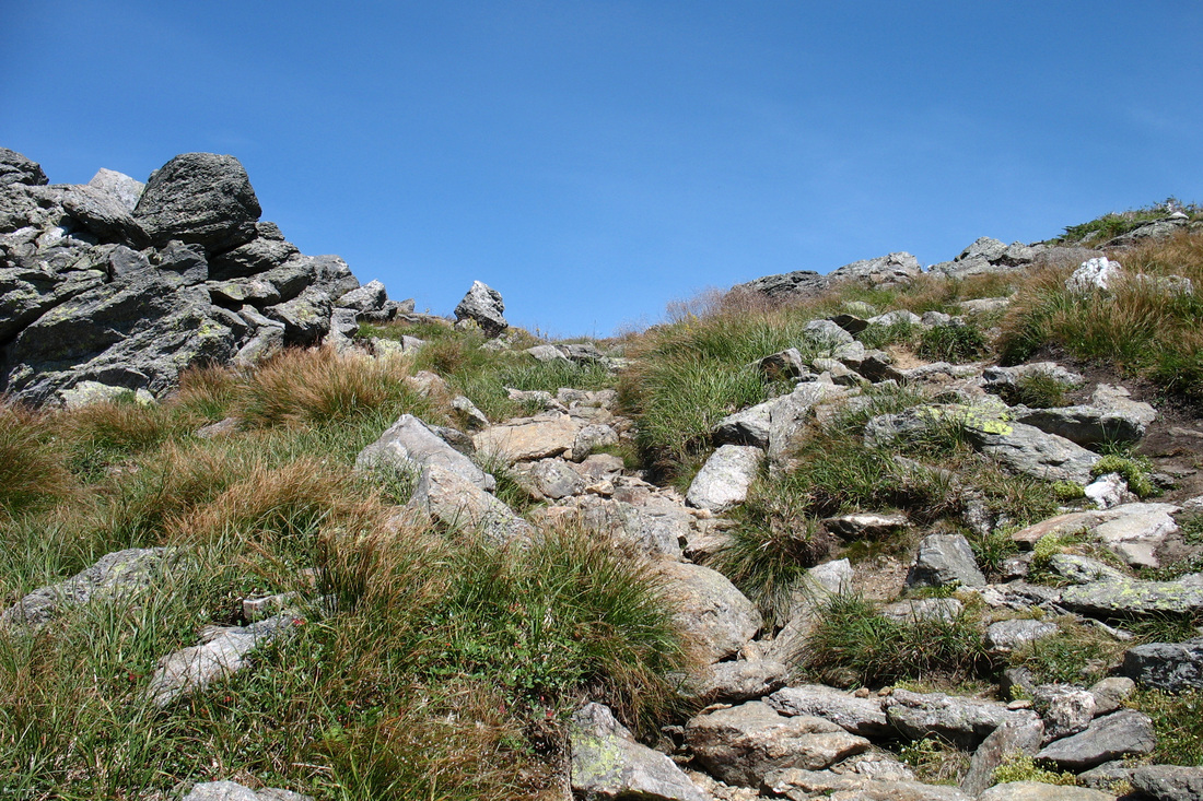
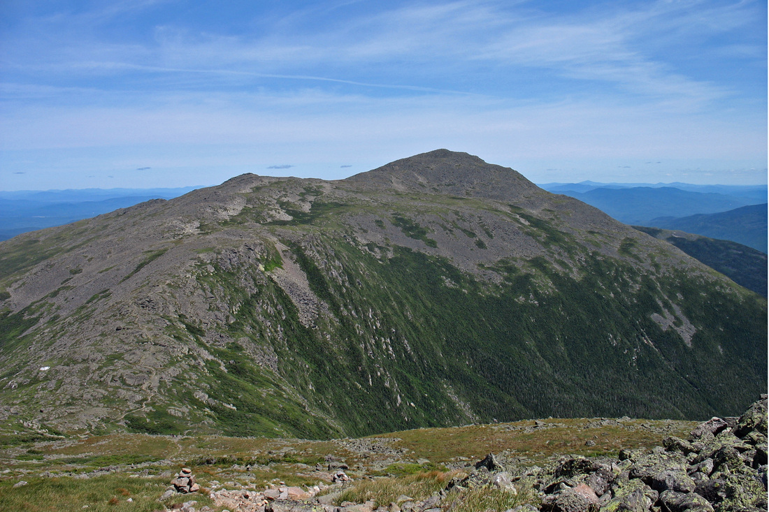
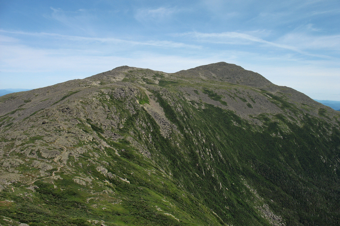
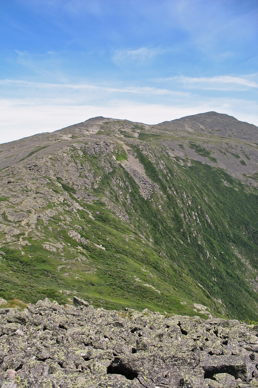
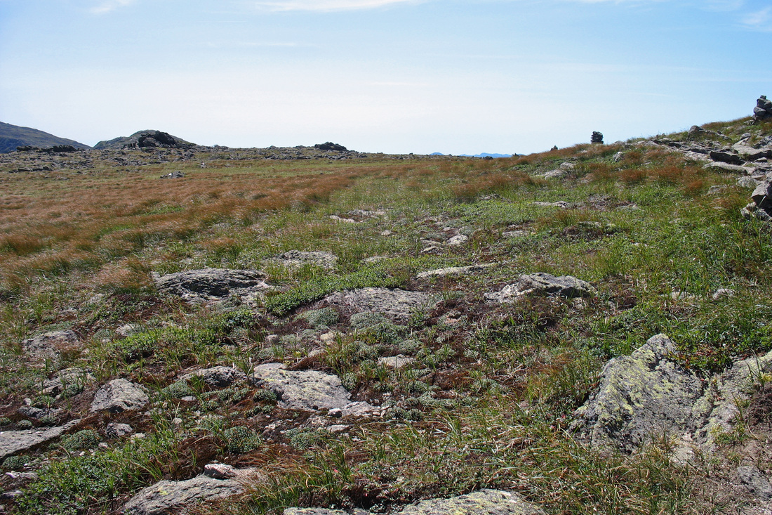
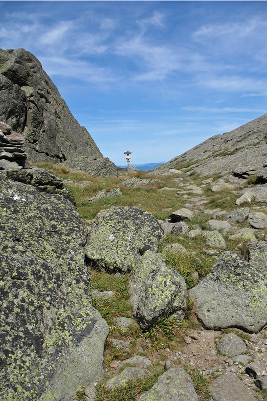
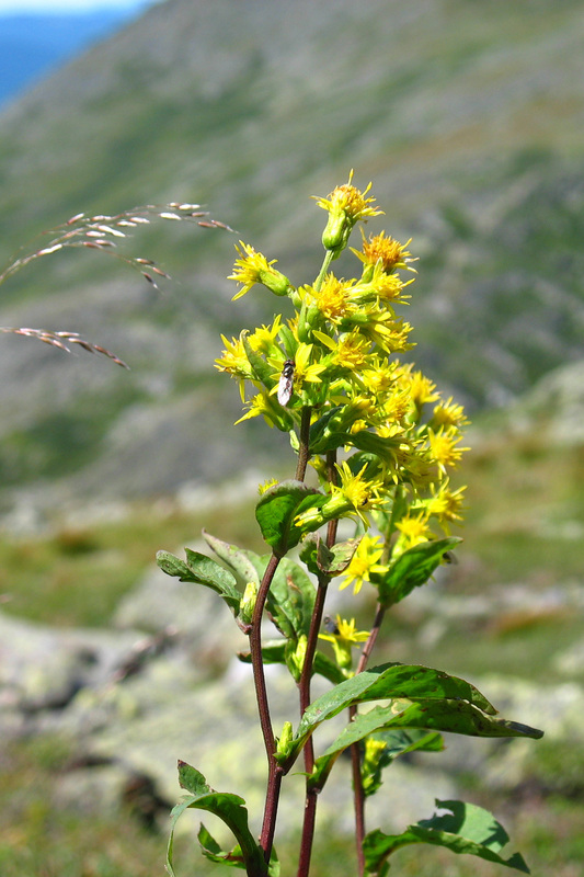
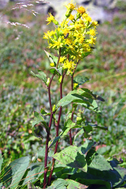
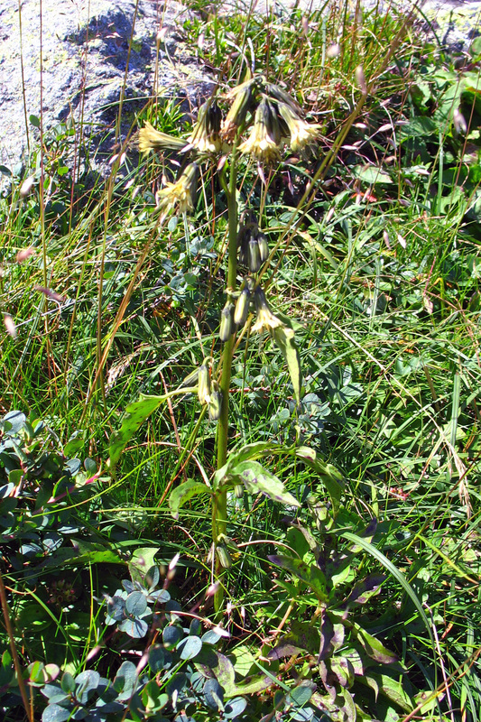
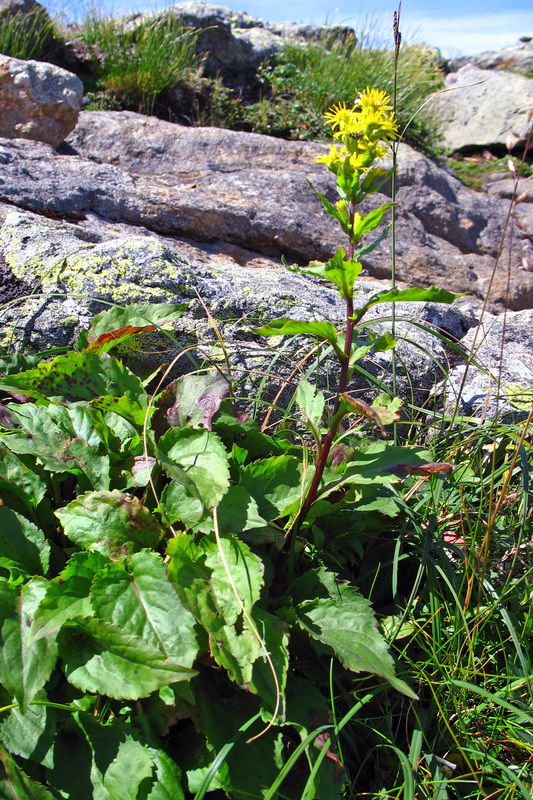
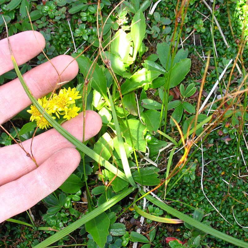
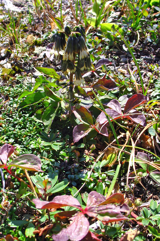
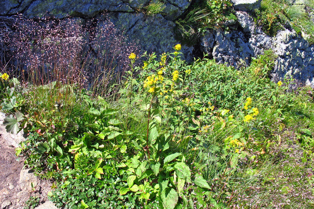
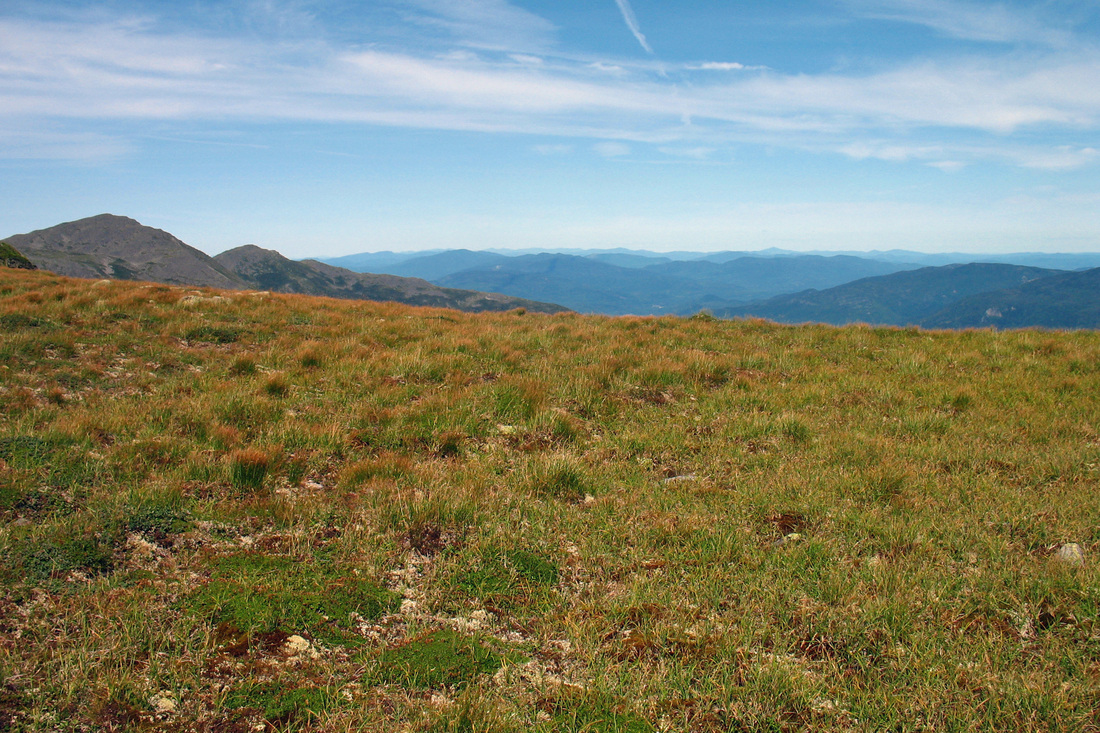
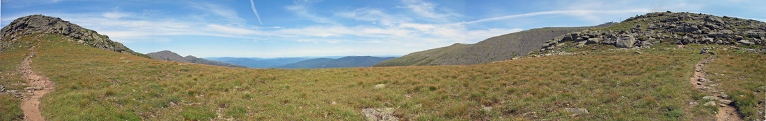
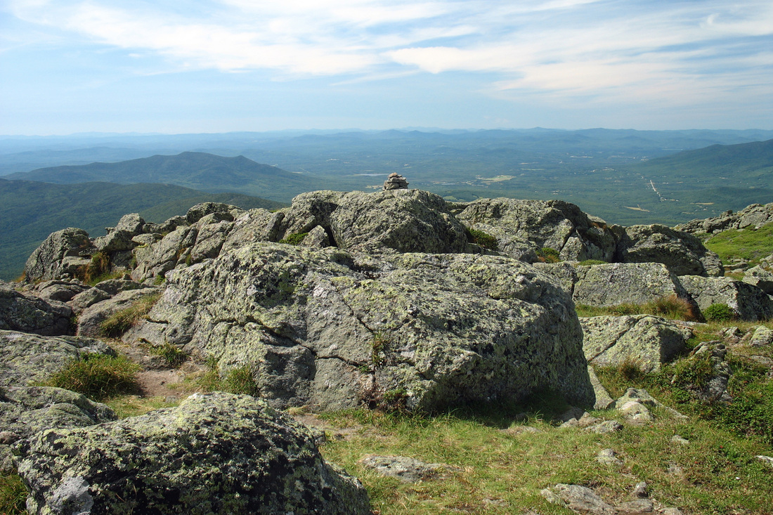
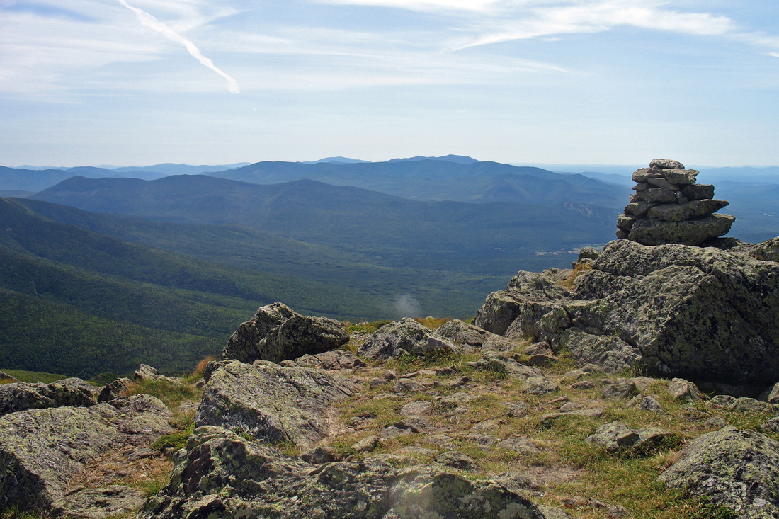
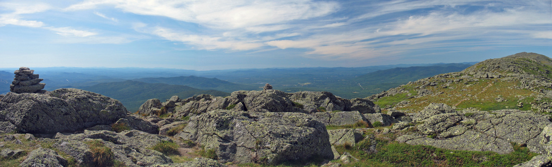
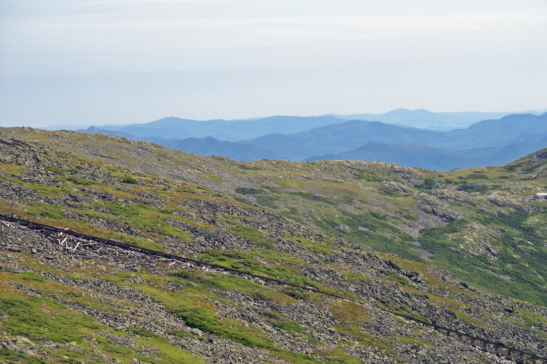
I began to move through a variety of plant communities as I distanced myself from Jefferson. One particularly abundant plant was Large-leaved Goldenrod. The summit of Mt. Clay is a longish ridge with a few bumps. From the first bump it was hard to tell which was the highest. Wandering along the ridge I observed Low Rattlesnakeroot in flower, a lot more Large-leaved Goldenrod, tiny little Dwarf Birch, Alpine Goldenrod which is also very small, and a few other Low Rattlesnakeroot. There were so many other types of foliage and gone-by flowers that I've determined a return trip in the spring is necessary to catch these "gardens" in full bloom. A very minor col separates the north summit ridge of Clay from a south knob. As I descended to it I passed a nice patch of mixed plants with plenty of Goldenrod and an odd Mountain Avens still in flower. I enjoyed the scenery from the col, whose flat meadow provided a nice foreground for panoramic views east and west. I gained the south knob of Clay, with its close-up view of Mt. Washington, and nested on a flat rock for another lunch break. Sweater on.
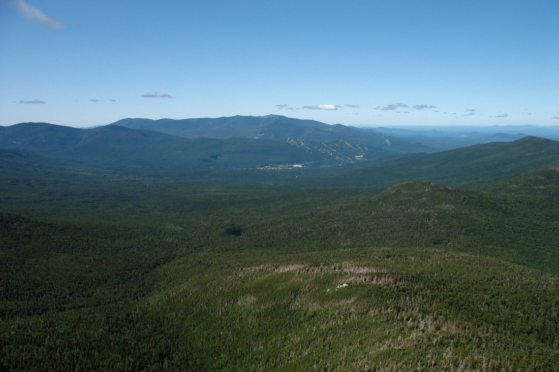
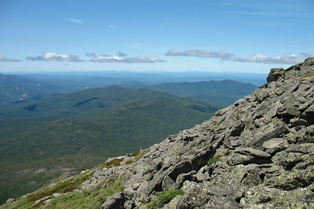
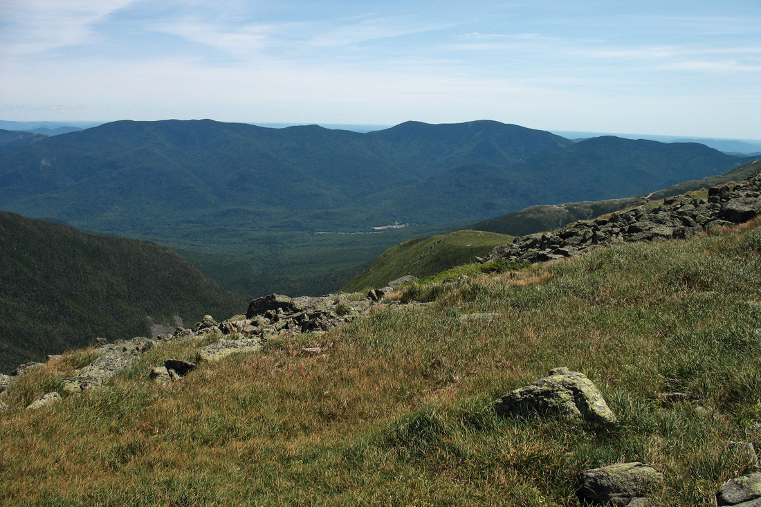
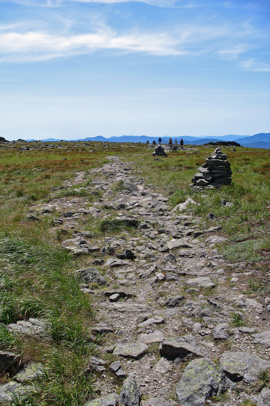
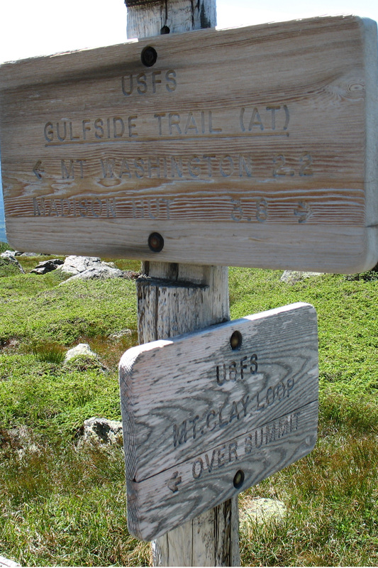
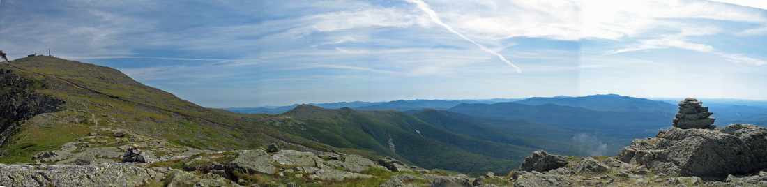
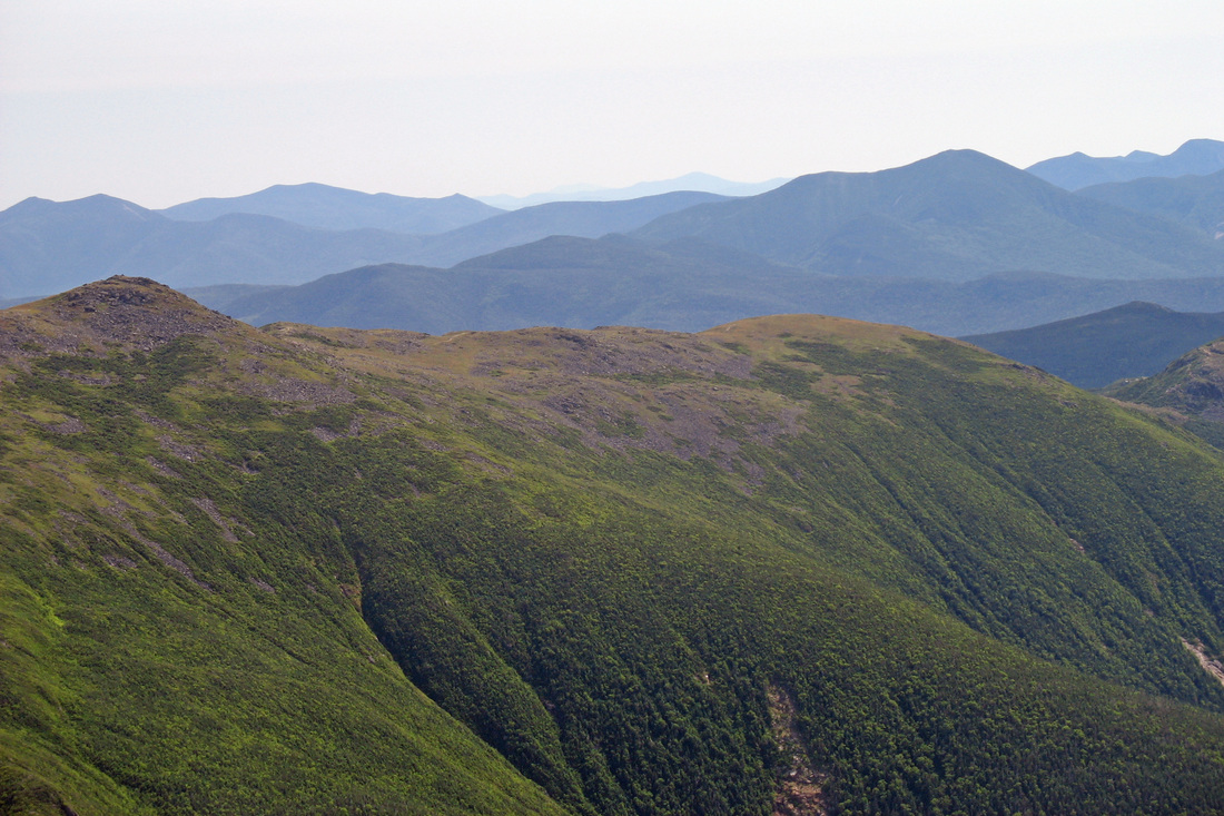
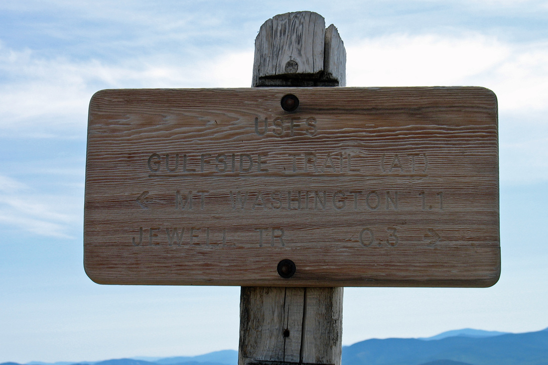
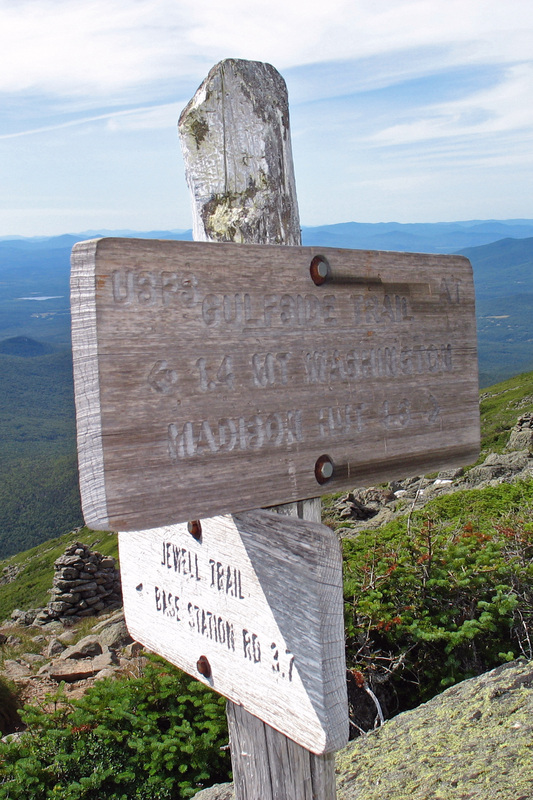
While I ate lunch and made gatorade I absorbed the views in all directions. I almost made myself dizzy, spinning around on my lunch rock in an effort to take it all in. I particularly fancied the Jefferson-Adams-Madison grouping to the northeast. The view south was also fine and I could just pick out Mt. Monadnock on the horizon, 105 miles away. To the southwest the horizon was dominated by the Franconia Ridge and Mt. Moosilauke, with Tom-Field-Willey in the foreground and the Bond-Twin range in between. The northwest view overlooked the town of Twin Mountain with Vermont peaks visible on the horizon. Over the Great Gulf were Moriah and many Maine peaks. In addition to extensive mountain views, the Clay Loop provides an interesting perspective into the Gulf. I regained the Gulfside Trail not far south from my lunch spot and headed north on it to the Jewell Trail which I followed down a long open ridge toward the Cog base station. Even this little bit of elevation loss cut the wind considerably. Sweater off.
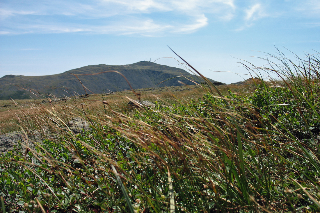
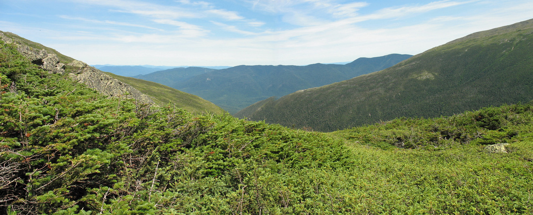
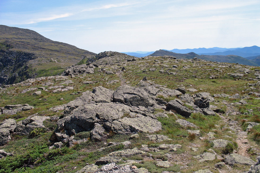
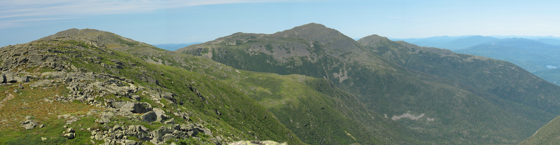
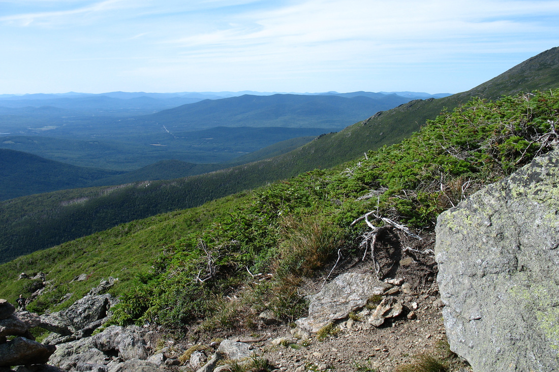
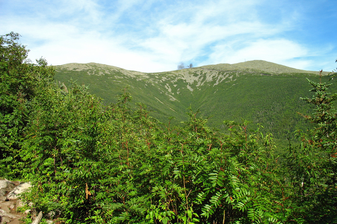
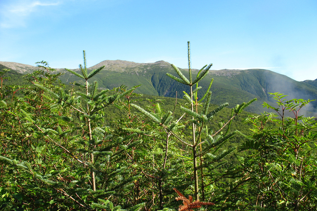
The Ridge of the Caps was just north of my descent route and I got many interesting looks at it as I dropped off the mountain. Roughly seven hours after I broke tree line this morning I re-entered the woods. A major rule in the National Forest is no camping above tree line (where the trees are less than 8 feet tall) unless there is 2 feet of snow on the ground. Sure enough, when I got to the point where the trees were about 8 ft tall there was a large cleared camping area. It looked heavily used but it didn't seem to sprawl too badly. A good distance below this I got one last look at Washington and the southern Presidentials before being enveloped by a dense forest canopy. As stated in the guidebook the Jewell Trail has a steady, but never very steep grade. It was somewhat slow going above tree line due to the rocks but once below the treadway cleared and the grade eased somewhat. I made great time on this section and was surprised when I found myself already at the bridge over Clay Brook.
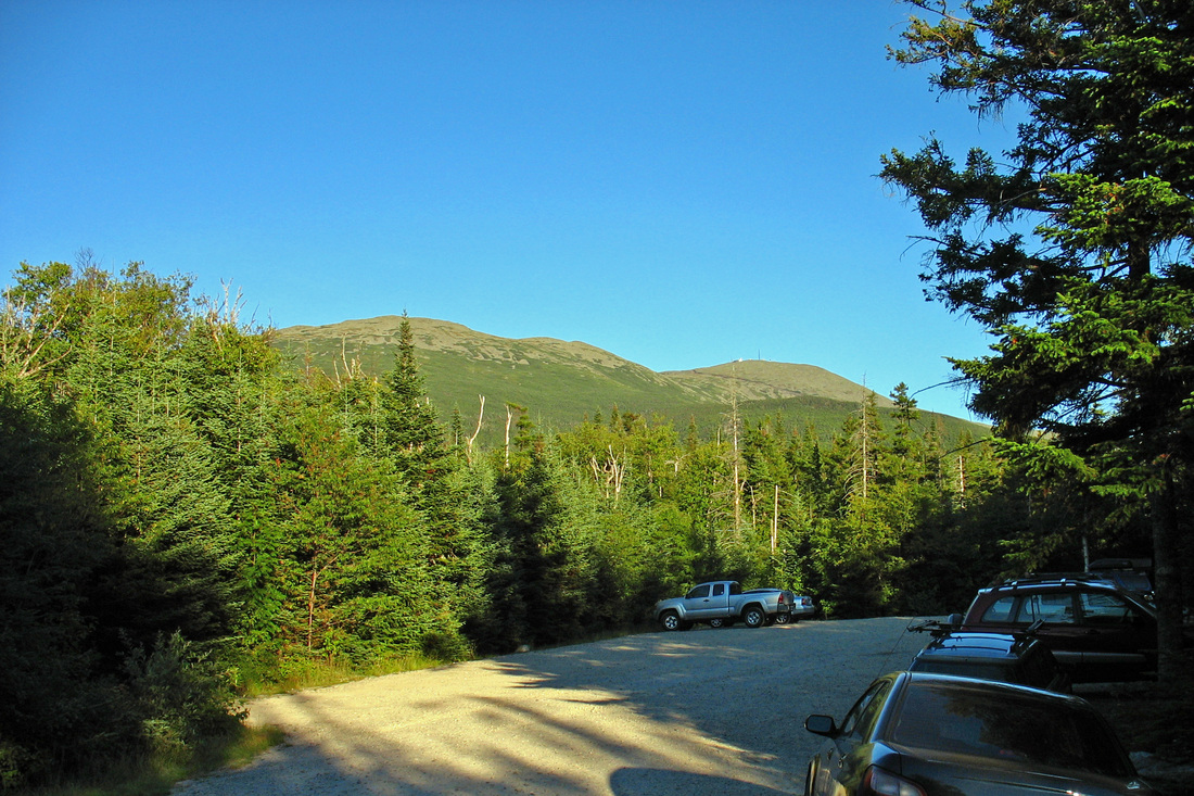
It wasn't far from there to the Boundary Line Trail which cut north from near the base station over to the Jefferson Notch Road. The guide book said that this trail was poorly marked and difficult to follow. Awesome. On the map the trail appeared to be a straight shot running on a bearing of magnetic north. I set my compass and followed what started out as a very clear footpath. The path stayed quite clear and even had apparently recently painted yellow blazes at regular intervals. I continued checking the compass to update the bearing in case the trail suddenly disappeared but it never veered from north and it never disappeared. It remained a clear path, if lightly used, the whole way. After fifteen minutes I recrossed Clay Brook in a beautiful little valley, and five minutes after that I arrived at the Jeff Notch Road. I had a final 1.4 miles and 500 vertical feet to gain in order to reach my car. This last part went quickly; I was passed by only one vehicle and two hikers and their dog who I'd seen a few times up on the ridge. After thirty minutes of road walking I reached the notch and the car park which had a nice late-afternoon view of much of my route.
I set out from Jefferson Notch at 9:15 with the plan of bypassing Jefferson since I'd visited it many times before. I would take the Cornice north to the Ridge and head over to Mt. Clay which is reputed to have outstanding views and, because it is not a "list peak", not much in the way of crowds. The first mile of the Caps Ridge Trail rises easily through the woods and opens at an outcrop with great views where I'd planned to take my first break. Unfortunately some butt-smoking slob had already stationed himself there and was polluting the air. I told him what I thought of his cigarettes as I pushed on, back into the scrub. I passed the junction with The Link almost immediately after and knew the trail would soon be opening up for good. Indeed, within minutes I was at another small clearing where I could take a drink while surveying the southern Presidentials. I didn't linger too long because I was looking forward to the Caps, a series of ledgy knobs that involve some hand-over-foot scrambling and are generally a lot of fun. Arriving at the first, I stowed my hiking poles on my pack in order to free up my hands, and clabbered on up. From the top of this Cap I enjoyed my first 360-degree view. I looked back over the low ridge I'd ascended so far, and then up ahead at what I'd be climbing in the next few minutes. Nestled among the many rocks were a variety of plants. Many, like Alpine Azalea and Bunchberry, had already flowered and were showing their fruit. As I gained elevation I got ever-improving views of Mt. Clay and the summit of Jefferson began to be visible. I continued climbing into the morning sun, stopping frequently to admire the scenery and look back over the progress I'd made. After a time I came to the junction of the Cornice and the Caps Ridge Trail. It was here that I had expected to pick up the Cornice as it slabs south around Jefferson, bringing me closer to Mt. Clay. But Jefferson looked so close, and I could think of no good reason not to take the scenic route on this day. So I remained on the Caps Ridge, although the Caps were behind me now. The trail proceeded up a rocky slope and its precise route was hard to determine in some places. As I approached the summit the wind picked up and I started to get chilly. I encountered an interesting little plant growing in a gap between boulders. It's probably a Mountain Sandwort but the flowers seemed to have way too many petals. I gained the peak 2.5 hours after I began my hike and found a couple dozen other folks enjoying the rewards of their climb. I found an unoccupied rock out of the wind to eat some lunch. After sufficiently topping off the fuel tank and resting I packed up. Conditions hadn't deteriorated in the least and seemed, in fact, to be getting even better. In the interest of maximising my tree line experience I decided to head south to Mt. Clay by going north. As soon as I stepped out from behind my rocky windbreak, however, it was clear I needed my sweater.
Pack back off. Dig sweater out from very bottom of pack. Sweater on. Pack back on.
Feeling cozier I followed the Jefferson Loop toward Mt. Adams. The rocky descent took some time and I rewarmed quickly. Sweater off.
I eventually reached the junction with the Gulfside Trail which runs the ridge of the northern Pressies. From here I had interesting views back up to Mt. Jefferson, north to Edmands Col and Mt. Adams, and east to the Carters. I headed south on the Gulfside, roughly following a contour around Jefferson. Shortly I crossed at the Six Husbands Trail, a steepity steep route ascending a "knee" of Jefferson from the Great Gulf. The trail has quite a reputation which was supported by some young boys I met at the junction who had just come up that way. They had tales of a "scary" trail with ladders that didn't just go up...they hung back into thin air. Sounds like a trail I'm game to try, but perhaps not solo, and definitely not going down. An hour after leaving the summit I arrived at one of my favourite places: Monticello Lawn. This sunny, grassy plateau lies south of and just below the summit of Jeff. Mt. Adams was growing more distant as I continued south along the Gulfside Trail. Nearing Sphinx Col some good views of the Carters and Ball Crag were available over the Great Gulf and the wind picked up as it was funneled through the gap between Mt's Jefferson and Clay. The Sphinx Trail branched east passing between two ledges before dropping into the Gulf. Sweater on.
Within minutes I reached the Clay Loop junction. This loop runs up and over Mt. Clay while the Gulfside runs along its western flank. The two rejoin just north of the Clay summit. The Loop climbed steadily southward over solid footing, requiring a little more exertion on my part. Sweater off.
I began to move through a variety of plant communities as I distanced myself from Jefferson. One particularly abundant plant was Large-leaved Goldenrod. The summit of Mt. Clay is a longish ridge with a few bumps. From the first bump it was hard to tell which was the highest. Wandering along the ridge I observed Low Rattlesnakeroot in flower, a lot more Large-leaved Goldenrod, tiny little Dwarf Birch, Alpine Goldenrod which is also very small, and a few other Low Rattlesnakeroot. There were so many other types of foliage and gone-by flowers that I've determined a return trip in the spring is necessary to catch these "gardens" in full bloom. A very minor col separates the north summit ridge of Clay from a south knob. As I descended to it I passed a nice patch of mixed plants with plenty of Goldenrod and an odd Mountain Avens still in flower. I enjoyed the scenery from the col, whose flat meadow provided a nice foreground for panoramic views east and west. I gained the south knob of Clay, with its close-up view of Mt. Washington, and nested on a flat rock for another lunch break. Sweater on.
While I ate lunch and made gatorade I absorbed the views in all directions. I almost made myself dizzy, spinning around on my lunch rock in an effort to take it all in. I particularly fancied the Jefferson-Adams-Madison grouping to the northeast. The view south was also fine and I could just pick out Mt. Monadnock on the horizon, 105 miles away. To the southwest the horizon was dominated by the Franconia Ridge and Mt. Moosilauke, with Tom-Field-Willey in the foreground and the Bond-Twin range in between. The northwest view overlooked the town of Twin Mountain with Vermont peaks visible on the horizon. Over the Great Gulf were Moriah and many Maine peaks. In addition to extensive mountain views, the Clay Loop provides an interesting perspective into the Gulf. I regained the Gulfside Trail not far south from my lunch spot and headed north on it to the Jewell Trail which I followed down a long open ridge toward the Cog base station. Even this little bit of elevation loss cut the wind considerably. Sweater off.
The Ridge of the Caps was just north of my descent route and I got many interesting looks at it as I dropped off the mountain. Roughly seven hours after I broke tree line this morning I re-entered the woods. A major rule in the National Forest is no camping above tree line (where the trees are less than 8 feet tall) unless there is 2 feet of snow on the ground. Sure enough, when I got to the point where the trees were about 8 ft tall there was a large cleared camping area. It looked heavily used but it didn't seem to sprawl too badly. A good distance below this I got one last look at Washington and the southern Presidentials before being enveloped by a dense forest canopy. As stated in the guidebook the Jewell Trail has a steady, but never very steep grade. It was somewhat slow going above tree line due to the rocks but once below the treadway cleared and the grade eased somewhat. I made great time on this section and was surprised when I found myself already at the bridge over Clay Brook.
It wasn't far from there to the Boundary Line Trail which cut north from near the base station over to the Jefferson Notch Road. The guide book said that this trail was poorly marked and difficult to follow. Awesome. On the map the trail appeared to be a straight shot running on a bearing of magnetic north. I set my compass and followed what started out as a very clear footpath. The path stayed quite clear and even had apparently recently painted yellow blazes at regular intervals. I continued checking the compass to update the bearing in case the trail suddenly disappeared but it never veered from north and it never disappeared. It remained a clear path, if lightly used, the whole way. After fifteen minutes I recrossed Clay Brook in a beautiful little valley, and five minutes after that I arrived at the Jeff Notch Road. I had a final 1.4 miles and 500 vertical feet to gain in order to reach my car. This last part went quickly; I was passed by only one vehicle and two hikers and their dog who I'd seen a few times up on the ridge. After thirty minutes of road walking I reached the notch and the car park which had a nice late-afternoon view of much of my route.