Sunday, 01 July 2007
I got a late start hiking as I needed to get the cabin ready to hand over to Dave (Slowfoot) Buonomo. Kevin took me into town this morning to drop off trash to Linda C's. She also made her shower available to me. I stopped on the way back to the cabin for a snack. We had met Dave (and Pat Fletcher) at Linda's and arrived at the cabin shortly before them. After snacking and seeing that Dave was settled in I hit the trail at 11:45 and Kevin headed for home. I saw a lot of day hikers and a few backpackers between Goose Pond and Finerty Pond. On the way up Becket Mountain I saw a small (15 cm) milk snake on the trail but it was dead. I took a lunch break on top of Becket Mtn where there were some other hikers doing the same. After leaving Becket I descended for a short while before passing Finerty Pond. I stopped only briefly to admire it as I was eager to get to tonight's camp. There were moose tracks on the trail in the mile before the lean-to but I saw no moose. The last couple miles to the shelter were pretty rough: my knee was acting up and my feet were killing me. I arrived at October Mtn lean-to at about 16:15 to find Tripe already set up. He had been at the cabin the night before. I pitched my tent, we ate supper, and Tripe had a fire going. Later came Hawk, a southbound section hiker, and Second Wind from near Bath, ME who was doing a northbound section. Had some rain after going to bed. It was a very cool night and all was dry by morning. Today's highlight was getting to the shelter! And good company there!
Monday, 02 July 2007
I awoke to a cool, sunny morning. Took a bit of a lie in after a week of making pancakes at 6:00. I got up around 7:30 to find that Hawk and Second Wind had already gone. After a rather leisurely breakfast and packing I hit the trail at 9:15. Tripe was still at the shelter but would leave not long after. The woods along today's section were mostly open deciduous (lots of Beech!) with a lush carpet of ferns – quite pretty. The trail also passed through some Hemlock groves. Tripe passed me at the first road crossing where I sat to take a short break.
The highlight of the day was the “summit” of Warner Hill. It was an easy 0.7 mile climb from the Blotz Rd and the summit was a big fern-filled and sunny clearing in the woods...very pretty! On the way down from Warner is when things started to hurt again but the terrain was easy so I gimped along. I passed under a powerline cut with good westerly views and some Canada Lilies. Soon after I came to the Kay Wood spur trail and met Tripe who was continuing on to Dalton. Kay Wood is a nice shelter, the same style and approximate age as October Mtn, set on a ledgy step above a stream that is just out of sight. There was a lot of bird activity and plenty of wood thrush songs to keep me company. Noise from the nearby road is the only downer.
The highlight of the day was the “summit” of Warner Hill. It was an easy 0.7 mile climb from the Blotz Rd and the summit was a big fern-filled and sunny clearing in the woods...very pretty! On the way down from Warner is when things started to hurt again but the terrain was easy so I gimped along. I passed under a powerline cut with good westerly views and some Canada Lilies. Soon after I came to the Kay Wood spur trail and met Tripe who was continuing on to Dalton. Kay Wood is a nice shelter, the same style and approximate age as October Mtn, set on a ledgy step above a stream that is just out of sight. There was a lot of bird activity and plenty of wood thrush songs to keep me company. Noise from the nearby road is the only downer.
Tuesday, 03 July 2007
I thought I was going to have a night alone last night but a man arrived with his teenage daughter and college-age son at about 19:30. They are just beginning a short southbound section. Very pleasant folks. Soon after I woke up this morning the son – who evidently talks in his sleep – slurred, “Only in America would someone go to Burger King and order a double cheeseburger, fries, and a Diet Coke...only in America”. Pretty funny.
I startled a white-tailed deer on the hike down into Dalton. The trail goes right through this old mill town and many of the homes were decorated for Independence Day. The trail goes by the home of Tom Levardi who had been hosting hikers for decades. He was out on his porch as I passed and asked if I needed water. I had been hoping to meet him and so took him up on his invite. While I drank my bottle for refilling and drank a soda he offered we talked trail and hikers, comparing our impressions of the “attitude” of thru hikers over the last 15 or so years and how it changes. After chatting for about an hour and refilling my water tank we took pictures of each other and I set out for Cheshire.
The section from Dalton to Cheshire is 8 miles up and over a low mountain (North Mtn). The forest was mostly open Hemlock groves and open deciduous groves with a carpet of ferns and grass. I though my day's highlight was meeting Tom but on the way up this mountain I was treated to a second highlight: a male scarlet tanager! The walk along the ridge was nice enough but uneventful. Near the top I passed Gore Pond which, if it was in Maine, would have had several moose in it. On the way down I passed over one of the Cheshire Cobbles – large, interesting rock formations hanging over the town of Cheshire. I had a good view west and took a couple pictures. I did not take a blue blaze that I later learned went over another cobble with great views of Cheshire.
After a short, steep descent I arrived in town and met the Umbrella Lady and Habitual Hiker (UL & HH...and their cranky but lovable dog Mac) leaving an ice cream parlor and headed for the hiker hostel at St. Mary's Church. We were welcomed to stay in their basement function room with water bubbler, electricity, flush toilets...and it was much cooler inside (it was a hot and humid day)...Nice! The priest allowed me into his house to use his phone. They charge nothing for this hostel, only a picture to make a collage of their hiker guests. Later on Achilles arrived so it is just the five of us. I'm hoping for an early start tomorrow. Up and over Mt. Greylock!
Wednesday, 04 July 2007
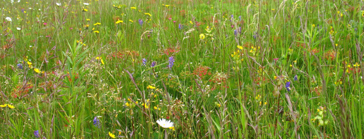
I was up and out of St. Mary's at 6:35 this morning, the last to leave by only a few minutes. The trail went through town a bit, passing a replica of a giant cheese press of historical significance. I then started climbing gently through pasture including cows who stopped their cud-chewing to watch me pass, and some interesting wooden ladders for climbing rather ungracefully over barbed wire fences. Leaving my bovine friends behind the trail bolted steeply up to Jone's Nose, passing Mark Noepel shelter along the way where I met Pat and Maryanne who'd been at the cabin last week. Past Jone's Nose the trail offered a view over the valley of Kitchen Brook and Mt. Greylock, then leveled off passing bogs, bog bridges, and a small tarn before the final push up to the summit of Greylock. On this climb the forest changed to the moss-carpeted spruce-fir mix that I am more used to. It felt good to be getting into a more northern environment. The final mile of the climb happened to be the first stretch of the AT that I ever hiked, nearly 20 years ago. The summit was today's highlight. I used to hike this mountain often when I was in college and grad school but haven't been up here in >10 years. The cool thing this season (and next) is that all the roads are closed so the only “traffic” on top was hikers. There were lovely small fields of wildflowers but the sky was threatening so I didn't linger as long as I'd hoped to. I took a few quick pictures and bolted down a snack before setting off.
The last 3.3 miles to Wilbur Clearing were uneventful if rather steep and rocky at times. I was first to the shelter at 13:15, followed an hour later by Pat & Maryanne, and later still by UL & HH and a brother-sister combo (Jon & Wendy) out for a weekend. It's raining steadily now but I'm quite snug in my bag for the night having eaten an early supper. On to VT tomorrow!
The last 3.3 miles to Wilbur Clearing were uneventful if rather steep and rocky at times. I was first to the shelter at 13:15, followed an hour later by Pat & Maryanne, and later still by UL & HH and a brother-sister combo (Jon & Wendy) out for a weekend. It's raining steadily now but I'm quite snug in my bag for the night having eaten an early supper. On to VT tomorrow!
Thursday, 05 July 2007
I took a leisurely morning as I waited for the last of the showers to abate. I hit the trail at about 8:30 after HH & UL but before any of the shelter residents. The hike down Greylock was not as steep as I'd expected based on other hikers' comments. Compared to a lot of descents in the Whites it was a cakewalk, but also a bit of a carwash. The walk through North Adams didn't take me past any services so it didn't slow me down. Leaving town a pedestrian bridge carries hikers over the Hoosic River and a rail line. The bridge smelled funny. The first part of the climb up to the state line followed the Sherman Brook which was flowing nicely after last night's rain. Further up was a short, steep boulder scramble followed by a peat bog where I had a staring contest with a white-tailed deer (I won). I passed over Pine Cobble which would have had a view had it not been so hazy. Today's highlight was entering VT and actually beginning the Long Trail. Thins went downhill after that: the trail was muddy and overgrown, the map and E2E guide were misleading & inaccurate. I came to a road crossing & thought I'd missed the shelter so I backtracked 0.5 mile – found nothing – returned and headed down the road about 0.3 mile – nothing – met some jeep-driving, beer-drinking rednecks on my way back who directed me to the shelter which was only just ahead. I finally rolled into the site at 16:00 to find a junk-filled, dilapidated, creepy-looking lean-to; a spider-filled privy; and a register containing stories of bear visitations. Sweet. Luckily only a few minutes later (just after an epic and ultimately victorious battle with the privy spiders)Spartan rolled in and said that UL & HH were just behind. A couple other LT hikers (Josh & Will, from Baton Rouge) had also showed up for the night. Having some friendly souls to share this dump with improved my mood considerably. The nearby stream was flowing well & my feet (which have not stopped hurting yet...my knees have quit arguing) enjoyed a frigid soak while I washed off. After supper I hung my food bag, taking much more care than I ordinarily would, and settled into my tent for the night as a thunderstorm passed over.
Friday, 06 July 2007
I packed my wet tent this a.m. to find a salamander had taken refuge under it. It was pretty cute. I shooed him along, finished packing, and got walking at 7:25. My dreadful map indicated a short, steep, 1000-ft climb up to Consultation Peak. In reality it was a climb up to a rolling ridge with Cons. Peak 4 miles away. The peak was discernible only because after a couple hours hiking I started a definite, prolonged descent. It was a humid day and although it wasn't raining I was getting plenty of carwash. I didn't care very much though because I was heading into Town: a nice dry room with a hot shower and Kevin would be waiting for me in a few miles. Bumping along the ridge I passed a couple of beaver ponds. One was held back by a 1-m high, 50-m long dam. The trail here consisted of bog bridges (some floating/sinking) right below the dam. It was weird to be hiking along and look to the side to see water at waist-height. I didn't take any pictures because I was afraid of dropping my camera in the water. The highlight of the day came a bit later as I was dropping down to a good stream not far from Congdon Camp and startled a fairly small moose! I rolled into Congdon a few minutes later to find HH & UL finishing a break. They thought it was quite unfair that I got to see a moose since I'm from Maine and I get to see them “all the time”. They had a fair point, but I never get tired of seeing moose.
We all headed off for the last few miles of our hike. After a bit of a climb and a short descent the trail headed up Harmon Hill. It reminded me of Warner Hill a few days ago with open fern fields and spotty tree coverage. HH & UL caught me there and it started to rain. We packed up and started down in a hurry as the wind picked up and thunder started rumbling. I thought it would be a short, passing shower as there were patches of blue sky but those quickly filled in and it got darker and windier and rainier. As I started down the mile of stone steps right before the road the thunder was coming sooner and sooner after the lightning. I noticed that some of the rain was bouncing in a funny way. And then it was bouncing off my head and neck and it was hail. It was coming down in buckets. And it really hurt; and I didn't like it at all. The wind and rain and hail all picked up and the lightning and thunder were simultaneous as the storm passed directly overhead and it got pretty cold. Finally the storm began to ease as I picked my way down the last bit to VT RT9. I headed into the car park at 13:45. UL & HH came in soon after and Kevin drove in within about 10 minutes. We made room in the car for HH, UL, and muddy Mac and well all headed into Bennington to get clean, dry, and fed.
We all headed off for the last few miles of our hike. After a bit of a climb and a short descent the trail headed up Harmon Hill. It reminded me of Warner Hill a few days ago with open fern fields and spotty tree coverage. HH & UL caught me there and it started to rain. We packed up and started down in a hurry as the wind picked up and thunder started rumbling. I thought it would be a short, passing shower as there were patches of blue sky but those quickly filled in and it got darker and windier and rainier. As I started down the mile of stone steps right before the road the thunder was coming sooner and sooner after the lightning. I noticed that some of the rain was bouncing in a funny way. And then it was bouncing off my head and neck and it was hail. It was coming down in buckets. And it really hurt; and I didn't like it at all. The wind and rain and hail all picked up and the lightning and thunder were simultaneous as the storm passed directly overhead and it got pretty cold. Finally the storm began to ease as I picked my way down the last bit to VT RT9. I headed into the car park at 13:45. UL & HH came in soon after and Kevin drove in within about 10 minutes. We made room in the car for HH, UL, and muddy Mac and well all headed into Bennington to get clean, dry, and fed.
Saturday, 07 July 2007
After a bit of a lie in I got packed. I had been hiking with a smaller, lighter EMS pack that I use as my winter daypack. I could easily fit all my gear into it but it wasn't up to the weight I'm lugging. Kevin brought my trusty big Blue behemoth which easily supports 75 pound loads so I knew it would handle my 35-40 pounds without any problem. Kevin dropped us all off at the trailhead at 11:00. We had plans to make 10 miles to Goddard shelter but stopped at Melville Nauheim for a snack break. As we munched the predicted “possible T-storms” appeared to be moving in. After a great deal of hemming and hawing and even a false start we decided to stay here & stay dry. Now, several hours later, it still hasn't rained. Hopefully it isn't waiting for tomorrow. Oh well. It's a good rest for my feet which are still hurting bad by the end of each day. Four other LT hikers are in for the night.
Sunday, 08 July 2007
There was some rain overnight but it was dry in the shelter. It was pretty clear this morning but muggy. I got hiking shortly after 7:00 and soon came to a powerline cut with a view toward Bennington. The LT Guide noted several views along the way to he summit of Glastenbury Mountain. the first of these was Porcupine Lookout where I saw no porcupines but did see some wind turbines on a distant ridge. They were barely visible through the thick haze. I wondered how clearly they would have stood out on a drier day. I missed the Little Pond Lookout and met HH & UL before the Glastenbury Lookout. There is a view through trees to the summit and tower of Glastenbury Mountain. The hiking was easy and the miles were flying by. Before long I came to Goddard Shelter. It's a nice new one with a porch and what would be a great view on a clear day. I took a hearty lunch there but the black flies kept me from relaxing too much so I moved on to the summit fire tower. Again, I'd love to revisit this place on a clear fall day! I climbed back down the tower, patched my feet a bit, a started out on the last 4 miles to Kid Gore. It was getting darker and thicker overhead and I was keen to get into the shelter dry. No such luck. I was about a half mile away when it started dumping...DUMPING! Apparently VT doesn't believe in light showers; it's a monsoon or it's nothing at all. At least I didn't get hailed on this time. The trail quickly became a raging torrent of runoff, especially as I got close to the shelter. The downpour let up as I steeped under the roof of the lean-to. I was in for the night and some entries in the register suggested a top bunk due to an active porcupine population. I quickly tossed some gear onto the upper platform to reserve my porc-free space. Several other hikers arrived thinking they'd move on as it appeared to be clearing. As they cooked and ate, however, several more downpours came and went. Most moved in for the night. It's definitely a wet one. Hopefully it will be porcupine-free. Hopefully it will clear off overnight, too, as this shelter has a good easterly view.
Monday, 09 July 2007
Well, no porcies last night but no sunrise views this morning either. I wanted a good early start since I had a longish day of hiking. I was ready to go before 7:00 but just as I was to leave a big thundery downpour started. Sweet. So I hung out in the shelter with my raincoat and pack on for 15-20 minutes until the thunder stopped and the downpour reduced to just a good steady rain. I set out. After a while the rain stopped and I started to get hot. I was planning a snack break at the first shelter and I figured I was pretty close so I kept on hiking. Finally I couldn't stand it anymore. I dropped my pack, took off my raincoat, stashed it, made a few other adjustments, hurled my pack back on, took about five steps, came around a corner, and saw the stupid shelter. I figured I deserved another break since it had been a whole thirty seconds since my last...so I took one. I tried patching up my feet and wringing out my nasty socks but the dogs are pretty pulpy and it didn't help much.
I put my pack back on and set out. As I approached the Arlington-Stratton Road it got sunnier (!) and, of course, hotter and muggier. But Sun! At the road crossing I took another break to snack and air out my feet. It looked like more T-storms were developing and I didn't want to get hit with them on Stratton Mountain so I didn't linger. I packed up and started climbing. I soon came to a bail out option: an old logging road that would have allowed me to get to Stratton Pond without going over the summit. The weather was still holding so I climbed. I'm glad I did! The climb was easy and went pretty quick. There was even some Blue Sky when I summited. I chatted briefly with the summit caretakers and climbed the tower. My camera was buried in my pack because of the rain and I was too lazy to dig it out. It was still pretty hazy anyways so the views were pretty limited. I went back down to snack and met Early Bird on the summit. She is doing her 7th LT end-to-end hike. The descent to the pond was long but uneventful. The new shelter is a lovely building but is dark inside and is VERY MOSQUITOEY! I pitched my tent inside the shelter so that I'd still have some blood left in the morning. A late afternoon swim in Stratton Pond was on my agenda and it was fantastic! I wouldn't have minded the water being a little colder but really, no complaints. No leeches either! It would have been nice to linger on the shelter porch after supper and chat with the other hikers but intense mosquito warfare sent us all to bed early.
I put my pack back on and set out. As I approached the Arlington-Stratton Road it got sunnier (!) and, of course, hotter and muggier. But Sun! At the road crossing I took another break to snack and air out my feet. It looked like more T-storms were developing and I didn't want to get hit with them on Stratton Mountain so I didn't linger. I packed up and started climbing. I soon came to a bail out option: an old logging road that would have allowed me to get to Stratton Pond without going over the summit. The weather was still holding so I climbed. I'm glad I did! The climb was easy and went pretty quick. There was even some Blue Sky when I summited. I chatted briefly with the summit caretakers and climbed the tower. My camera was buried in my pack because of the rain and I was too lazy to dig it out. It was still pretty hazy anyways so the views were pretty limited. I went back down to snack and met Early Bird on the summit. She is doing her 7th LT end-to-end hike. The descent to the pond was long but uneventful. The new shelter is a lovely building but is dark inside and is VERY MOSQUITOEY! I pitched my tent inside the shelter so that I'd still have some blood left in the morning. A late afternoon swim in Stratton Pond was on my agenda and it was fantastic! I wouldn't have minded the water being a little colder but really, no complaints. No leeches either! It would have been nice to linger on the shelter porch after supper and chat with the other hikers but intense mosquito warfare sent us all to bed early.
Tuesday, 10 July 2007
More T-storms and heavy rain last night. Hazy & Hot this morning. I was in a hurry to leave the pond and its bloodthirsty swarms this morning. I did get to see a beaver in the pond as I hurried by. The terrain was easy and pretty enough but my feet are shot. Broken orthotics, disintegrated insoles, and perpetual wetness have taken their toll. I need to go home for a few days to fix up my feet and boots. Early Bird told me about a shortcut into Manchester Center. A 4WD road leads into town from Prospect Rock. Prospect Rock had a nice (and of course, hazy)view over the town. I took a long break there and chatted with UL, HH, and EB who let me use their phone to call for a ride home. I wished my companions well and set off down the road. About a mile down I began to pass some houses. A local woman named Kim picked me up. She said she could tell from the way I was walking that I wanted a ride. She suggested Northshire Books as a good hangout for the afternoon. It was a great suggestion. It's a good-sized independent bookstore with a nice cafe (vegan offerings!) and a comfortable seating area for eating, reading, and lounging. They had a public phone so I could call Kevin and tell him where to find me. They also have a good sized bathroom that I was able to wash up in. I had no problem passing 3 hours there. When Kevin arrived we had some lunch and then hit the road back home. On the way out of town we saw Spartan walking up the road towards the trail 5 miles away so we picked him up and took him to the trailhead. We passed through some sever weather soon after: thunder, lightning, heavy rain, hail, and winds...just what I've come to expect from Vermont skies. There was even talk of tornados. I can't say I'm sorry to be out of the woods for tonight, but I'm hoping my feet heal up quick so I can get back on the trail.


