Thursday, 25 June 2009
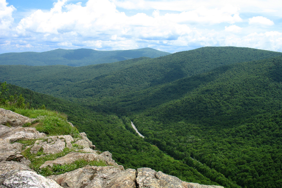
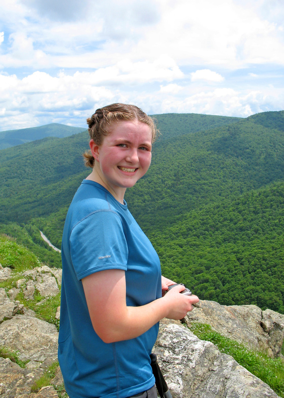
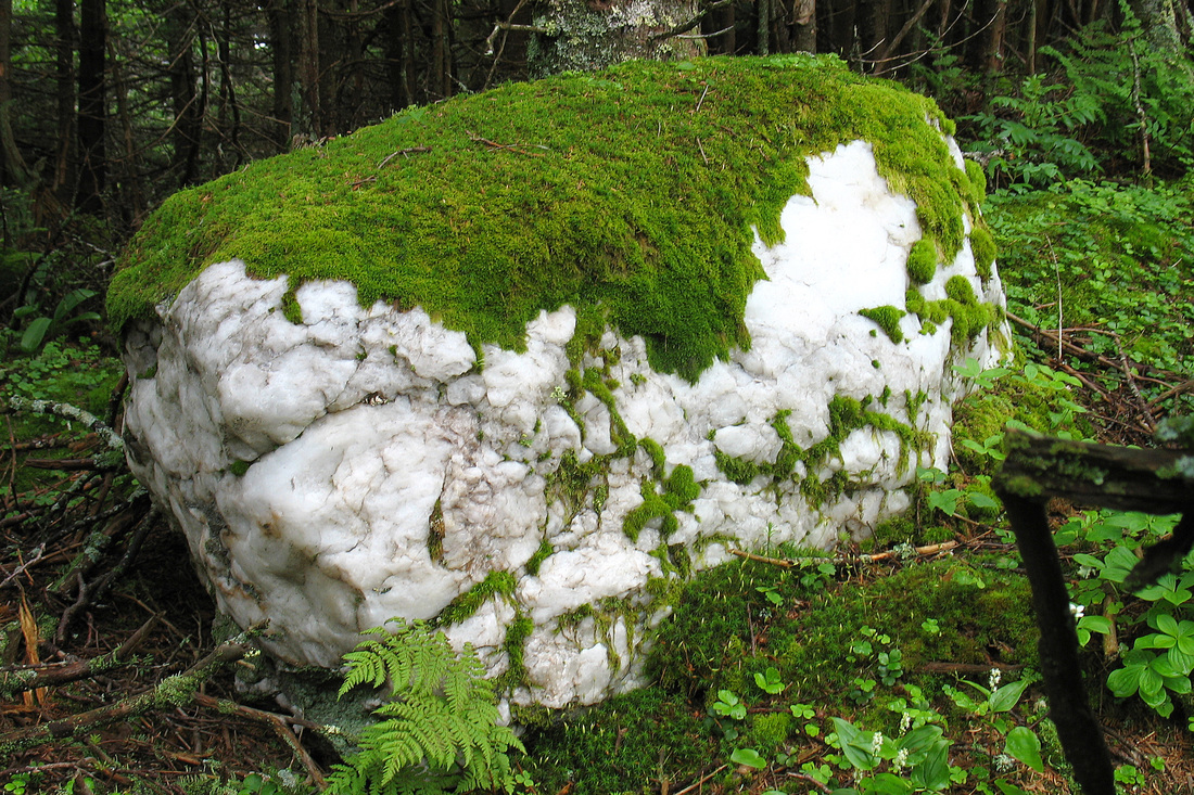
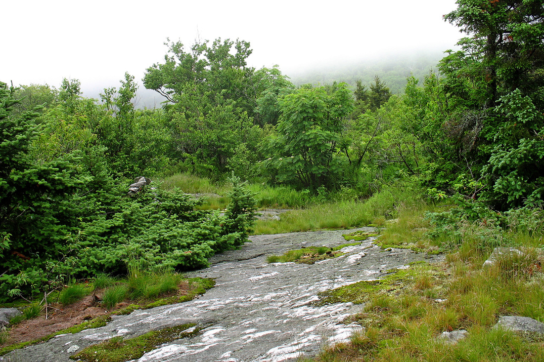
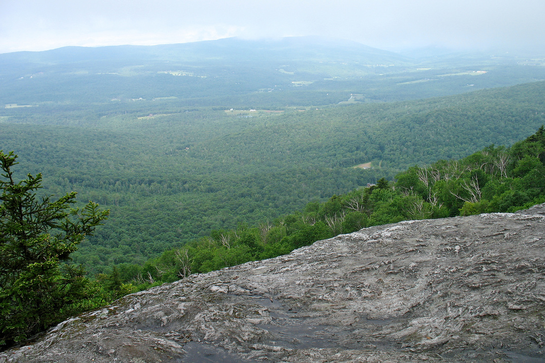
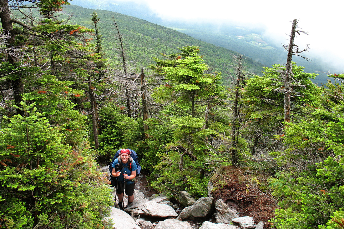
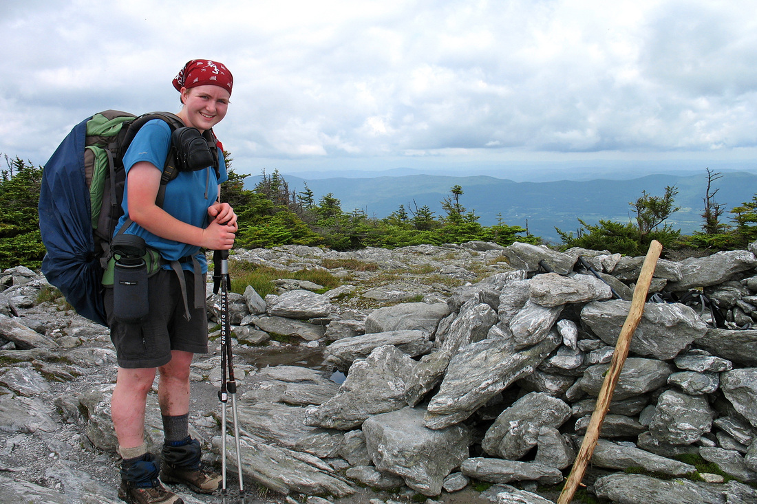
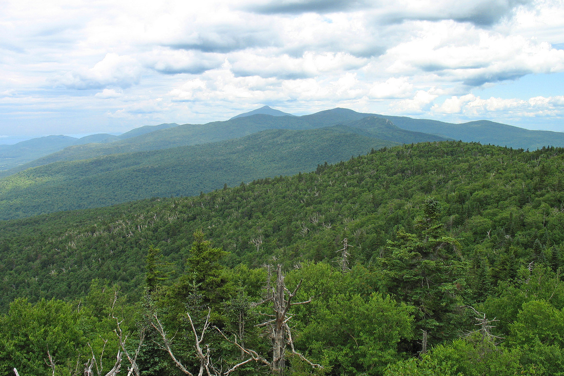
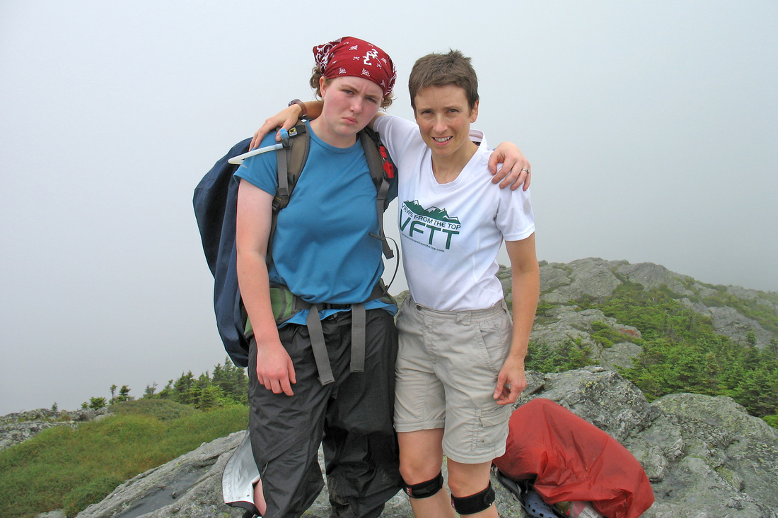
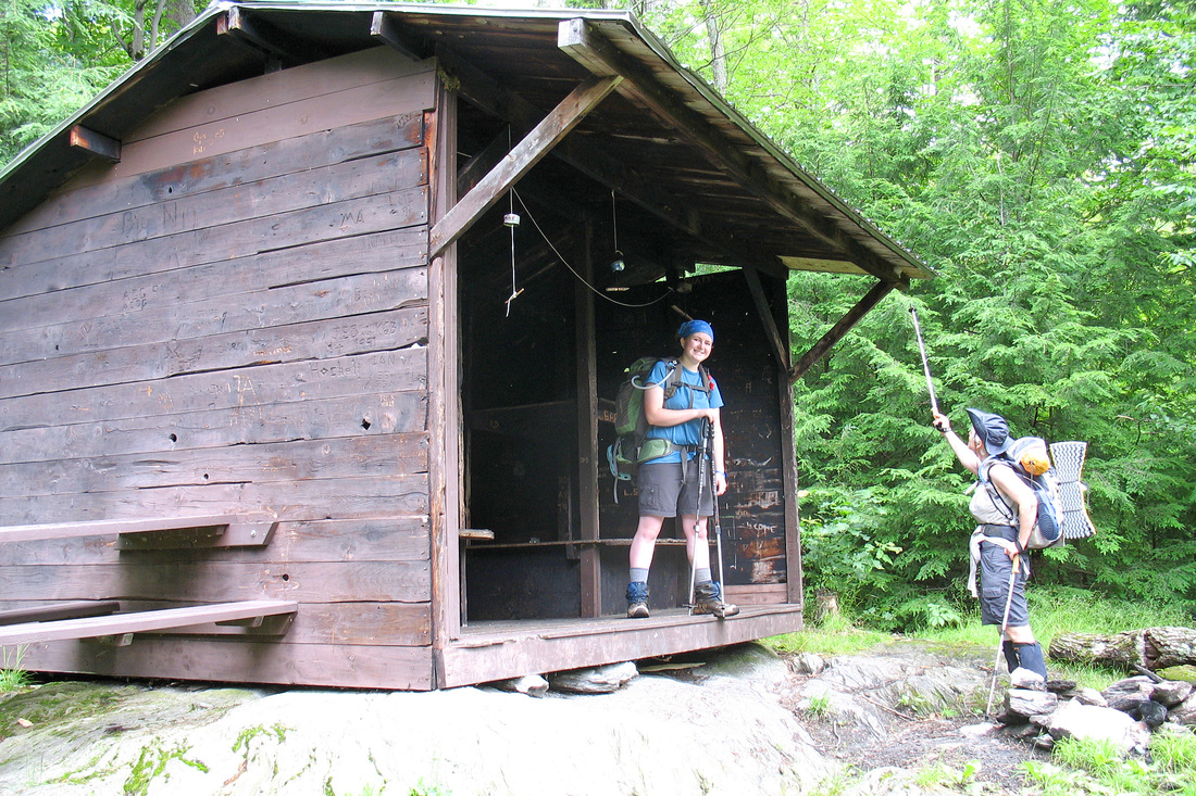
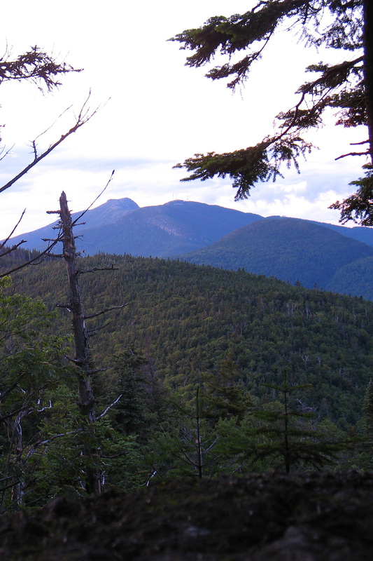
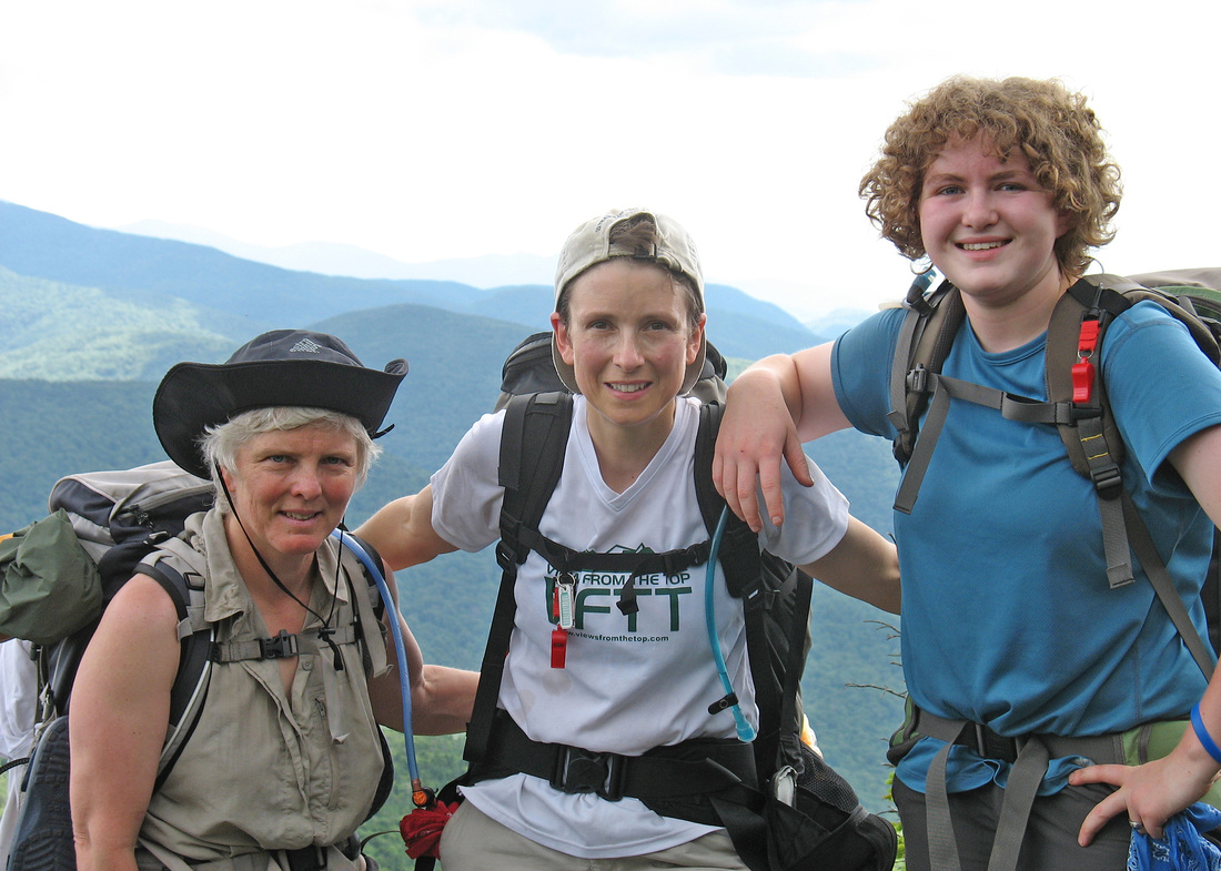
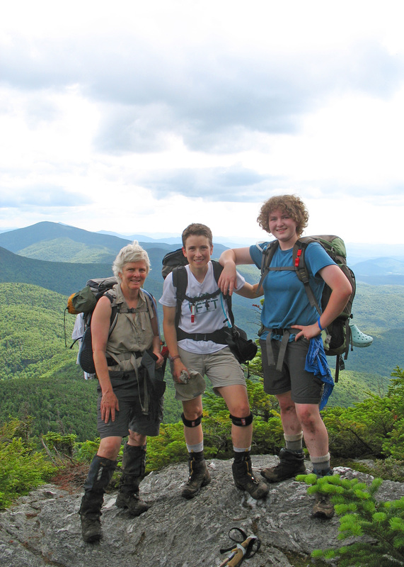
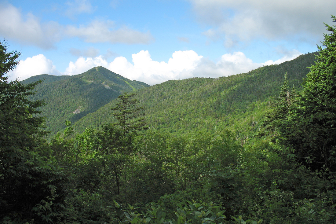
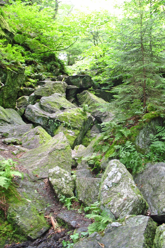
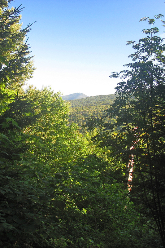
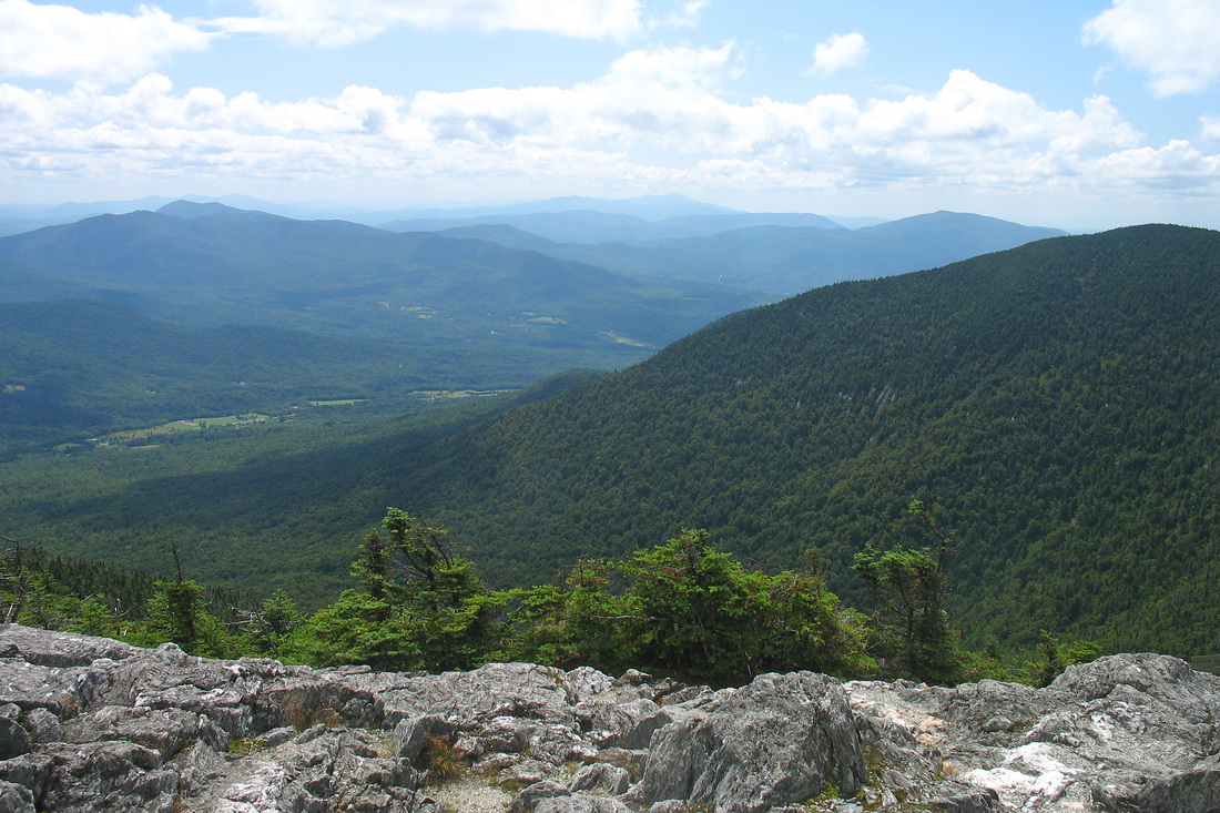
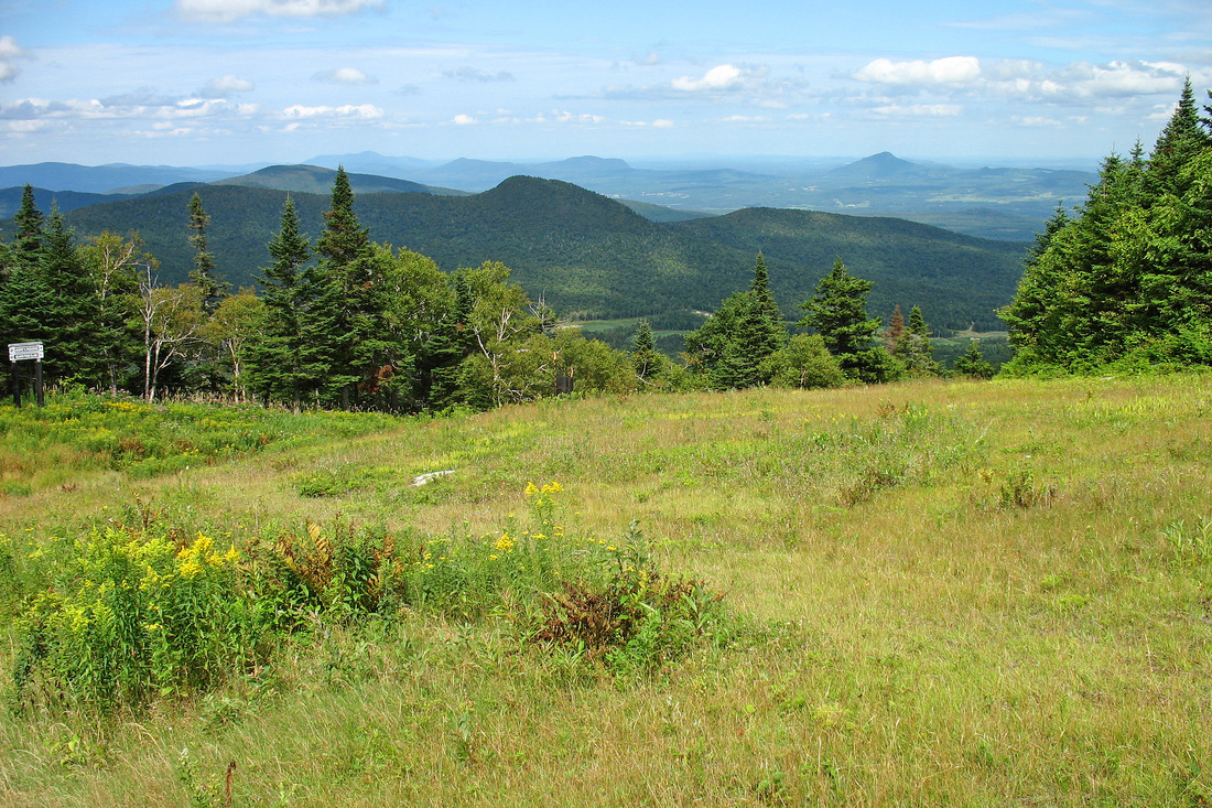
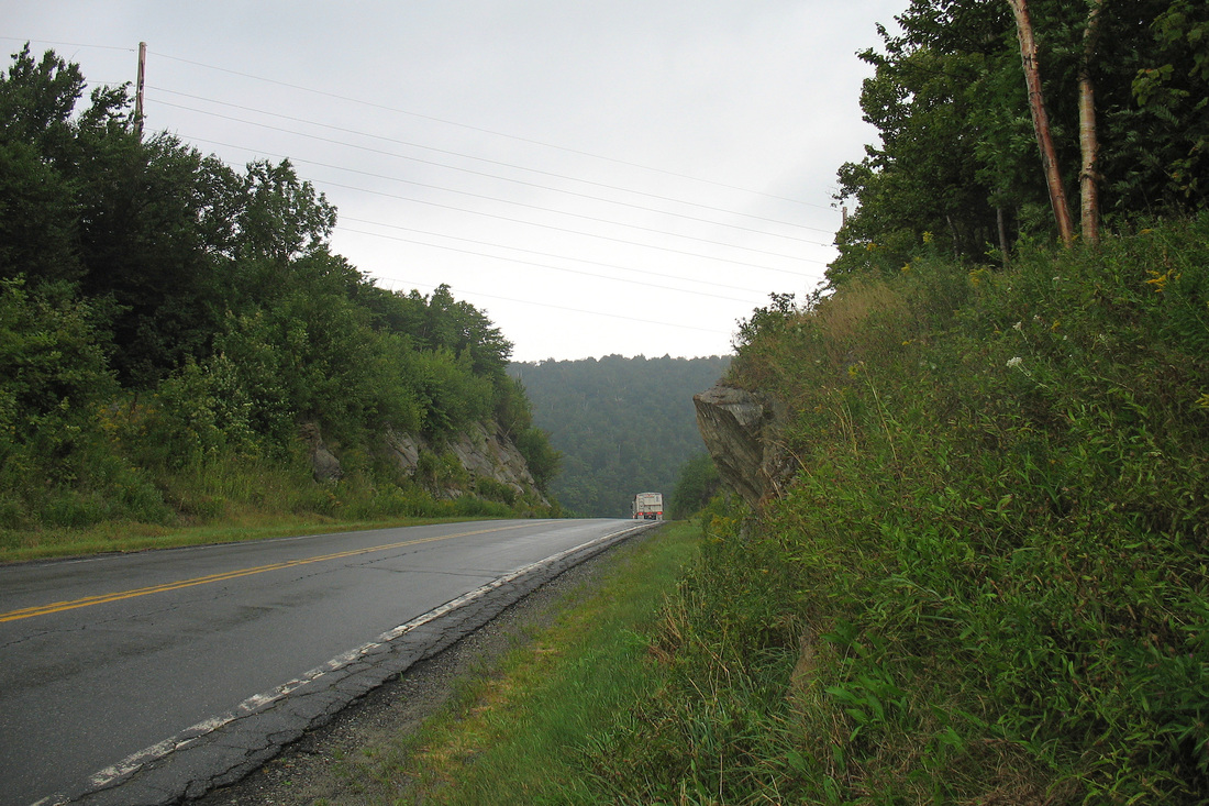
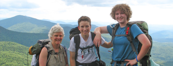
This year my niece, Chelsea, is joining me on the Long Trail. She aspires to hike the AT someday and we thought the northern half of the LT would be a nice little nugget for her first try at long backpack trips. Wendy (my sister and Chelsea's Mom) and Chelsea got to my house by 7:30 this morning and we got our final packing and organising done quickly. We were on the road shortly after 8:00 and we stopped at the Cafe in Rochester where Wendy and Chelsea got sandwiches before heading up to Brandon Gap. We were hiking by 12:30 and soon got to the Great Cliffs of Mt. Horrid for some great views. Chelsea almost threw up but didn't and we hiked on enjoying the sunshine that has been so rare lately. We saw several toads as we hiked through woods ranging from open birch glades with a carpet of fern and grass to wet, mossy forest of gnarled and stunted spruce fir. There were occasional views to the valley which provided interest and a chance to check on the sky which stayed fairly clear even as we heard thunder in the distance to the north. I heard Juncos, Hermit Thrushes, Swainson Thrushes, and Winter Wrens. I also heard Black-throated Blue Warblers and Blackpoll Warblers and some other birds I don't know. We got to the lean-to shortly after 17:00 and settled in. Another hiker, Otter, was already there and is hiking the whole LT this summer. It is now 19:20 and we're all ready for bed.
Friday, 26 June 2009
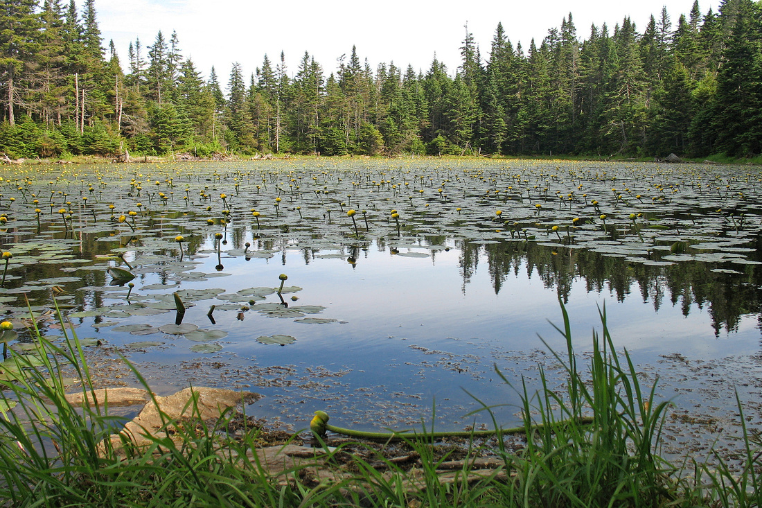
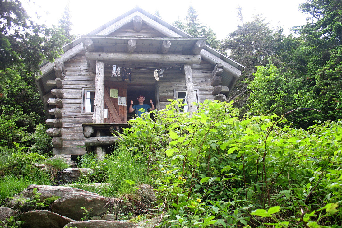
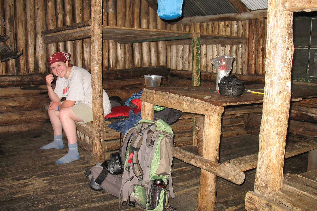
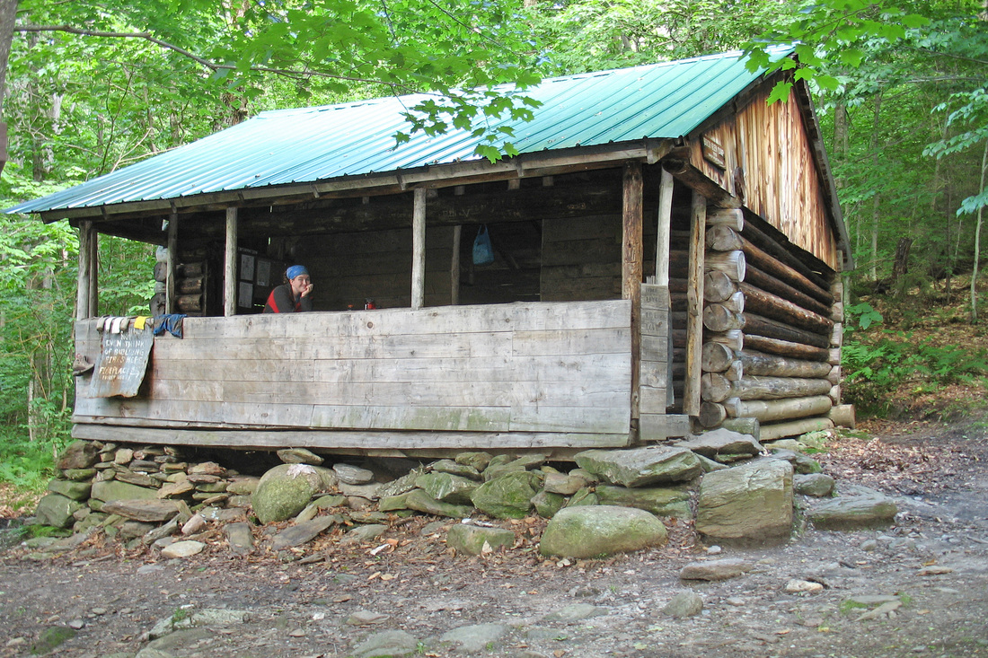
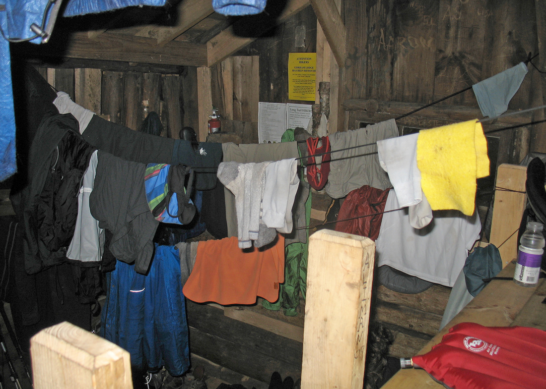
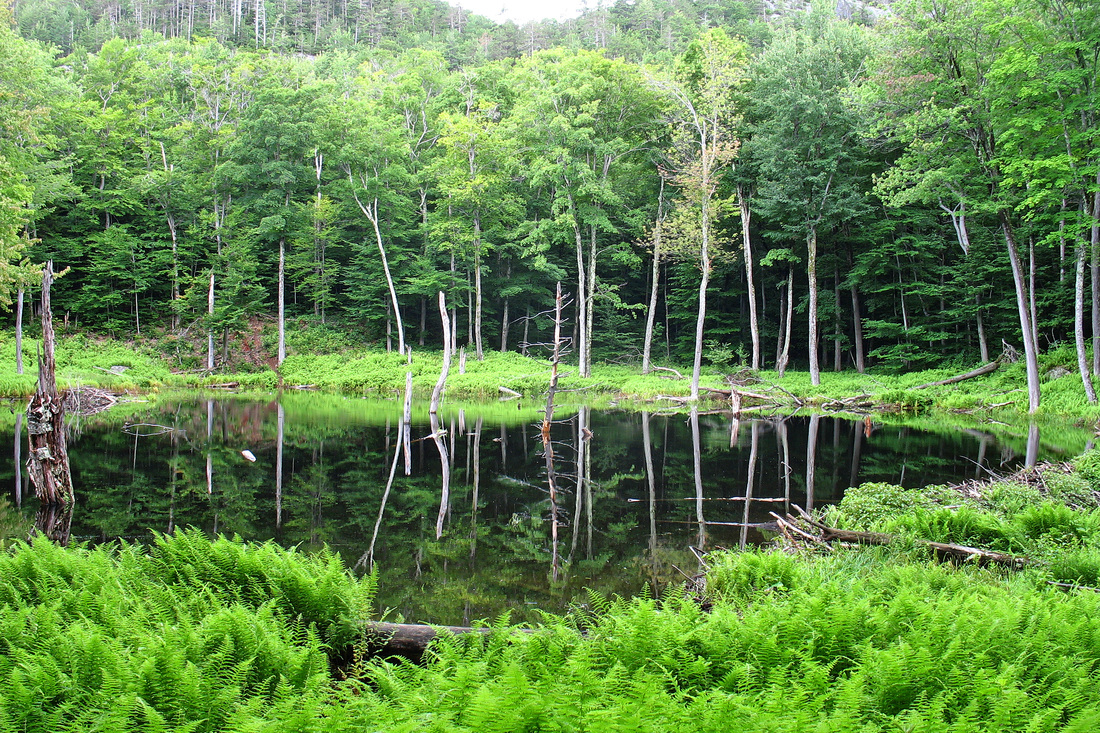
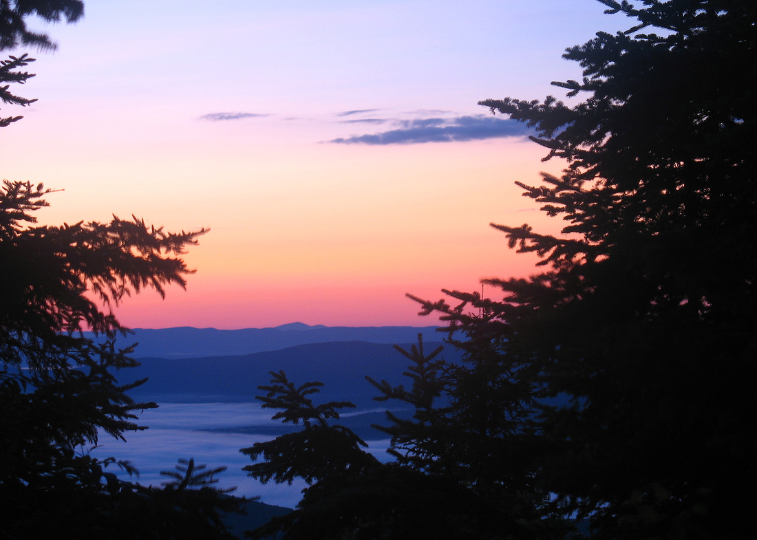
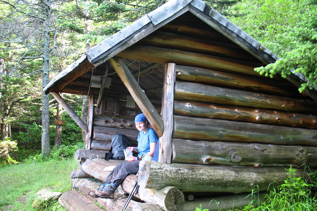
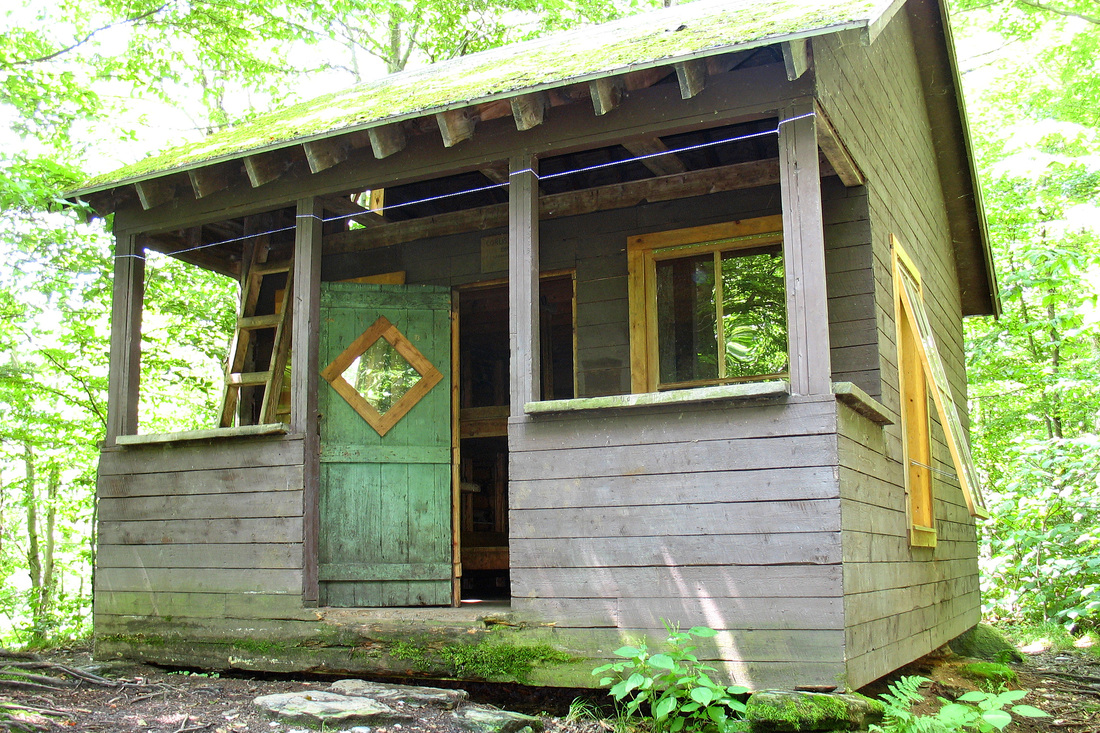
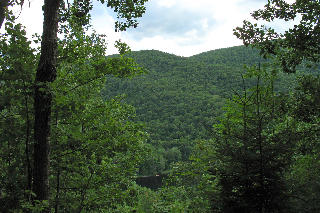
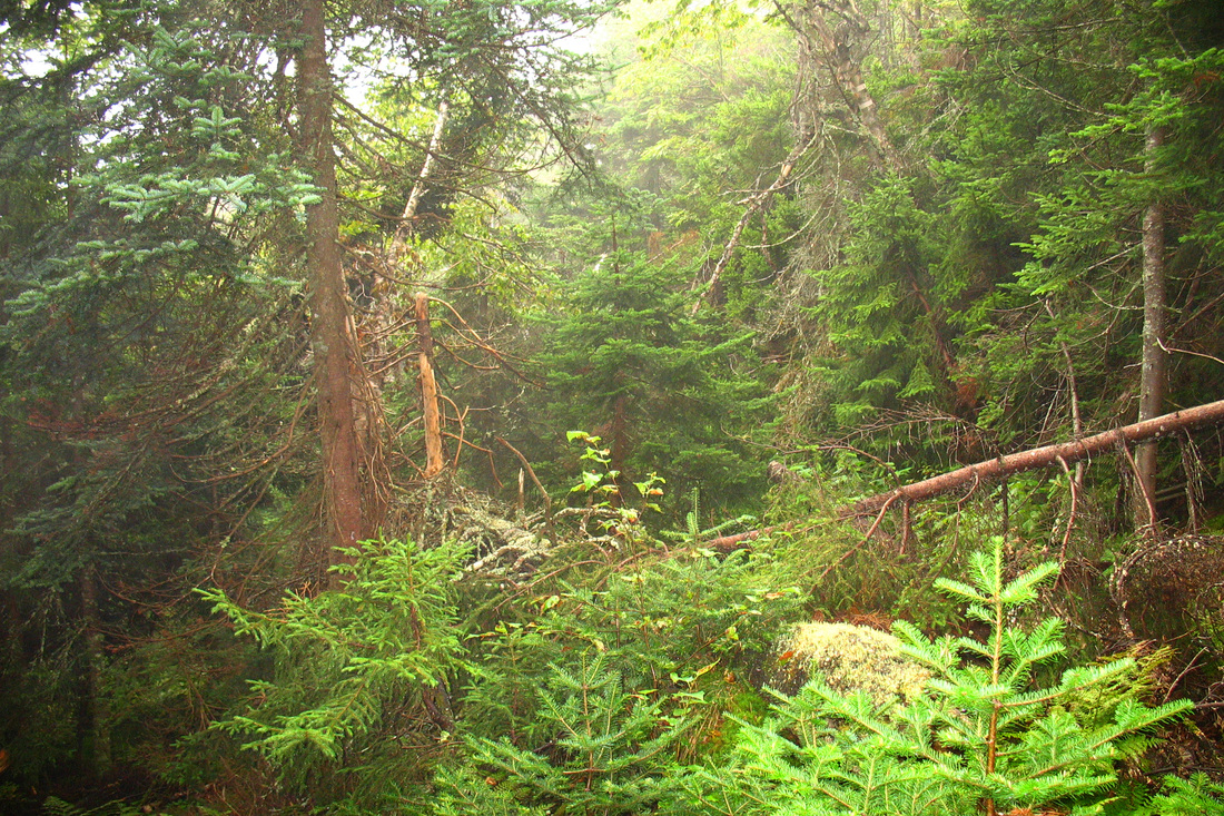
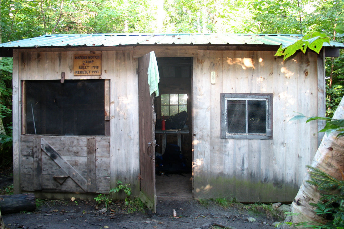
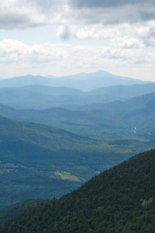
A dry cool breezy night allowed for good sleeping last night. We were on the trail by 8:00 and took our time on the climb up Worth Mountain. There were some small views on the way up but the summit was wooded. On the descent we came to Middlebury Snow Bowl and had nice views from the ski slopes and chair lift platform. We ate lunch on the steps of a ski patrol shack and then continued on, spending more time that it was worth finding the dreary Worth Mountain Lodge where we could have camped if we were desperate. We weren't so we kept hiking. On the way down we took a short spur to view Lake Pleiad, a sweet little pond rimmed by low hills. Unlike the Worth Mtn Lodge, it was well worth the extra effort to find it. At Middlebury Gap we saw Otter whose husband was dropping off a friend to hike with her for a few days. We chatted and then they moved up the trail ahead of us. The limb out of the Gap was steep but uneventful. We walked along slowly, seeing several toads. I heard and saw a Black-throated Blue Warbler. Earlier in the morning we had come upon a family of Ruffed Grouse. We saw some of the young birds fly off and I heard what I believe was the mother squawking. We came to Boyce Shelter and took a break and filled some water bottles. We had only 2 miles to go to get to Skyline and we thought only one more climb. That climb came and went and after descending a bit we found ourselves ascending a rather significant climb up Mt. Battell. Finally we topped out and soon came to Skylight Pond. The Lodge is a small log cabin with two sleeping decks and a porch. The pond is beautiful and the view from the porch looks out over the pond to distant mountains, some of which must be the Whites. Supper was taco with corn bread dumplings, eaten on the porch. The black flies have gotten bad so we came in. I'm setting the alarm early tomorrow in hope of a good sunrise over the pond. The air is damp and the sky unsettled so it may pan out.
Saturday, 27 June 2009
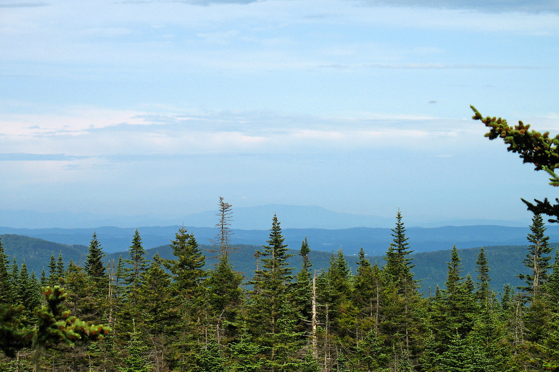
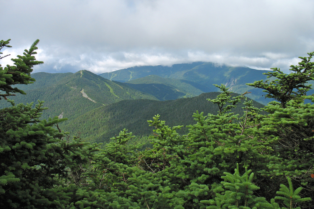
We were treated to a rollicking good thunderstorm and downpour at Skyline Lodge and we enjoyed it immensely. The rain was LOUD on the metal roof! The spectacular sunrise I'd hoped for got clouded out and a rain shower kept us in bed a little late. We got hiking at 8:5 and got climbing up Breadloaf Mountain which warmed us up. We were pretty well socked in but the woods were attractive and the hiking was enjoyable. We cam to a short spur trail which passed directly (almost) over the summit to a vista. We visited the summit because it is a New England Hundred Highest peak but skipped the vista because we already know what the inside of a cloud looks like. We took a snack break at Emily Proctor shelter before proceeding to Mt. Wilson where we did get a view through the clouds. Then followed a long descent with many small climbs mixed in. One of them was Mt. Roosevelt where we sneaked in another cloud-framed view. Our final climb for the day, Mt. Cleveland, was more significant but we topped it in just over half an hour. The descent to Cooley Glen was steep but not very long and we got pretty well settled in before a short downpour. Now the sun has been out a few times and we've been visited by Dark-eyed Juncos and serenaded by Swainson's Thrushes, Hermit Thrushes, and a Blackpoll Warbler. Father-daughter team, Harvey and Kate, arrived 18:30 from Sucker Brook.
Sunday, 28 June 2009
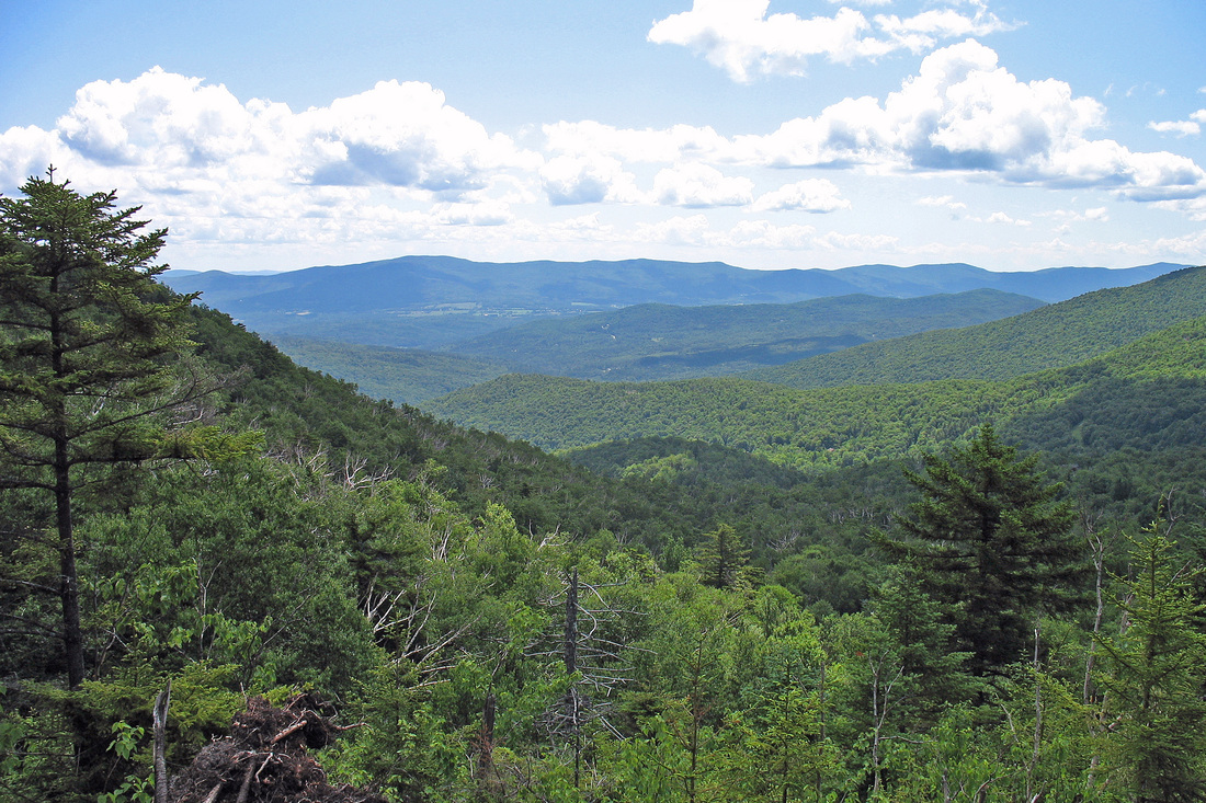
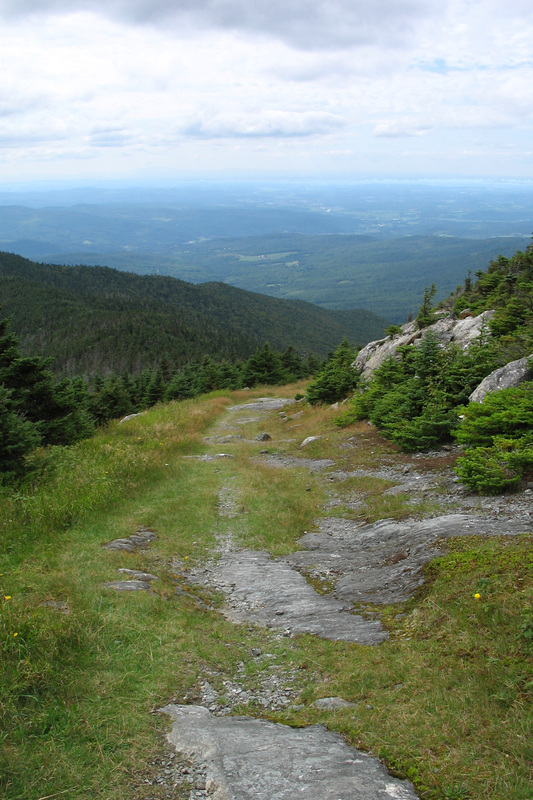
With the alarm set for 6:00 we were on the trail by 7:15. We had a fairly easy climb to warm us up followed by a several mile descent (with some short ups tossed in) that made for easy and pleasant hiking. It never rained and the clouds seemed to be trying to lift, affording us some occasional views. The view from Sunset Ledge was especially nice. We got to Lincoln Gap at around 10:30 and met Harvey and Katie who had a resupply stop there and were picking up other hikers. We stopped to wring out our socks and Katie's Mom offered us chocolate chip cookies and fresh peaches. The peaches were juicy and wonderful and Chelsea said the cookies were terrific - our first Trail Magic!
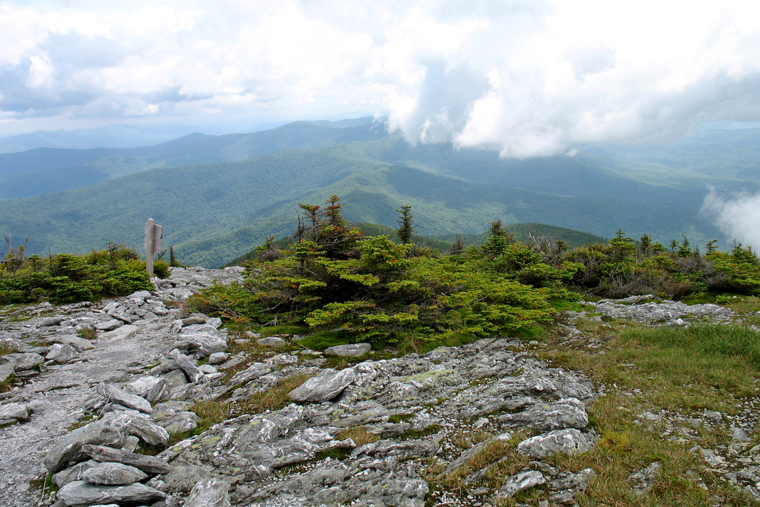
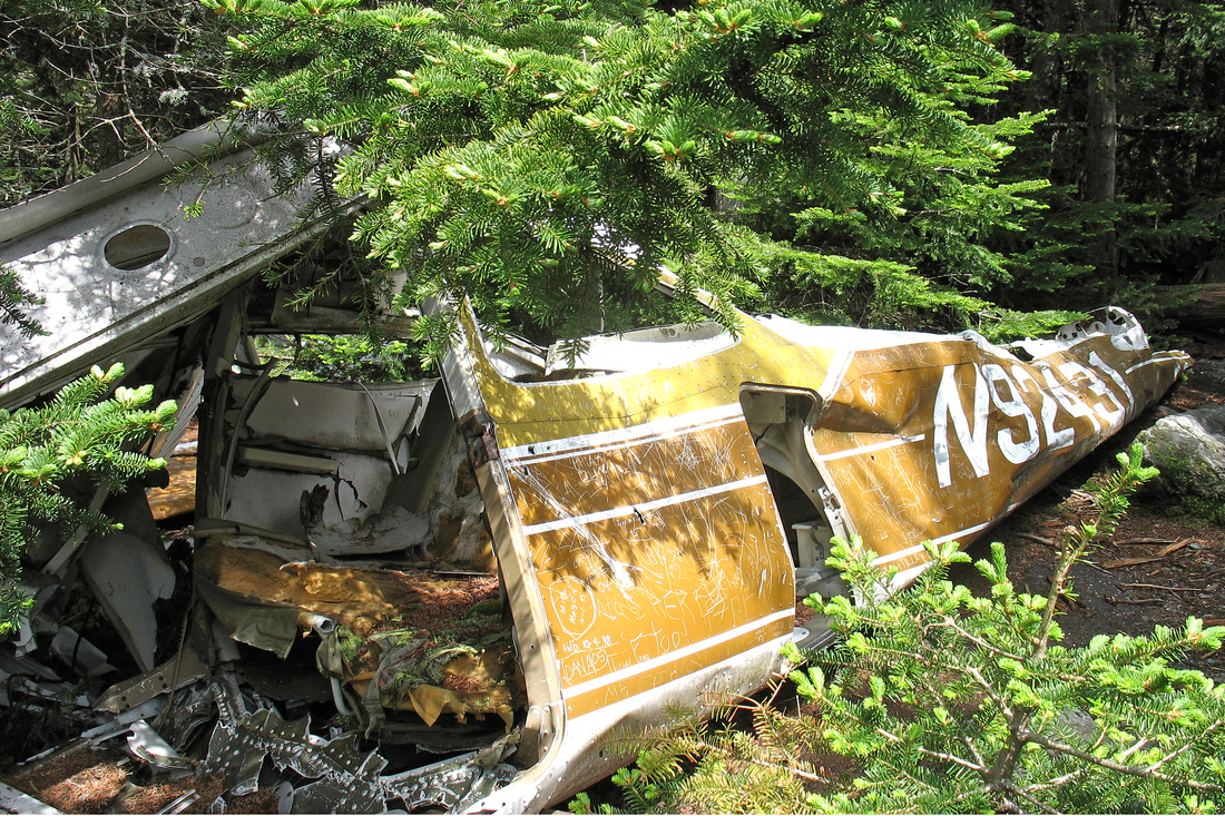
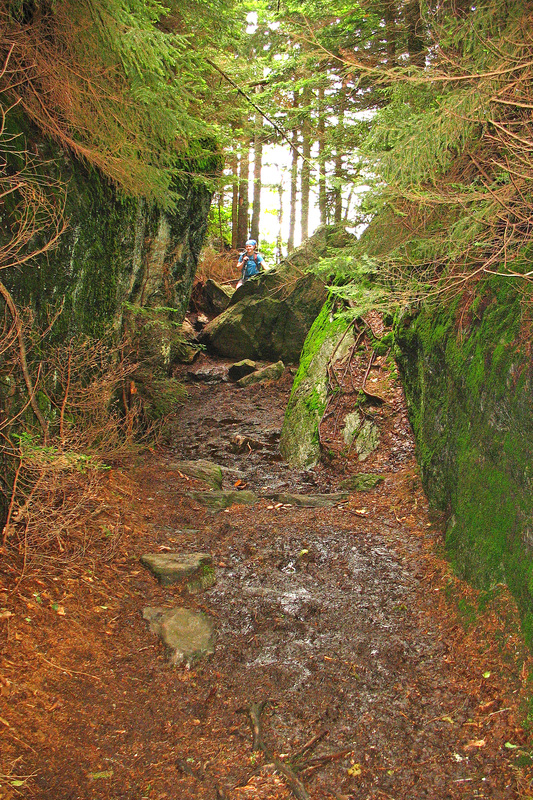
The initial climb out of Lincoln Gap was fairly easy and we were soon at Battell Shelter. Our initial plan would have had us sleeping here last night. Fortunately we didn't: what a moldy smelling stink hole. It made me wheeze. We filled our water, swallowed some food and split. The climb from Battell to Mt. Abraham was wicked fun with lots of scrambling up steep ledges. The sky was still clearing so we were getting some great views. We met a lot of day hikers, too, which was fun. The summit of Abe was gorgeous, poking just above tree line, and we enjoyed views in all directions. We met Harvey and family up there and he told us about an old plane crash site just off the summit. We checked it out - a small plane was in pieces and had, unfortunately been graffitied heavily.
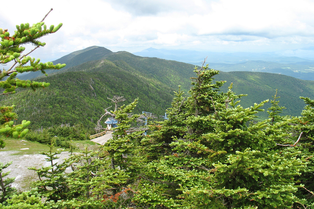
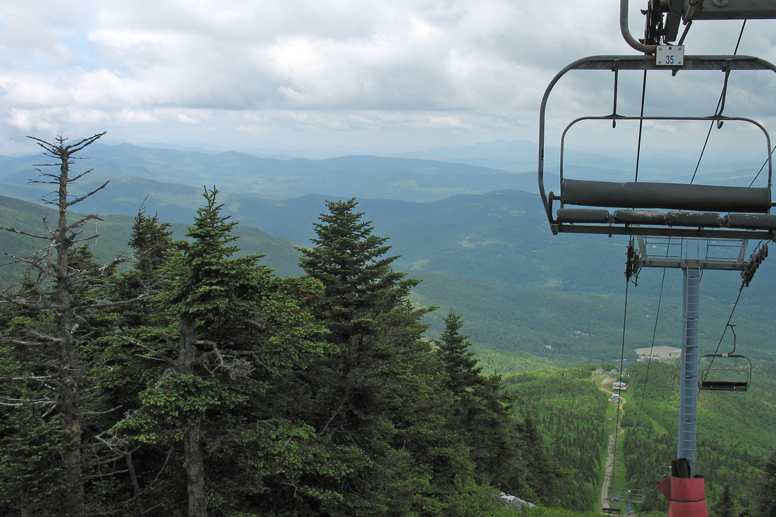
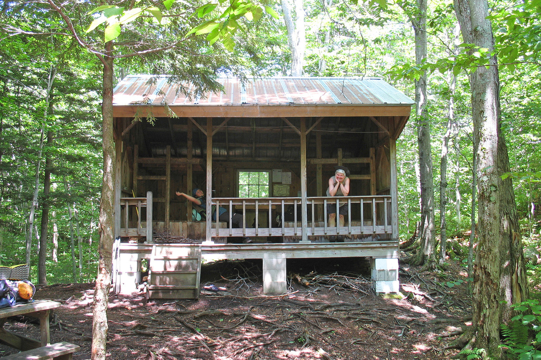
We continued along the ridge which was mostly in the trees but had many minor summits and ledges for views which was nice because the weather was holding, for a change. We finally topped out on Mt. Ellen, a 4K peak, and came out to a chairlift and ski slopes and had a hard time finding the trail. We finally did and began our descent which was loooong and full of wet roots and rocks that we slipped and tripped over. At last we came to the side trail to Glen Ellen Lodge and we were soon moving in. The Lodge has seen its best days but is pretty cool and welcoming despite being run down. It sits on a small ledge with a nice eastern view. Shortly after we arrived clouds moved in and rain began. I'm hoping it clears off enough for a nice sunrise.
The initial climb out of Lincoln Gap was fairly easy and we were soon at Battell Shelter. Our initial plan would have had us sleeping here last night. Fortunately we didn't: what a moldy smelling stink hole. It made me wheeze. We filled our water, swallowed some food and split. The climb from Battell to Mt. Abraham was wicked fun with lots of scrambling up steep ledges. The sky was still clearing so we were getting some great views. We met a lot of day hikers, too, which was fun. The summit of Abe was gorgeous, poking just above tree line, and we enjoyed views in all directions. We met Harvey and family up there and he told us about an old plane crash site just off the summit. We checked it out - a small plane was in pieces and had, unfortunately been graffitied heavily.
We continued along the ridge which was mostly in the trees but had many minor summits and ledges for views which was nice because the weather was holding, for a change. We finally topped out on Mt. Ellen, a 4K peak, and came out to a chairlift and ski slopes and had a hard time finding the trail. We finally did and began our descent which was loooong and full of wet roots and rocks that we slipped and tripped over. At last we came to the side trail to Glen Ellen Lodge and we were soon moving in. The Lodge has seen its best days but is pretty cool and welcoming despite being run down. It sits on a small ledge with a nice eastern view. Shortly after we arrived clouds moved in and rain began. I'm hoping it clears off enough for a nice sunrise.
Monday, 29 June 2009
We had Glen Ellen to ourselves last night, just us and the rain. I pulled out the weather radio which forecast heavy rain and severe thunderstorms for the next several days. Not so good for going over Camel's Hump and Mansfield. We decided to wait it out at home and called Kevin. We set out in chilly rain but the hike back up to the LT and then up General Stark Mountain was warming. We took a break at Stark's Nest, a warming hut that Mad River Glen leaves available to hikers. We were grateful for the chance to get a few minutes out of the rain for a snack.
The descent from Stark's Nest to App. Gap was steep with numerous slick ledges and roots. Where the trail wasn't vertical the rain had pooled up to produce fantastic, boot-sucking mud. This wasn't really fun hiking. We were barely making 1 mile/hour. Finally we began to hear traffic but the cloud we were in was so dense that we couldn't see the road until we were nearly stepping out onto it. We dashed across to the parking area to wait for Kevin while we ate a snack. He pulled in about 20 minutes later from the west, having missed the lot on his way by the first time. We headed to Rough and Tumble's summer condo - we'd called them from Glen Ellen - for showers and a surprise lunch! It was fun to finally meet them. After visiting a while we headed home to monitor the weather situation for a chance to come back out.
The descent from Stark's Nest to App. Gap was steep with numerous slick ledges and roots. Where the trail wasn't vertical the rain had pooled up to produce fantastic, boot-sucking mud. This wasn't really fun hiking. We were barely making 1 mile/hour. Finally we began to hear traffic but the cloud we were in was so dense that we couldn't see the road until we were nearly stepping out onto it. We dashed across to the parking area to wait for Kevin while we ate a snack. He pulled in about 20 minutes later from the west, having missed the lot on his way by the first time. We headed to Rough and Tumble's summer condo - we'd called them from Glen Ellen - for showers and a surprise lunch! It was fun to finally meet them. After visiting a while we headed home to monitor the weather situation for a chance to come back out.
Monday, 06 July 2009
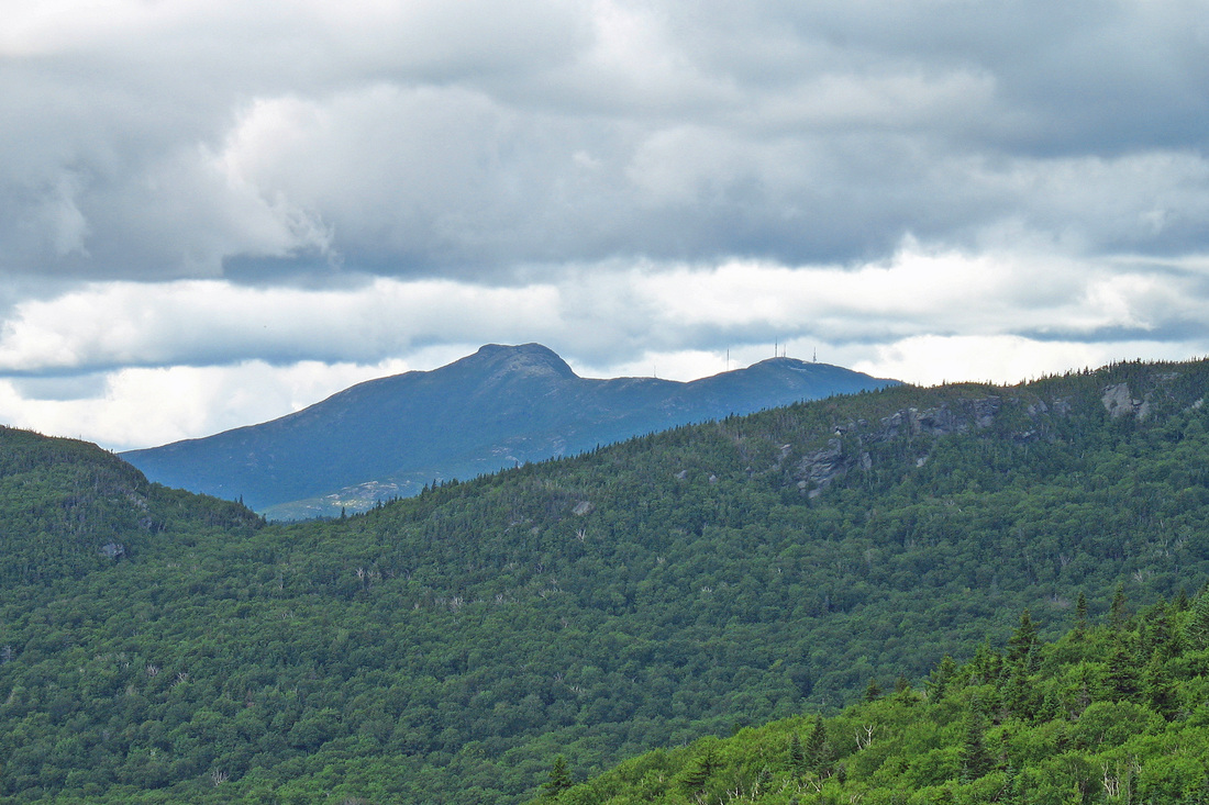
Back on the Trail! Although the forecast for the next two days has deteriorated we decided to come out and have a go. At least there were no wild storms predicted, just rain. Kevin dropped us off back at App. Gap. We were hiking by 11:15 It was sunny and even warm - we got some views! The climbing was fairly easy and the trail relatively dry but it wouldn't be the Long Trail without some steep, rooty ledges. from Molly Stark's Balcony we could see our next week of hiking - Burnt Rock, Camel's Hump, and even possibly Mt. Mansfield. (Correction, it was the Worcester Range, not Mansfield. Mansfield was blocked by Camel's Hump.) We walked through spruce-fir forest that was fragrant in the warm sun and bright open hardwoods dapples with light. After crossing a few streams we arrived at Birch Glen at about 13:15 and we are enjoying a leisurely afternoon.
Shortly after 18:00 a thunderstorm finally rolled in, it was so dark we almost needed headlamps. Soon after a hiker named AussieD (from Australia) rolled in, followed by Just Joe and Furlo. We had a good time talking to them. Somehow AussieD had managed to come without a sleeping bag and some other important gear. He slept in blue jeans, wrapped up in his tent and shivered all night.
Shortly after 18:00 a thunderstorm finally rolled in, it was so dark we almost needed headlamps. Soon after a hiker named AussieD (from Australia) rolled in, followed by Just Joe and Furlo. We had a good time talking to them. Somehow AussieD had managed to come without a sleeping bag and some other important gear. He slept in blue jeans, wrapped up in his tent and shivered all night.
Tuesday, 07 July 2009
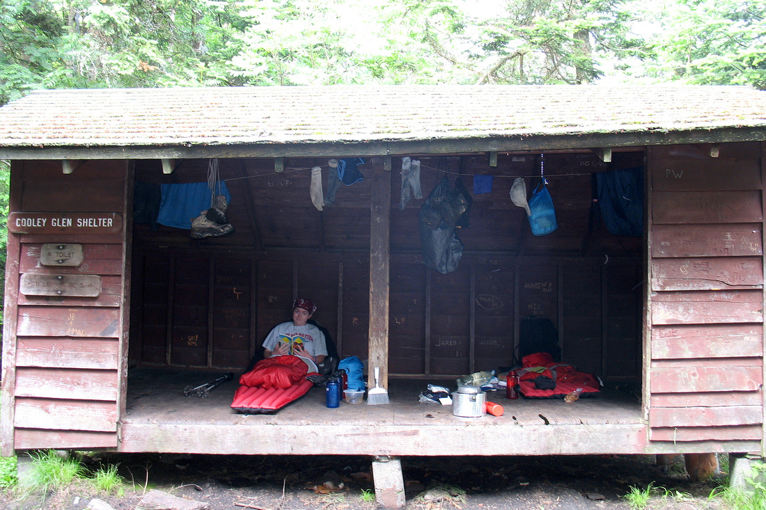
The first part of the day was nice - dry, easy walking, we made good time and got to Cowles Cove Shelter at 10:00 where we took a snack break. There was a southbound hiker there sho hadn't gotten rolling yet. We also saw Just Joe and Furlo there. The climb up Burnt Rock Mountain was a fun scramble over mostly dry ledges. We had a good view of clouds but the summit was quite pretty anyway. Shortly after we topped out the rain began, soon followed by hail, lightning, and thunder. We stopped to get our jackets on. It was quite a cold rain and the slick ledges were slow to descend. After about an hour we finally began the limb of Mt. Ethan Allen. Despite the trail being full of water the footing was good and the climb was warming. a second round of rain, hail, and lightning visited us as we climbed. Then the Sun came out. And then it left again. We topped out on Ethan Allen and took a moment to admire the view of cloud from the little summit ledge. All we had left was a 1 mile drop to camp. I expected more horrible slick ledges but mostly we just walked down a rushing stream bed and arrived at the shelter at 15:00. Just Joe was already there and Furlo arrived about a half hour later. At about 18:00 as the four of us were making plans to hike together and dry out at Furlo's sister's house a trio of siblings arrived. Luckily this cabin is spacious and dry and we all fit easily.
Wednesday, 08 July 2009
We had a cozy night at the newly rebuilt Montclair Glen with rain and another T-storm later in the day. We were there with Just Joe and Furlo and a brother and two sisters. The morning was gloomy and we didn't get hiking until 9:00. The climb up Camels Hump was steep and rocky but I enjoyed it. JJ passed us early on and we mostly climbed with Furlo. We came to the junction with the Alpine Trail and looked up to see the summit mass looming over us through a haze of cloud. The final push was gorgeous and quite rigourous but the rocks were mostly dry. We gained the summit 20 min later and I pulled the camera out of my pack for a photo. We didn't linger as the sky was threatening and we had no views. We began our descent which we didn't enjoy at all. The six mile descent (in the rain) featured many significant ups-and-downs with slick, slimy, steep ledges. Hours passed and we seemed no closer to the valley. Furlo's husband, Tom, met us after hiking up 3.5 hours. We took a late lunch at Bamforth Ridge (nice shelter!) and finally, 5.5 hours from the summit, we reached the road. Tom and Furlo (Annette) took us home for the night where we dried out y the wood stove with a Maine Coon Cat named Swidgen.
Today I heard (and saw) a Hermit Thrush singing.
Today I heard (and saw) a Hermit Thrush singing.
Thursday, 09 July 2009
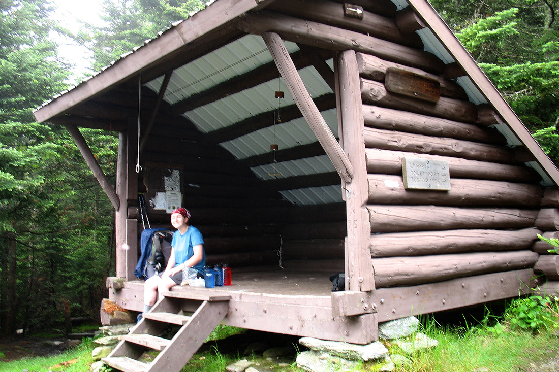
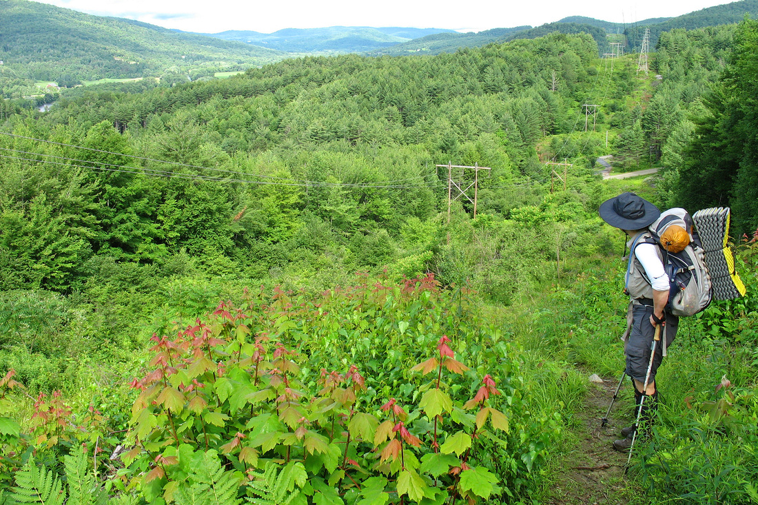
After a too-leisurely morning at the house and then a resupply at the post office we were walking by 9:00. We started out steeply up a power line before cutting into the woods. After a few steep, slick ledges we enjoyed beautiful, rolling hiking through open woods. We stopped briefly at Duck Brook then pressed on over Bolton Jr to Bolton Notch Road where Just Joe met us. We continued up the steady but enjoyable climb to Buchanan Shelter which we reached at 14:15. We didn't take the long spur to the shelter but snacked at the junction and decided to go for Puffer. the rest of the climb up Bolton seemed steeper and it began to rain lightly. Mudflap (Chelsea) turned 17 on this stretch of trail. The summit was really two peaks separated by a substantial saddle. The final peak seemed elusive but we finally gained it. I pissed on it and then headed downhill. I was out of water and snack and really started to bonk. The final half-mile descent was steep but not too difficult except that I was too hungry to focus. I finally got to the shelter - Chelsea was 10 minutes ahead of me. The shelter is simple but the view to Mansfield and to the east is excellent. Really a nice place! Tacos for supper on this cool, mostly clear evening. Swainson Thrushes are singing.
Today I saw a baby snake and some snails.
Today I saw a baby snake and some snails.
Friday, 10 July 2009
We planned on an early start today knowing we had a long day ahead of us. Fortunately we were treated to a natural alarm clock - a spectacular sunrise. Ii woke at 4:30 and took some pictures. Once the Sun was up so were we and we were hiking by 6:55. The trip down the rest of Bolton Mtn was slick and fussy but we eventually came to Taylor Lodge where we took a morning break. Thumbing through the register I saw a note to us from Rough and Tumble who had hiked in days earlier. We hiked away through Nebraska Notch and came to a clear rushing stream that the Trail crossed. We took advantage of the chance to rinse our faces and soak our feet in the cold water.
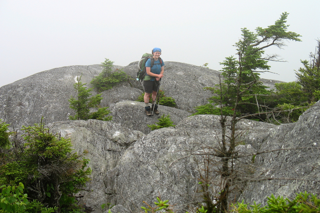
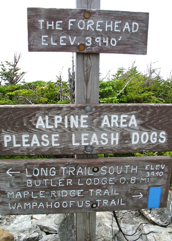
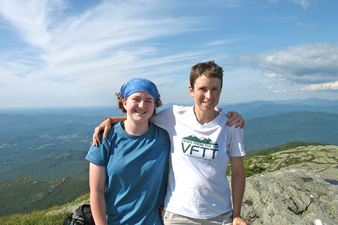
Our climb up Mansfield began after the water break and was pretty easy going up to Butler Lodge where we took another short break (and which is way ore than 0.1 mile off the trail, straight downhill). From there we began to climb the Forehead for real. In addition to several ladders there were three tricky maneuvers, two of which I removed my pack for, and should have done for the third. The last of them was the hardest. I went first and the Chelsea handed up all our poles and packs to me before she and Furlo climbed over it. Shortly after that move we met a hiker who said the hardest part was over. He took our picture and in a while we came to the summit of the Forehead where we saw massive dark clouds piling over Mt. Mansfield at the other end of the ridge, 2 miles away. there was nothing for it but to sprint and hope we got over the summit - and down a steepety-steep, rocky half mile on the other side - before the storm broke. The two miles, including about 600 feet of vertical gain and an unmarked road crossing that had us wandering around for several minutes trying to find the trail, took us less than an hour. Just as we crested the summit the sky cleared off without a drop of rain or even the slightest rumble of thunder. Grateful, we took a leisurely half hour on the summit snacking, making phone calls, and sight seeing.
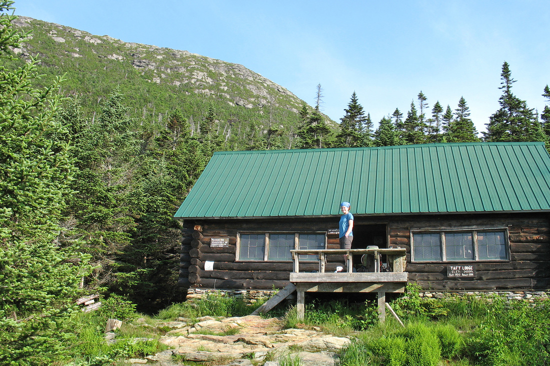
The final 0.7 mile down to Taft Lodge was STEEP and took us an hour. We arrived to find Furlo's husband waiting with apples, bananas, and other snacks. Tom told us that Epic Thunderstorms are forecast for tomorrow afternoon and we are hoping we can get to Whiteface Shelter before they hit.
Our climb up Mansfield began after the water break and was pretty easy going up to Butler Lodge where we took another short break (and which is way ore than 0.1 mile off the trail, straight downhill). From there we began to climb the Forehead for real. In addition to several ladders there were three tricky maneuvers, two of which I removed my pack for, and should have done for the third. The last of them was the hardest. I went first and the Chelsea handed up all our poles and packs to me before she and Furlo climbed over it. Shortly after that move we met a hiker who said the hardest part was over. He took our picture and in a while we came to the summit of the Forehead where we saw massive dark clouds piling over Mt. Mansfield at the other end of the ridge, 2 miles away. there was nothing for it but to sprint and hope we got over the summit - and down a steepety-steep, rocky half mile on the other side - before the storm broke. The two miles, including about 600 feet of vertical gain and an unmarked road crossing that had us wandering around for several minutes trying to find the trail, took us less than an hour. Just as we crested the summit the sky cleared off without a drop of rain or even the slightest rumble of thunder. Grateful, we took a leisurely half hour on the summit snacking, making phone calls, and sight seeing.
The final 0.7 mile down to Taft Lodge was STEEP and took us an hour. We arrived to find Furlo's husband waiting with apples, bananas, and other snacks. Tom told us that Epic Thunderstorms are forecast for tomorrow afternoon and we are hoping we can get to Whiteface Shelter before they hit.
Saturday, 11 July 2009
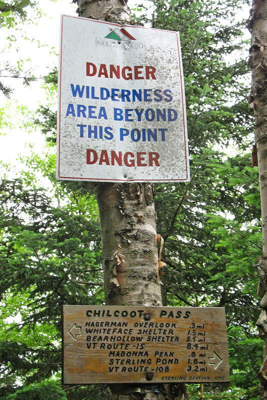
Didn't sleep well last night due to noisy males in the shelter and too hot on the top bunk. We hit the trail at 8:00 and a short way down found my friend Ryan on his way up to meet us bearing nectarines - more fruit! H hiked back down with us and we traded GMC and Gould gossip. At the road he agreed to shuttle us up to the old LT trailhead which is now the Sterling Pond trail, in the hope that we'd beat the storm. We hiked up to the new Sterling Pond shelter where we took a snack break before hitting the ridge. We saw a few backpackers and dayhikers on this stretch but not the crowds we saw headed up to Sterling Pond.
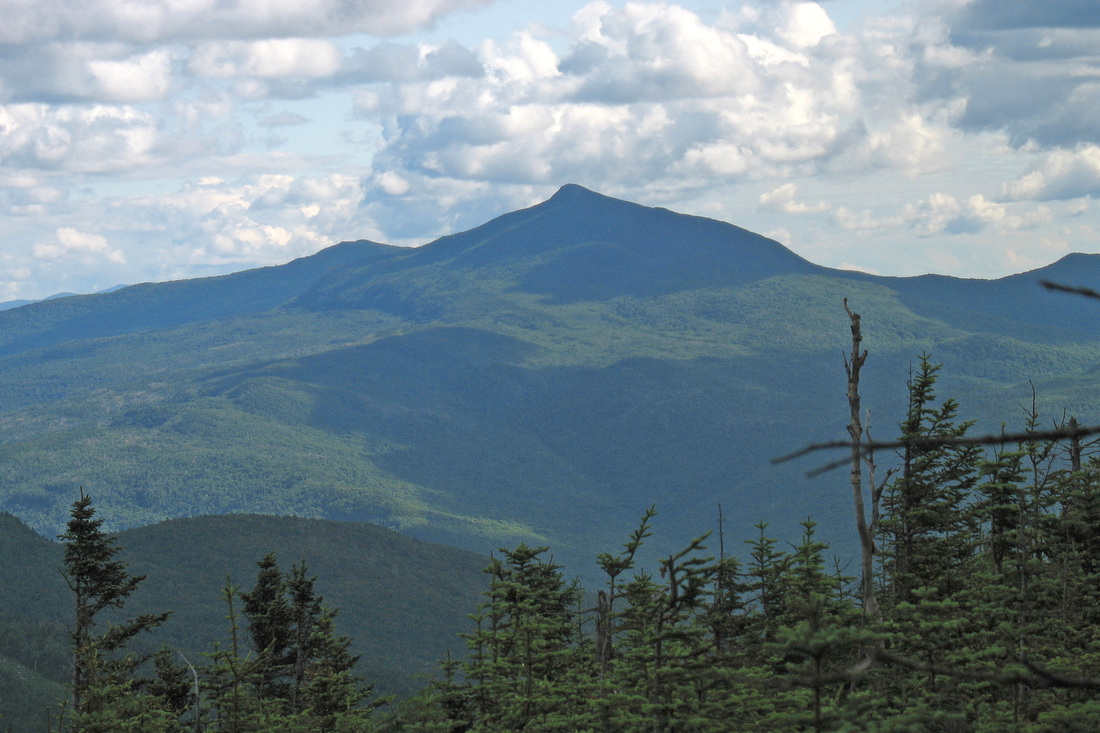
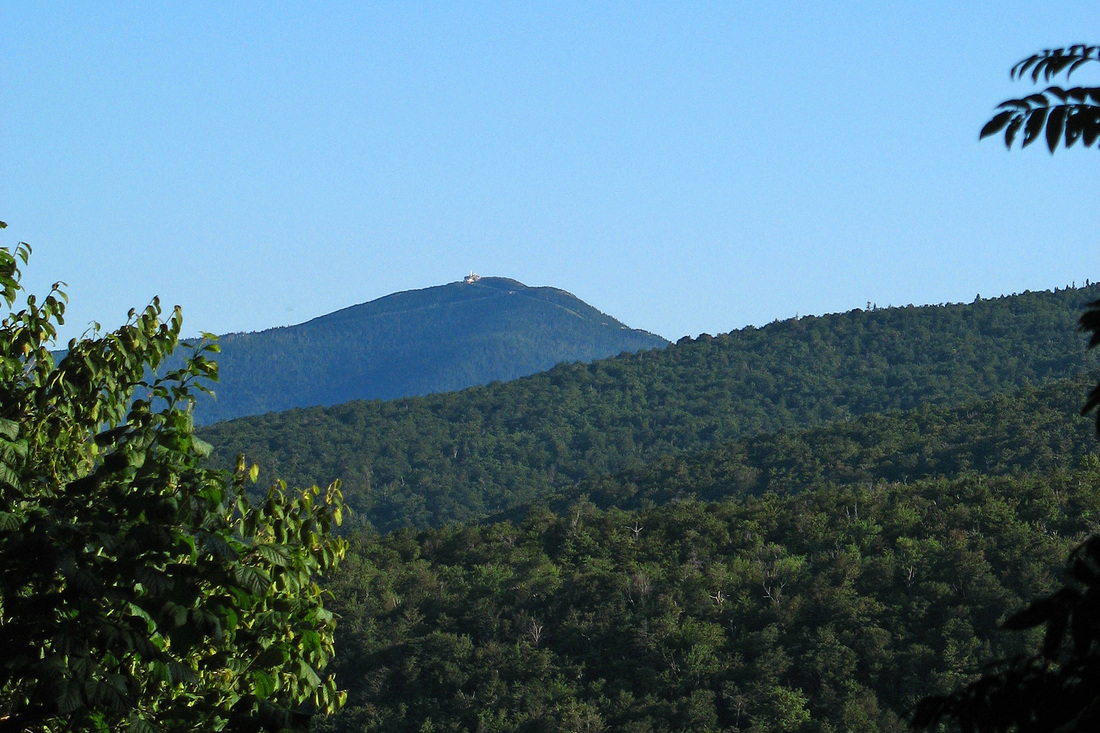
From the warming hut on Madonna Peak we could see Camel's Hump and Mansfield. The Hump looked too far away for us to have walked from there in just a few days. We could have stayed in the warming hut but the weather was still holding although the haze was thickening. The rest of the hike was business as usual and we arrived at Whiteface at 14:30, well before the storm.
We settled in with early supper and tea. The storm finally hit some time around 17:00 and is still ongoing nearly two hours later. We enjoyed watching it roll in over Mansfield and so far it has been very pleasant and mild - hardly epic. Hopefully it will clear by morning as predicted. Tomorrow night to Furlo's house again. Chelsea is excited for Pizza! And I'm excited for Beer!
Sunday, 12 July 2009
The storm cleared off by around sunset last night but resumed overnight with more wind, heavier rain, and louder thunder. I didn't sleep well because the floor was tipped and I was sliding all over the place. Eventually morning happened and we were socked in so stayed in bed until 7:15 when the weather seemed to be clearing. We hit the trail around 8:30 after seeing a cool bird in the scrub in front of the shelter. It was probably some kind of Warbler - it had a dark black throat and a lot of vivid yellow on it. We aren't sure what it was.
The climb up Whiteface was pleasingly steep with few ledges. A couple of openings near the top provided some views. The first couple miles of the down were steep with intermittent ledges but not too bad. Then the grade eased up at the Overhanging Rock. Soon after we met some friends of Furlo's, Alice and Gary, who were on their way up. We arranged to meet at the Hub for Pizza and Beer later. We stopped in at Bear Hollow shelter for a final snack before finishing the last, mostly easy 3.6 miles to RT 15 where we waited only a few minutes for Tom.
Happily the Hub makes its dough and sauce without dairy so I was able to order a cheeseless pizza (16-inch) and nearly finished the whole thing. Now relaxing in Fletcher at Tom and Annette's house, getting showered and laundry done and playing with Swidgen. We have less than 50 miles to go to Canada.
Monday, July 13 2009
I woke up this morning with a raging lung infection, unable even to walk to the bathroom. I am heading home to get meds and learn how to breathe again.
Wednesday, 29 July 2009
I should be writing about how good it felt to be to be back on the trail after two weeks off. I should be writing about how good the hiking was today - the lovely open hard woods, the easy, rolling terrain, the relatively low mud levels, and the cool, non-rainy 80F weather. All of that would be true, but today sucked. I wasn't in my usual state of pre-hike excitement yesterday. The packing and organizing were much more of a chore and not at all a a promise of an adventure to come. Kevin dropped us off in Johnson shortly after 9:00 after a 5:00 alarm. I was sluggish at the start but figured I'd hike through it. We stopped to put on some Deet - the bugs were thick - and continued plodding on. It was hot - though only 80F, cool by typical late July standards, it was scorching by this summer's standards. And it was humid. Deet-infused sweat was soon running off my forehead and into my eyes and mouth. We found our way across the Lamoille River and trudged up to Prospect Rock where we dropped packs for a short break. I went to pee and saw dark yellow fluid pool on the ground.
As we hiked away from Prospect Rock's hazy view I resolved to drink more and *did* drink more. The going was a little easier and we came upon Roundtop Shelter by 11:00. While the first mile had taken us nearly an hour, the nearly two miles from there to the shelter were covered in only 50 minutes. I started to feel some optimism, if not energy and enthusiasm. We checked the register and saw that Furlo had signed in. After a short rest we moved on but not rapidly. I continued my drinking regimen but it mostly made me queasy. We stopped at a small stream to rinse our heads and I attempted to eat a Clif Bar. I got about half of it in before it threatened to come back up. I put the other half away.
We came to the Codding Hollow Road and soon crossed a stream that was the last water we were sure of before Corliss Camp. We stopped to fill and treat our bottles. While we waited we briefly considered camping there. We had five miles to Corliss including a two hour climb that we were just about to embark on. We decided to move on. Twenty-five minutes later it was time to transfer the water from our bottles to our tanks so we stopped and dropped our packs. I felt like shit. Chelsea looked like she felt the same. "Want to just tent here?" "Yes."
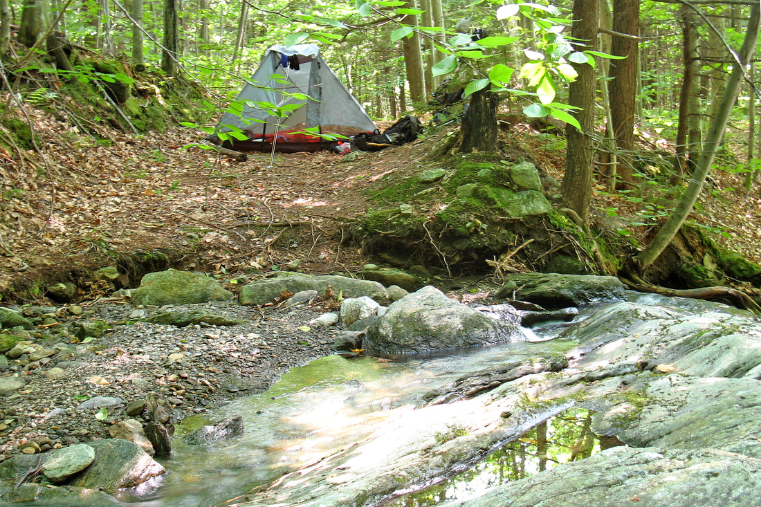
Instead we backtracked a few minutes to the last stream crossing so we could drink liberally. We made camp shortly before 14:00 just off a large stream where it runs over ledges. We've been relaxing here for nearly 3 hours now and are starting to feel better. We've studied the map and considered our options for finishing the trail We could be done on Sunday morning if all goes well after today and Chelsea skips work. Or we could go out Saturday as planned and have only a dayhike left. We'll see how it goes.
As we hiked away from Prospect Rock's hazy view I resolved to drink more and *did* drink more. The going was a little easier and we came upon Roundtop Shelter by 11:00. While the first mile had taken us nearly an hour, the nearly two miles from there to the shelter were covered in only 50 minutes. I started to feel some optimism, if not energy and enthusiasm. We checked the register and saw that Furlo had signed in. After a short rest we moved on but not rapidly. I continued my drinking regimen but it mostly made me queasy. We stopped at a small stream to rinse our heads and I attempted to eat a Clif Bar. I got about half of it in before it threatened to come back up. I put the other half away.
We came to the Codding Hollow Road and soon crossed a stream that was the last water we were sure of before Corliss Camp. We stopped to fill and treat our bottles. While we waited we briefly considered camping there. We had five miles to Corliss including a two hour climb that we were just about to embark on. We decided to move on. Twenty-five minutes later it was time to transfer the water from our bottles to our tanks so we stopped and dropped our packs. I felt like shit. Chelsea looked like she felt the same. "Want to just tent here?" "Yes."
Instead we backtracked a few minutes to the last stream crossing so we could drink liberally. We made camp shortly before 14:00 just off a large stream where it runs over ledges. We've been relaxing here for nearly 3 hours now and are starting to feel better. We've studied the map and considered our options for finishing the trail We could be done on Sunday morning if all goes well after today and Chelsea skips work. Or we could go out Saturday as planned and have only a dayhike left. We'll see how it goes.
Thursday, 30 July 2009
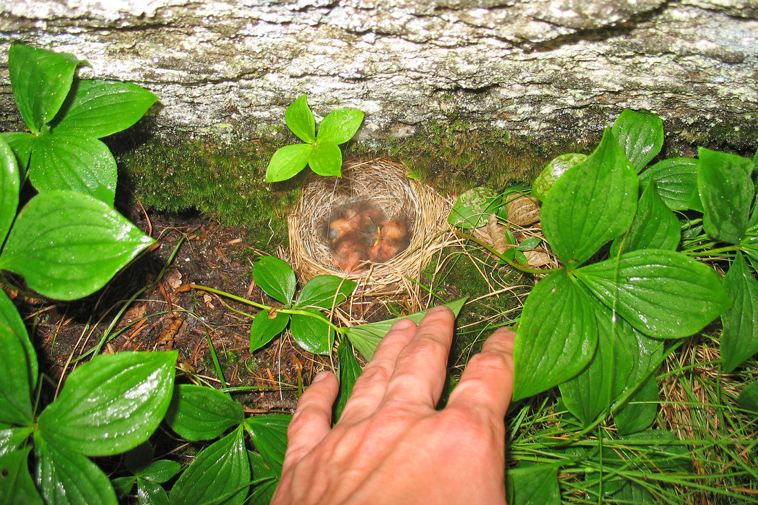
After a rainy and somewhat uncomfortable night sliding around in Chelsea's tarp tent we packed up on a misty morning. The rain had stopped, at least for the time being, and we started out up Laraway Mountain. We were both feeling a lot better and loved the cooler temperatures. As we progressed into the dense cloud enshrouding the mountain we noticed a cliff developing on our right side. Suddenly, out of the lush green carpet at the base of the cliff flew a small grayish songbird. i lost sight of her in the brush but investigated the place she had flown from. Sure enough there was a tiny grass cup of a nest holding three tiny chicks. they were so small their eyes weren't open and they had only the barest bit of fluff covering their skin. Lovely! After taking a couple of quick pictures we hiked on so that their mother could return to them.
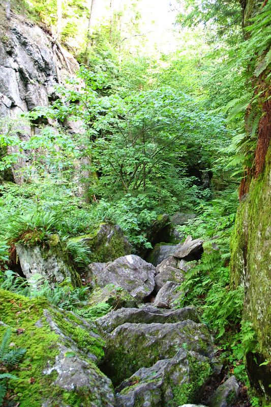
We expected another viewless experience from the top of Laraway and so were pleasantly surprised as the cloud lifted over the open ledge soon after we arrived. We were able to take in some views to the north while we rested and snacked. I quite enjoyed the trail from here as it moved along a ridge through soft green spruce-fir forest. Eventually we pulled into Corliss Camp and stepped inside to check it out. I had been wheezing, my lungs not being fully recovered yet, so I pulled out my inhaler to take a hit and...nothing. The mofo was empty. I had to go home and get it refilled. We continued up hill from Corliss taking our time so that I would not lose my breath. As long as I didn't get breathing too hard I should be okay. We paused at the top of black-fly-infested Butternut Mtn to call and arrange for a ride home. We had a lot of miles to cover but the terrain was gentle so it was easy to make progress without a huge effort. Despite this setback we really enjoyed this section of trail It was beautiful and the weather was becoming sunny and drier but still fairly cool. We had a good time going through Devil's Gulch which was a shorter, less intense cousin to Mahoosuc Notch near my house. Coming out of the Gulch I saw a tent, all stuffed in its sack and dry, laying right on the trail. With only a few miles to go we packed it out planning to advertise it on various websites. We arrived at the trailhead in late afternoon and while waiting for our ride I dwelt on this latest failure. At this point I don't really care about coming back to finish the Long Trail and probably won't until next year if at all. I wonder what will happen next to keep me from getting to Canada.
We expected another viewless experience from the top of Laraway and so were pleasantly surprised as the cloud lifted over the open ledge soon after we arrived. We were able to take in some views to the north while we rested and snacked. I quite enjoyed the trail from here as it moved along a ridge through soft green spruce-fir forest. Eventually we pulled into Corliss Camp and stepped inside to check it out. I had been wheezing, my lungs not being fully recovered yet, so I pulled out my inhaler to take a hit and...nothing. The mofo was empty. I had to go home and get it refilled. We continued up hill from Corliss taking our time so that I would not lose my breath. As long as I didn't get breathing too hard I should be okay. We paused at the top of black-fly-infested Butternut Mtn to call and arrange for a ride home. We had a lot of miles to cover but the terrain was gentle so it was easy to make progress without a huge effort. Despite this setback we really enjoyed this section of trail It was beautiful and the weather was becoming sunny and drier but still fairly cool. We had a good time going through Devil's Gulch which was a shorter, less intense cousin to Mahoosuc Notch near my house. Coming out of the Gulch I saw a tent, all stuffed in its sack and dry, laying right on the trail. With only a few miles to go we packed it out planning to advertise it on various websites. We arrived at the trailhead in late afternoon and while waiting for our ride I dwelt on this latest failure. At this point I don't really care about coming back to finish the Long Trail and probably won't until next year if at all. I wonder what will happen next to keep me from getting to Canada.
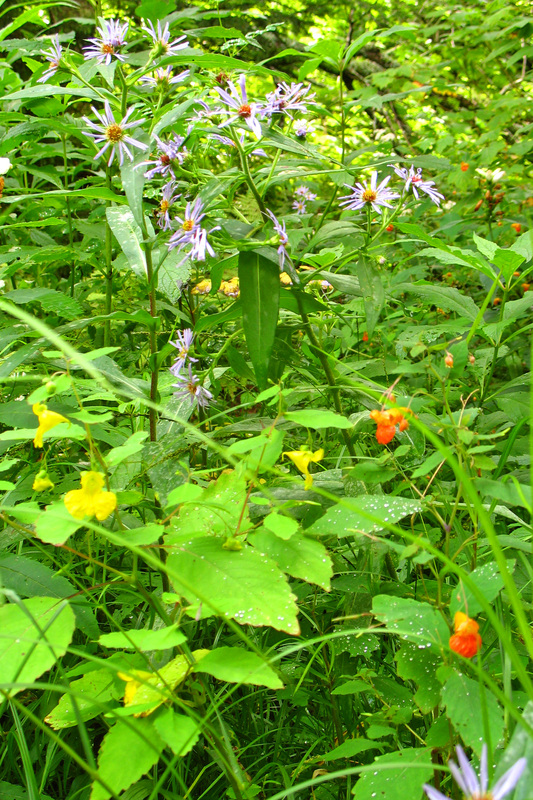
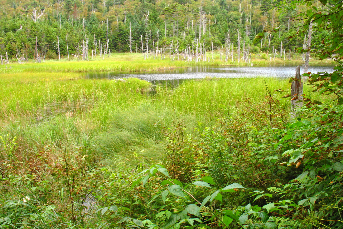
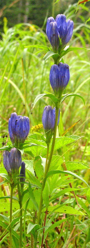
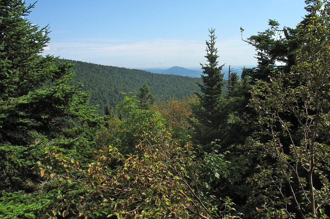
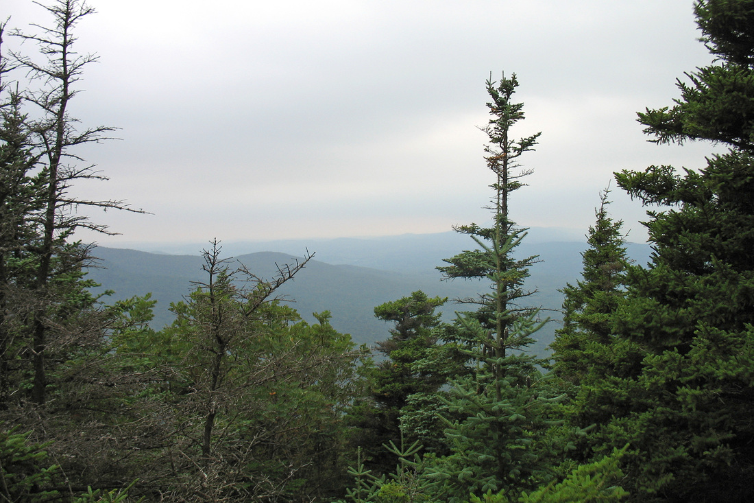
Monday, 24 August 2009
I'm hiking without Mudflap now because she is working but this is my last chance to come out and try to finish. I got to Rose Apple Acres Farm in North Troy this morning shortly before 9:00. The will keep my car and shuttle me to RT 118 and pick me p at Journey's End. Jay dropped me at 118 a little before 10:00. Heavy clouds filled the sky and the woods seemed dreary. These weren't the light, airy woods of the section just south of here. The climb up Belvidere was uneventful, punctuated by rain showers. Vermont's way of saying, "Welcome back" I suppose. When I topped out and saw the side trail to the fire tower I was in a cloud so I bypassed it. I've seen the inside of enough clouds to not want to go out of my way to see another one. The rest of the hike to Tilotson was easy and shortly before the shelter I passed a beaver pond and outlet stream with a lot of wild flowers including several kinds of asters, goldenrods, and some closed gentians. It was really beautiful. Tillotson Camp was kind of dreary but had nice views and an assortment of birds including several kinds of Warblers. I snacked there but it was only 14:00 and only 6 miles to the next camp so I moved on. A short, steep climb brought me to the top of Tillotson Peak and soon after I began descending I met an orientation group fro Lyndon State. They were excited when I told them they were almost done for the day. The ridge walk included a climb of Haystack Mountain where I got a nice view to the east. again I bypassed the spur. The drop from Haystack was rolling at first and then quite steep over muddy roots and ledges. I got to RT 58 at 17:00. I had 1.5 miles and a climb of about 700 feet to go. The trail was prettier, maybe because the sun was out. Surprisingly the last part took only 45 minutes. When I got to camp there was just one woman there: Mountain Goat (Faith). I was relieved because a group of six from Lyndon State were expected and I have no tent (I forgot it). They arrived later and some are tenting so the shelter isn't too full. Early night tonight I think.
Tuesday, 25 August 2009
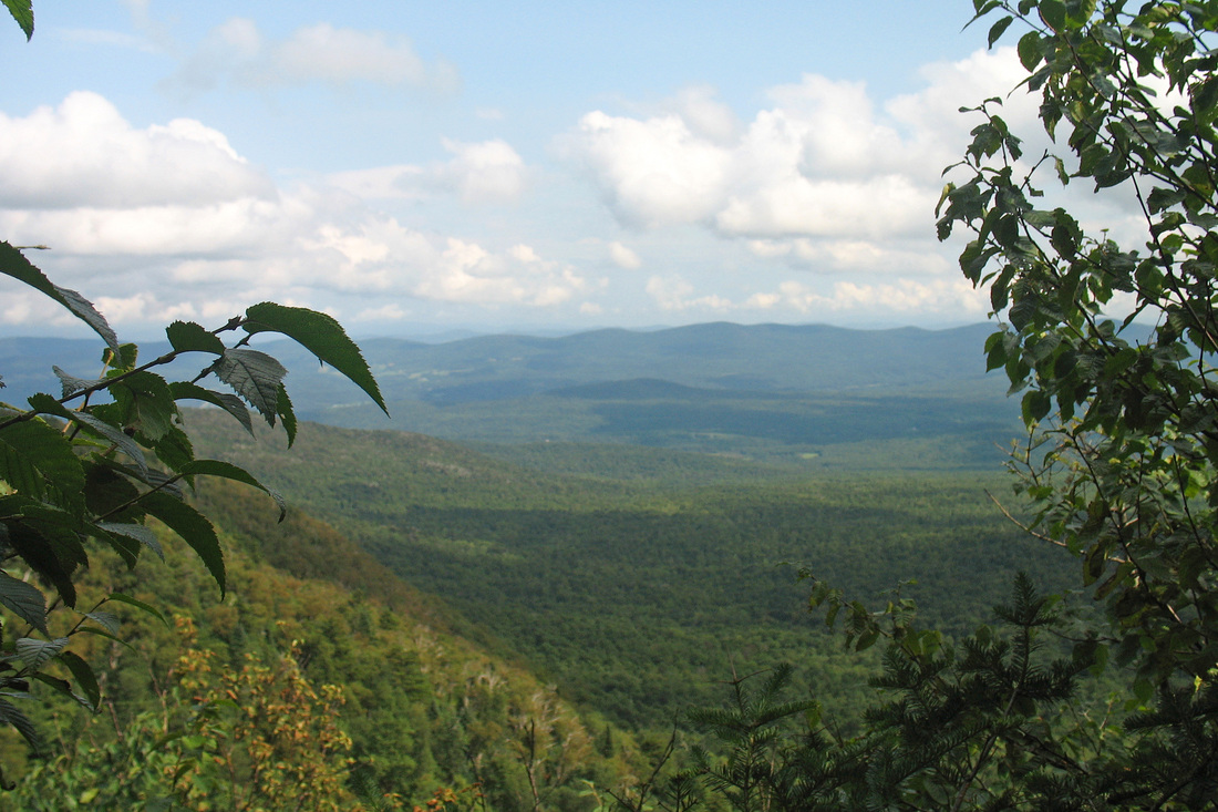
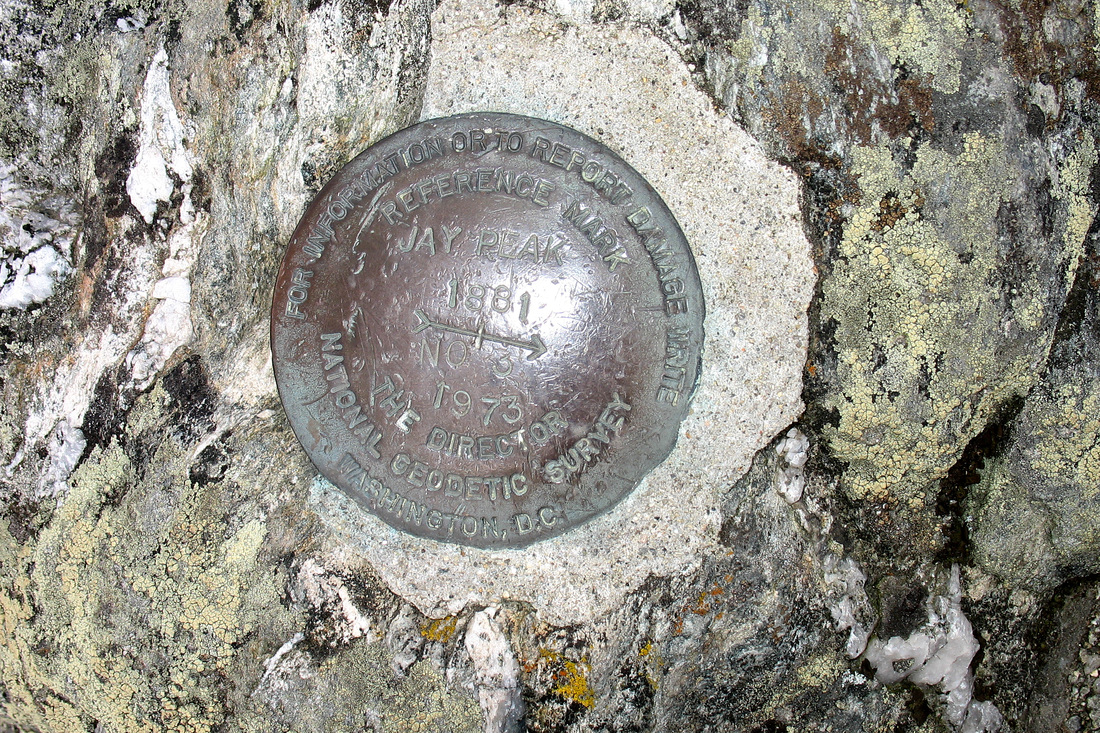
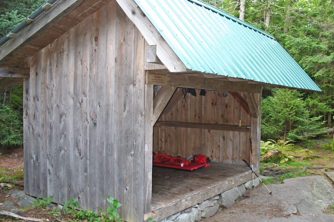
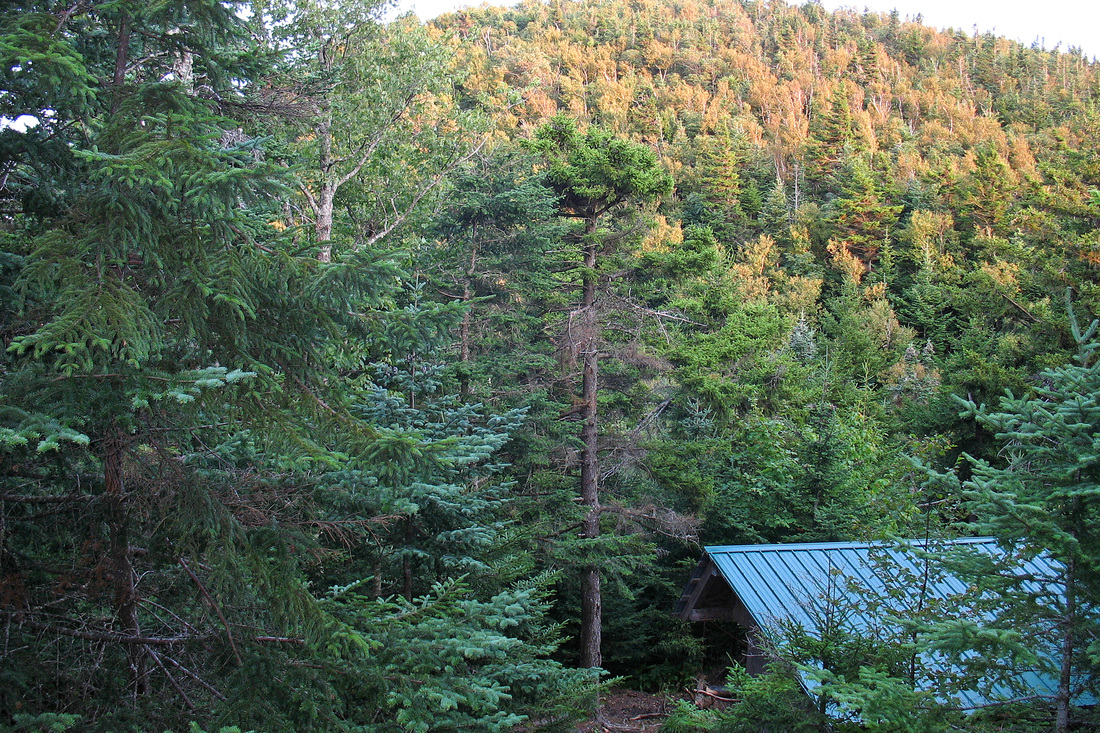
Surprisingly quiet last night for 10 people. My alarm went off at 6:00 but I ignored it until 7:00 and got on the trail just after 8:00. Mtn Goat was out ahead of me so I didn't have to eat a lot of webs. The sky was clear and I had a great view of Jay Peak from the lean-to. I hoped it would hold until I got there. The first few miles to Jay Camp presented several ups and downs - some of them significant - and few views. I hiked along the bumpy ridge cursing wet roots and rocks and numerous mud holes. Just before Jay Pass I crossed a small stream and filled my bottle. I then crossed the highway and began the 1.7 mile, 1600 foot ascent of Jay Peak. The climb was enjoyable and the trail was mostly dry. Near the summit I emerged onto a ski trail which I crossed before beginning the final 0.2-mile scramble up the summit cone. There was a terrific panoramic view and after pictures and exploring the summit and Tram Station I settled in for a snack and a nap with a view toward Mansfield. The drop off of Jay Peak was knee jarringly steep and not overly pleasant. I was relieved to get to Laura Woodward shelter. It was empty. I transferred my water to my tank and moved on. The walk to Shooting Star was bumpier than I expected with some rough footing but it was pretty and offered some small views. I heard Shooting Star before I saw it - a group from UVM was there. They quickly piled out of the lean-to when I got there, though, and have been polite and cheerful. The site is lovely and I'm sitting on a ledge just above the shelter watching the hill turn golden and darken with the sunset. Someone has just arrived - likely the father and son from Hazen's Notch. It's getting pretty dark so time to head in to the shelter.
Wednesday, 26 August 2009
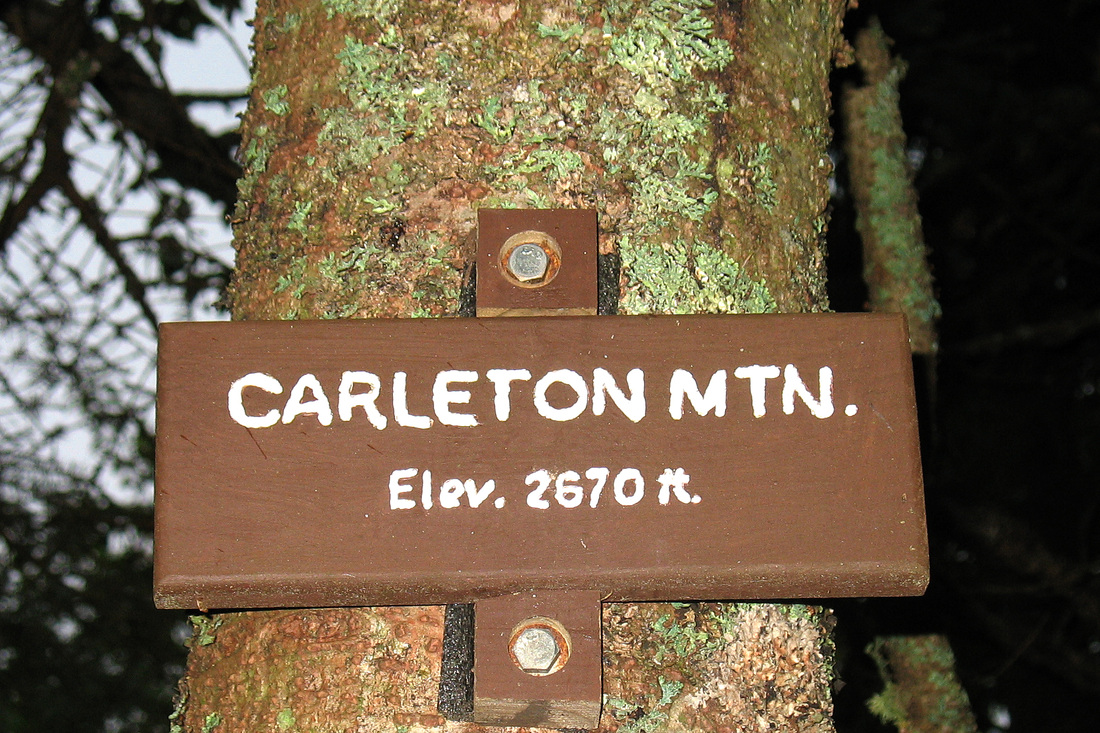
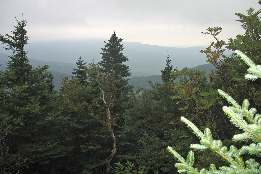
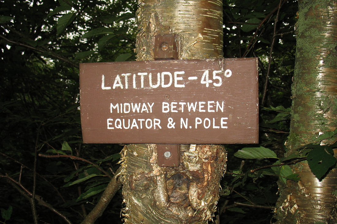
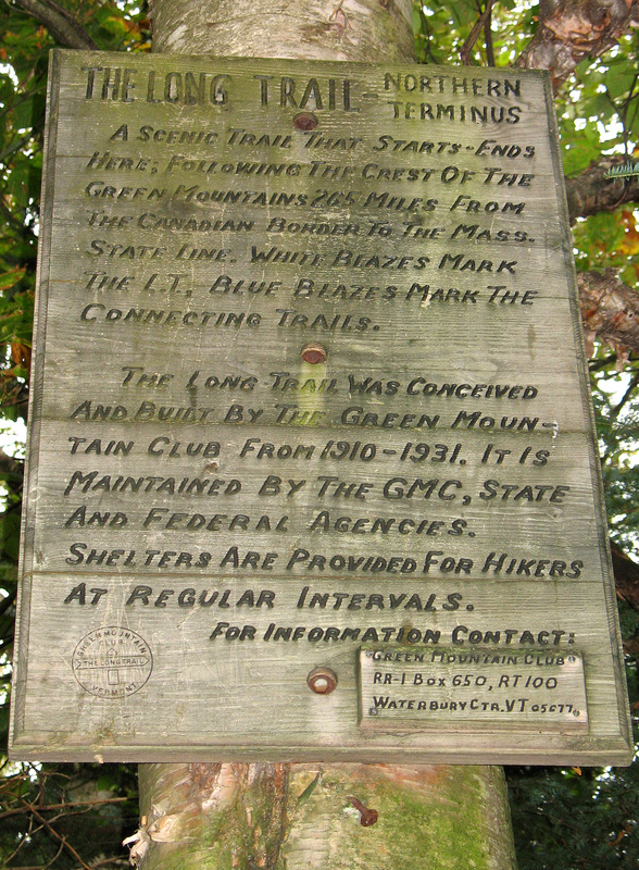
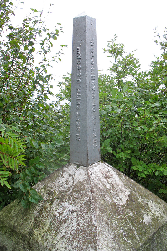
I lay awake most of the night listening to a roaring wind and thinking about this piecemeal three-year journey. In the morning I packed my things one last time and was hiking away before most anyone else was awake. Only the father was up, going through his last morning routine of the trail. The cloud ceiling was low and the woods were dark and full of mist. The view from Burnt Mountain was blank and I walked on, soon crossing the last road, a lonely and remote highway. Climbing out of North Jay Pass I nearly needed to break out my headlamp to see the trail clearly. I arrived at Carleton Mtn and because I had plenty of time I took the spur trail to the view which was bleak and forbidden. I returned to the white blazes and continued north as it began to rain. Over the gradual descent I wondered how much longer to the border and whether some catastrophic event would once again prevent me from getting there. It began to rain harder and I knew I must be close. I passed a small sign informing me I was now closer to the North Pole than to the Equator. It rained harder still and I arrived at the Journey's End Trail. A few more steps brought me to the border swath and I picked my way over a final wet ledge to embrace boundary post 572. I had finished, alone and a cold and driving rain. It made perfect sense that it should be this way. It was too raw for any kind of ceremony so I took a a quick couple of self portraits and headed out the Journey's End Trail. I found this last 1.3 mile to be quite pretty, descending gently through open woods and crossing a lovely stream. I stopped at Journey's End Camp but found it locked from the inside. No one responded to my attempts to enter so I kept walking which kept me warm. The folks from Rose Apple Acres collected me at the start of the Journey's End Road promptly at our arranged time. They welcomed me to change into dry things at their Inn and we had a pleasant chat before I began my dive home. As I drove into Newport I learned that Ted Kennedy had died.