Tuesday, 01 July 2008
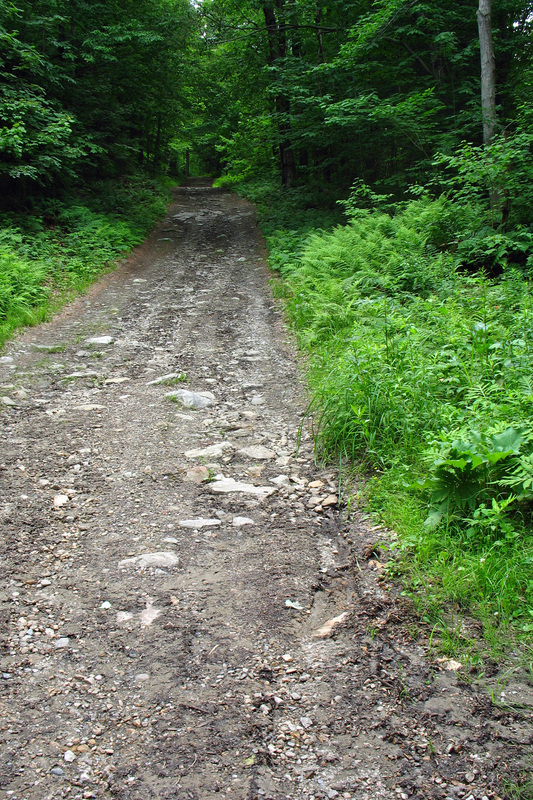
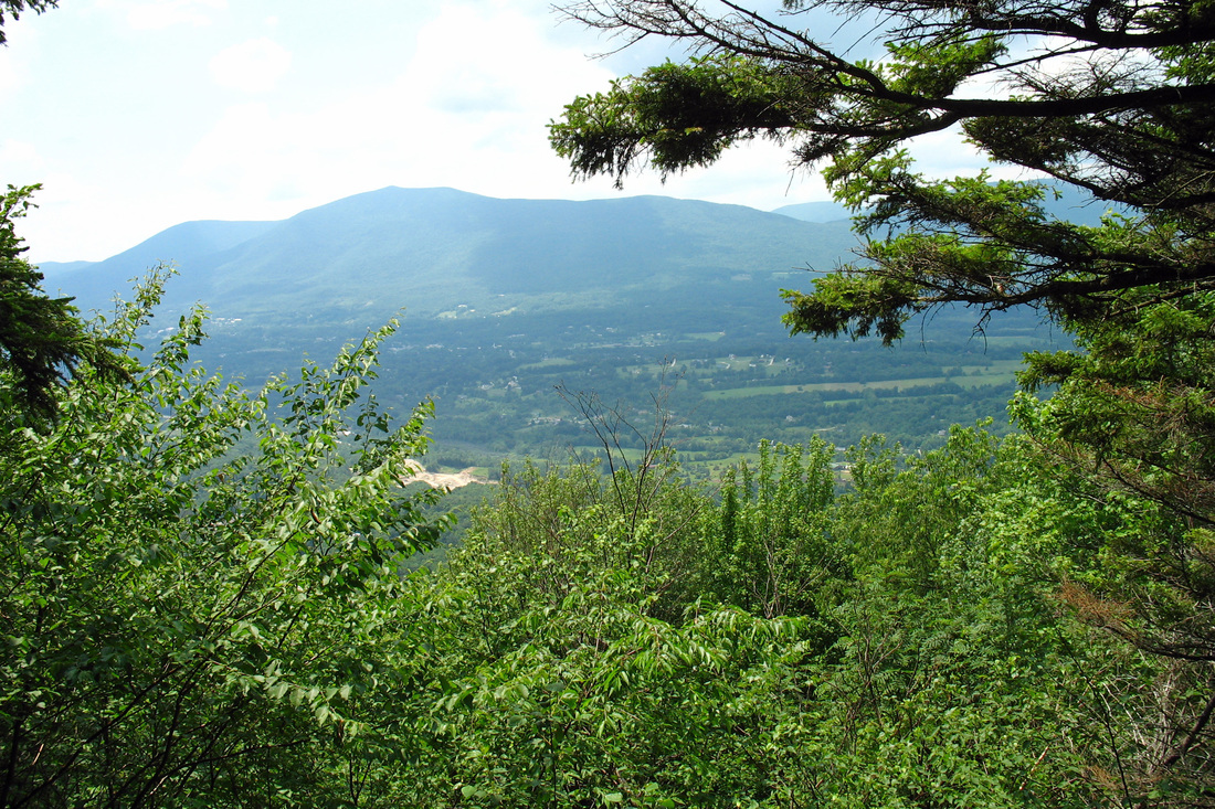
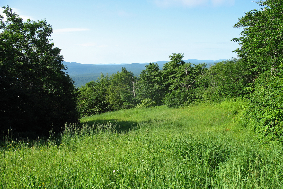
The alarm went off at 5:45 EDT and we were on the road shortly after 7:00 as Kevin drove me to Manchester Center. Skies looked a bit ominous in northern VT but conditions improved as we headed south and then west. Turning onto the Rootville Rd I told Kevin to drive up however far he could. That turned out not to be very far as the good gravel road suddenly became a washed out 4WD track just above the last house. I geared up and I started walking at 11:15. The road was fairly steep and rocky but it followed a pretty cascading stream for much of the way and I heard several (and saw one) Hermit Thrushes. It was barely noon when I made Prospect Rock and met two other hikers going from North Adams to Maine. I checked out the view and then followed the white blazes northward. I saw two Hairy Woodpeckers calling to each other from separate trees and felt a few drops of rain before the sun returned.
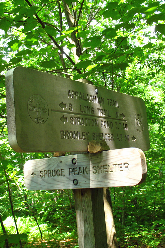
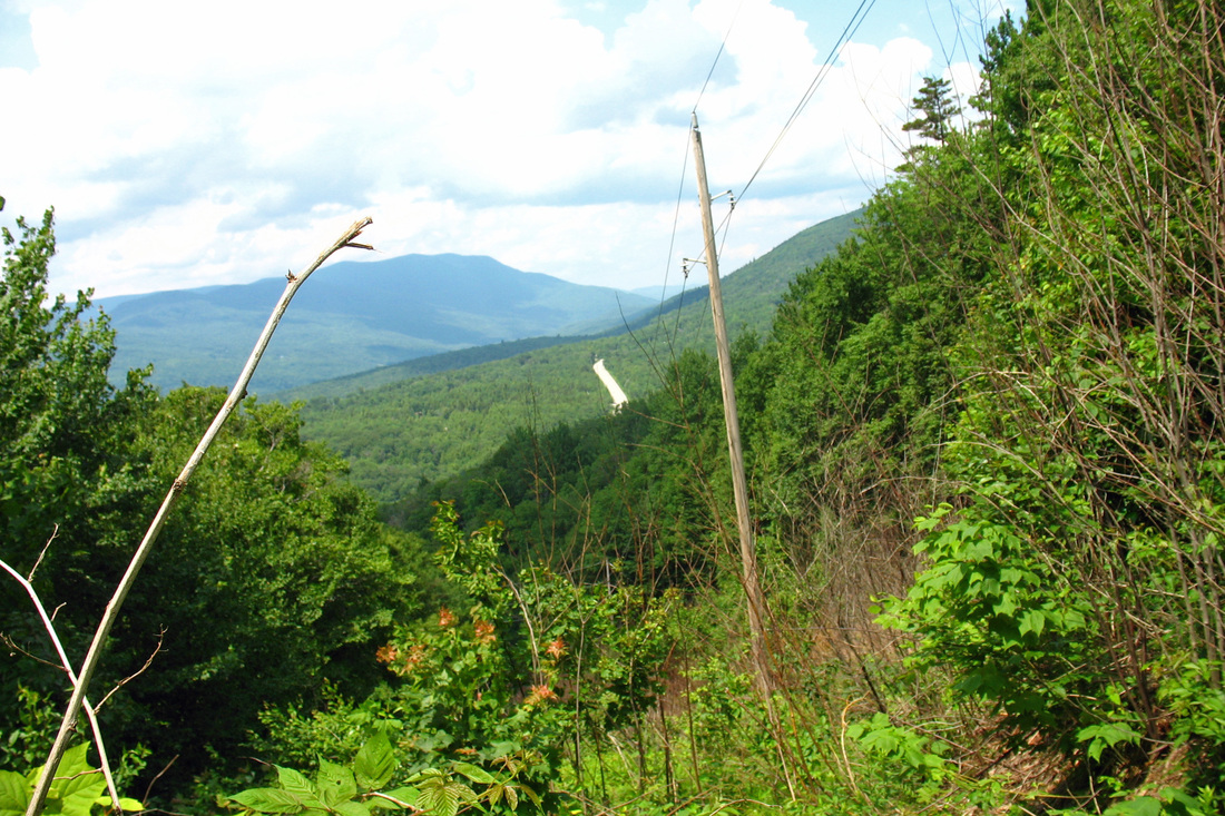
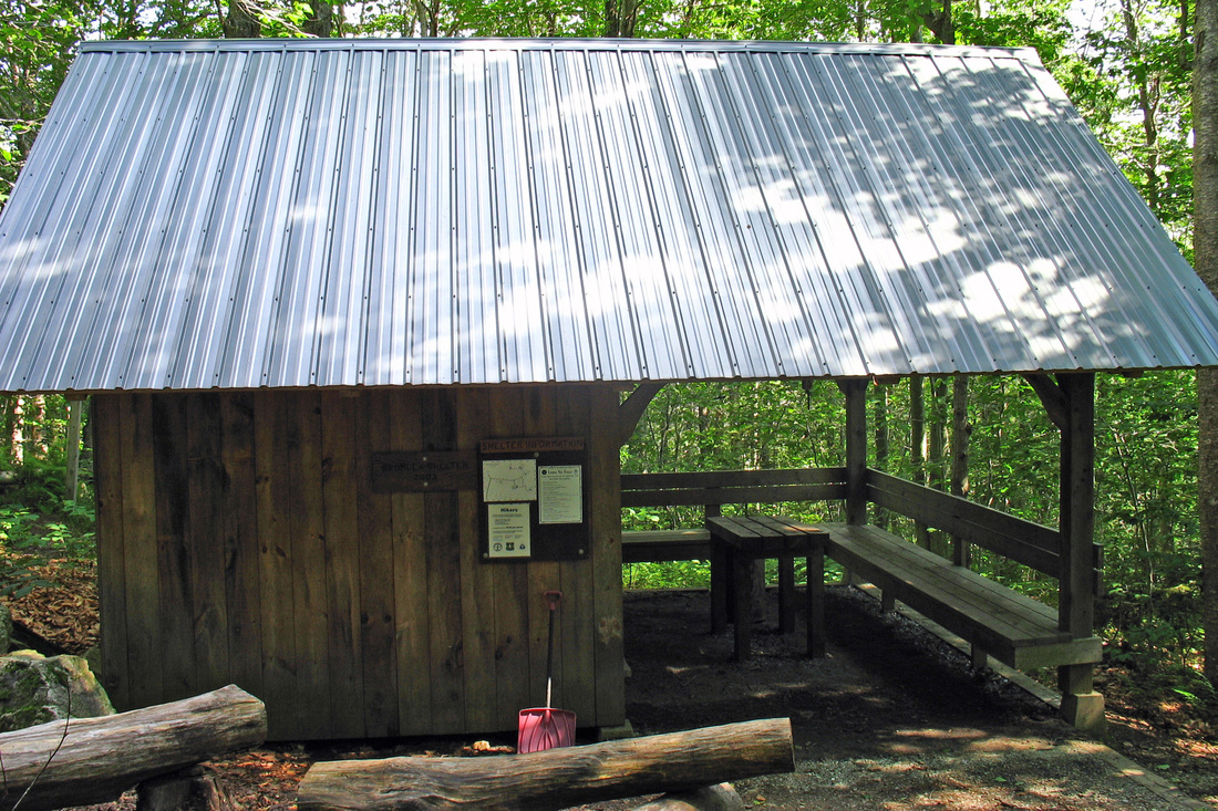
I reached Spruce Peak shelter just after 13:00. It is a unique shelter and would have made a lovely home for he night but even after snacking, visiting the privy, and signing the log it was only 13:30. Seeing that Bromley shelter was an easy-looking 8 km I set out. I soon came to a spur path for Spruce Peak so dropped my pack, grabbed my camera, and headed up just in case it;s on some hiking list I might pursue someday. The summit was rocky and wooded but there were some good viewpoints along the way.
Regaining the white blazes I continued north. I spied a solitary doe through the trees and she quickly spotted me and froze. We stared at each other across a couple hundred meters of forest for a minute before she bounded off, snorting all the way. She was still snorting as I passed where she had been. I also saw a chipmunk whose cheeks were so full of treats that I thought his face would surely explode-but he still managed to scold me as I trespassed on his lunch.
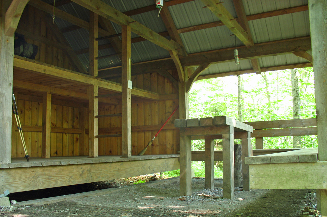
The descent to Rt 11 from Spruce Peak was gradual, not monotonic. I could hear the highway for quite some time before I crossed it and began my climb of Bromely. Early in the ascent there was a bridge over a small stream. The bridge consisted of...an I-beam. That's it. Just an I-beam on its side that had been dropped across the tiny gorge. Nice. The trail climbed only about 300 meters in the remaining 3.2 km to the shelter. I arrived at 16:00/ Nobody else in the shelter but there's a tent pitched up back. At 19:00 nobody else has arrived. It looks to be a lonely night but it's cooling off nicely and not horribly buggy.
I reached Spruce Peak shelter just after 13:00. It is a unique shelter and would have made a lovely home for he night but even after snacking, visiting the privy, and signing the log it was only 13:30. Seeing that Bromley shelter was an easy-looking 8 km I set out. I soon came to a spur path for Spruce Peak so dropped my pack, grabbed my camera, and headed up just in case it;s on some hiking list I might pursue someday. The summit was rocky and wooded but there were some good viewpoints along the way.
Regaining the white blazes I continued north. I spied a solitary doe through the trees and she quickly spotted me and froze. We stared at each other across a couple hundred meters of forest for a minute before she bounded off, snorting all the way. She was still snorting as I passed where she had been. I also saw a chipmunk whose cheeks were so full of treats that I thought his face would surely explode-but he still managed to scold me as I trespassed on his lunch.
The descent to Rt 11 from Spruce Peak was gradual, not monotonic. I could hear the highway for quite some time before I crossed it and began my climb of Bromely. Early in the ascent there was a bridge over a small stream. The bridge consisted of...an I-beam. That's it. Just an I-beam on its side that had been dropped across the tiny gorge. Nice. The trail climbed only about 300 meters in the remaining 3.2 km to the shelter. I arrived at 16:00/ Nobody else in the shelter but there's a tent pitched up back. At 19:00 nobody else has arrived. It looks to be a lonely night but it's cooling off nicely and not horribly buggy.
Wednesday, 02 July 2008
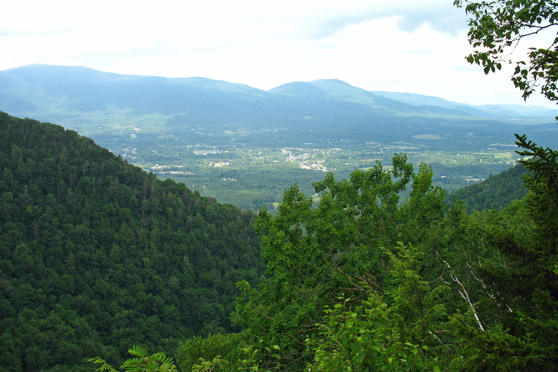
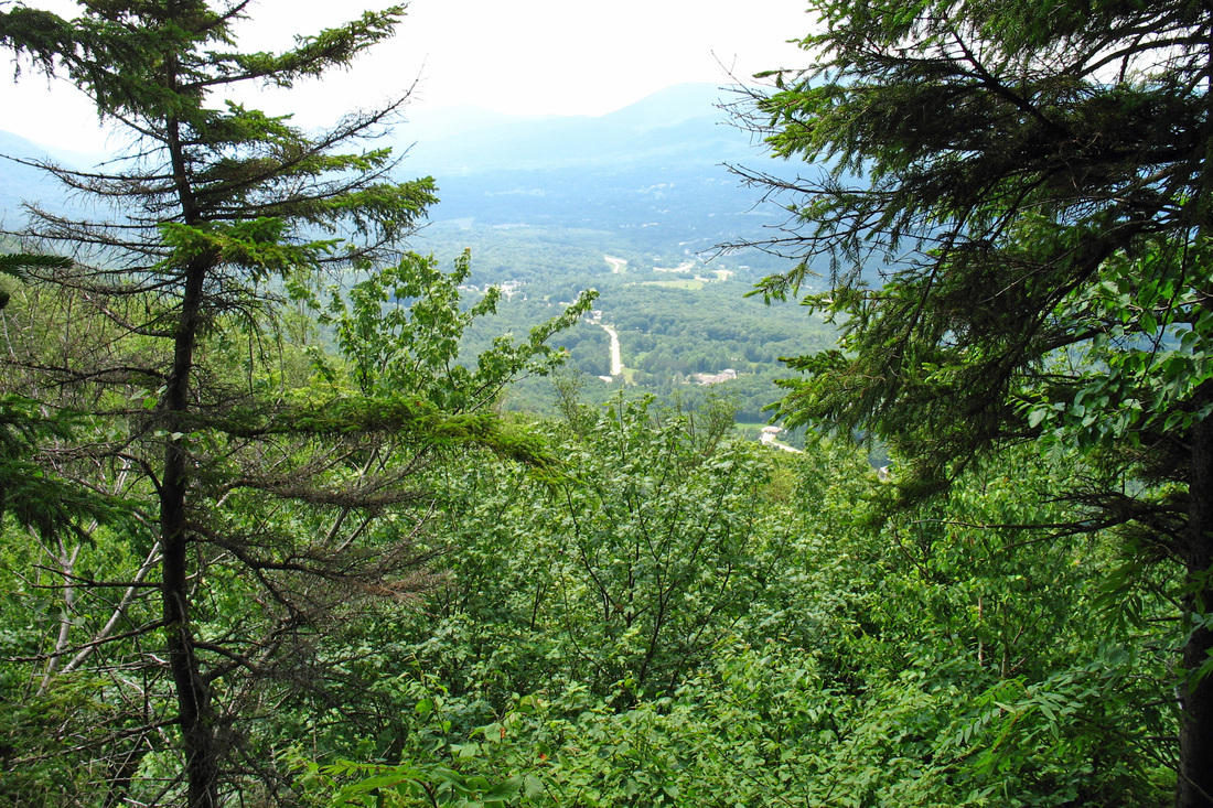
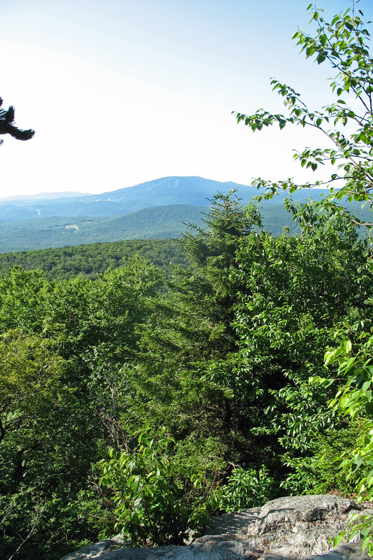
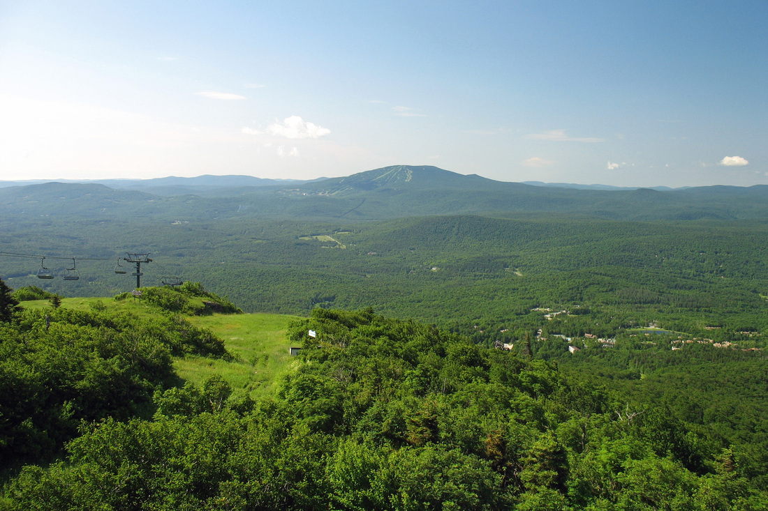
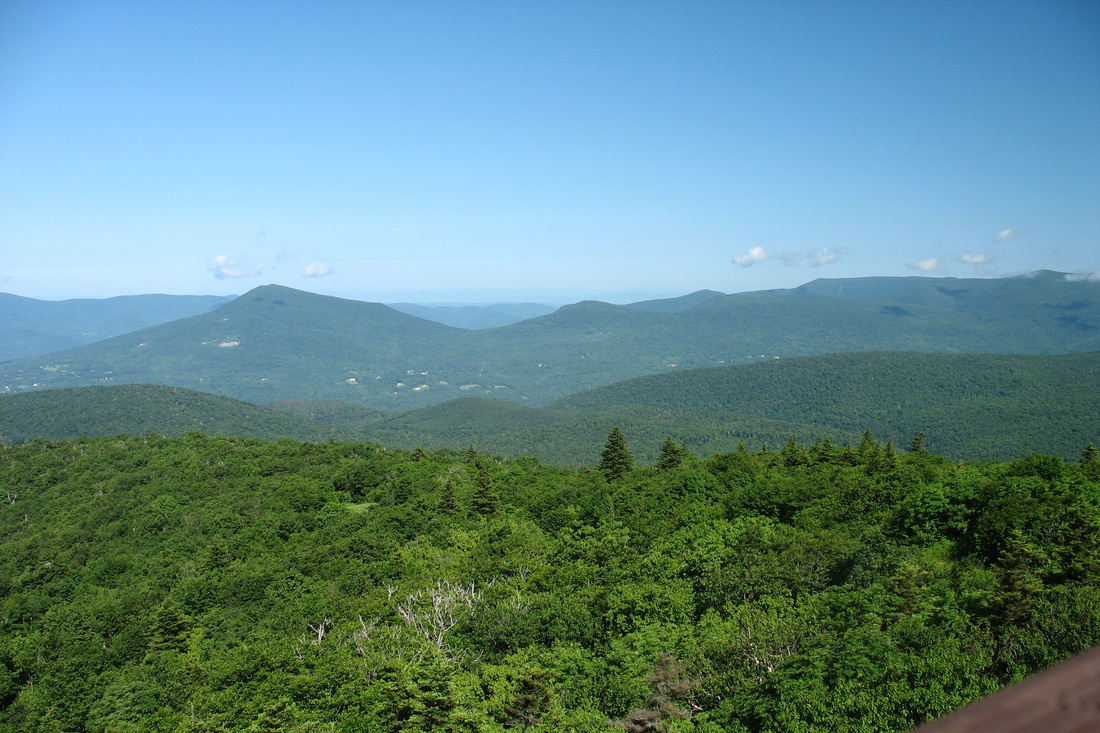
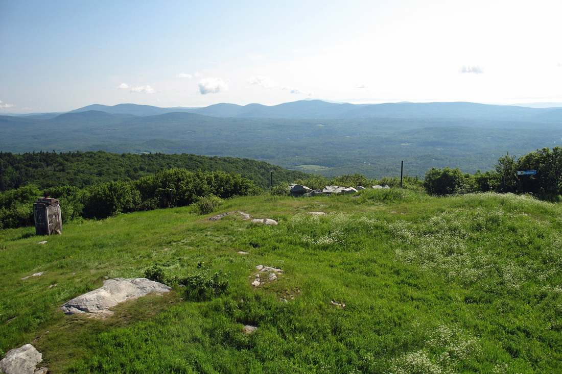
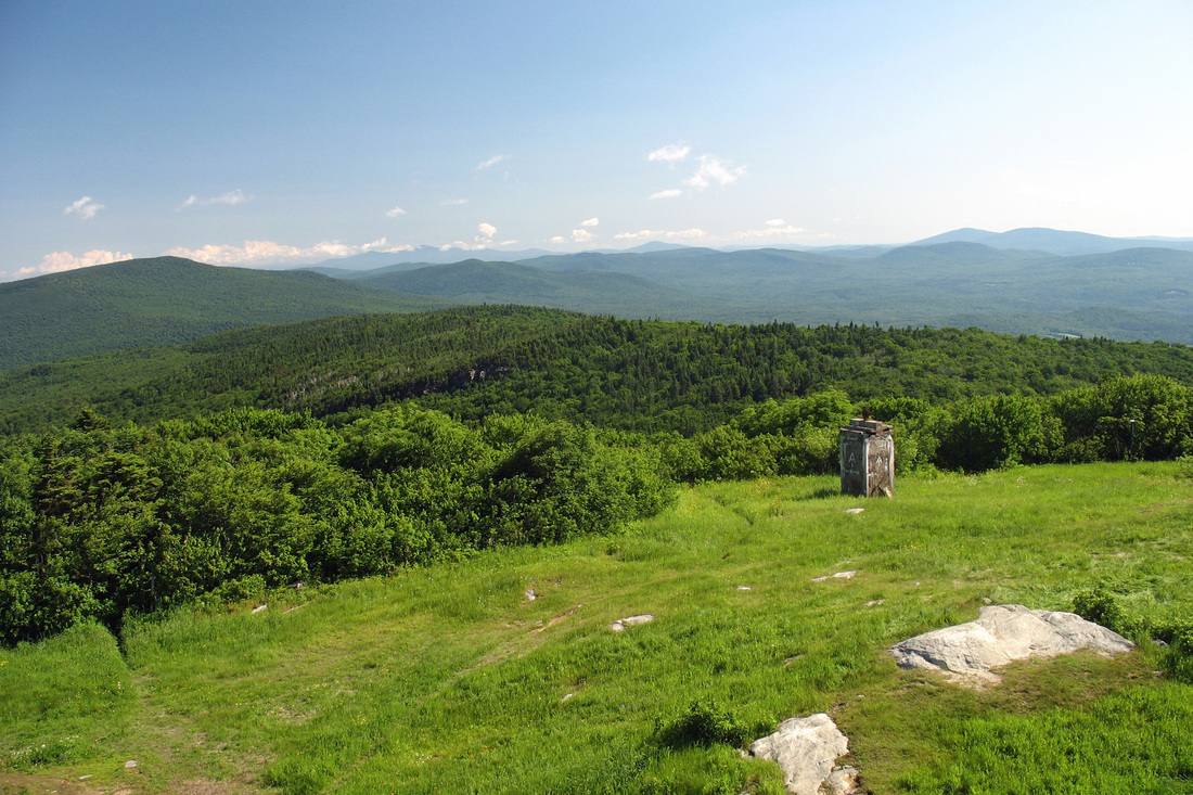
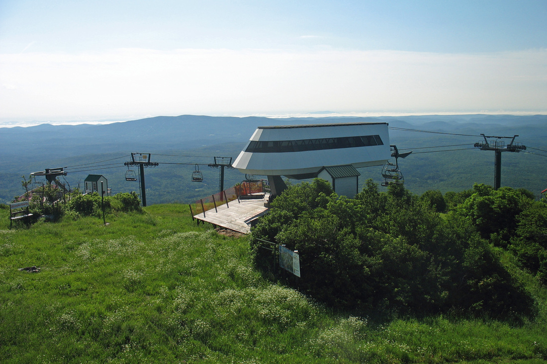
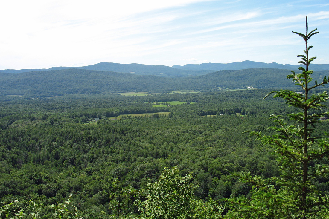
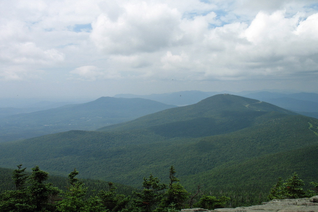
Set out shortly after 8:00 this morning for the remainder of the climb up Bromley. It was clear and stayed that way all day. The ascent was broken up by a vista from a short spur path. As I gained the summit the boys' camp group was just heading off. I tried to call home from the warming hut phone but there was no answer. I went up the tower for excellent views and some pictures before descending. I caught up with the boys' camp again at Mad Tom Notch where I also met Grey Ghost and Dee Jay, a grandfather-grandson team. Grey Ghost started at Springer and was joined by Dee Jay in PA.
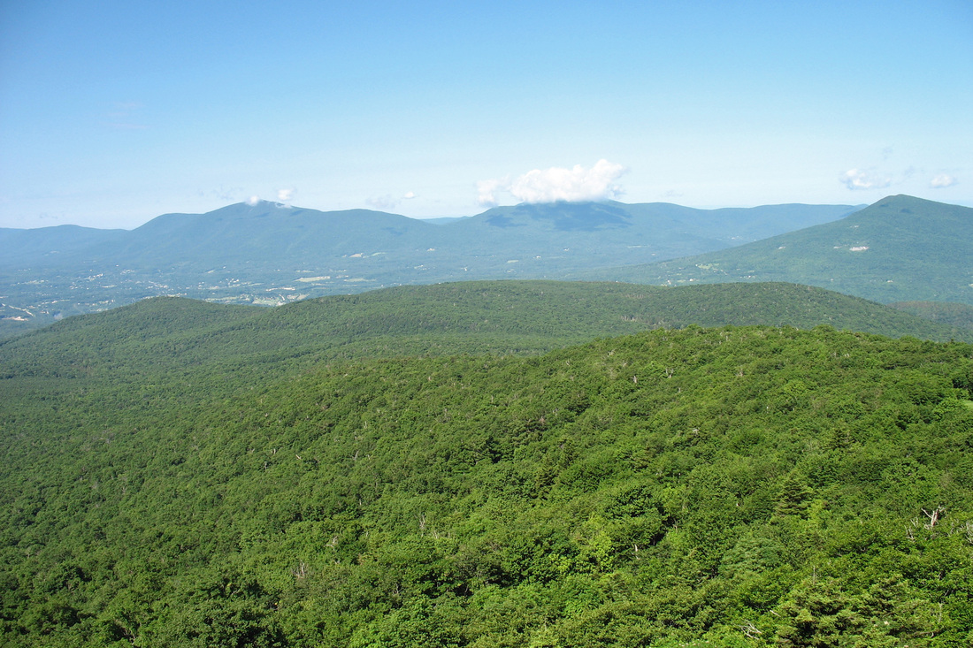
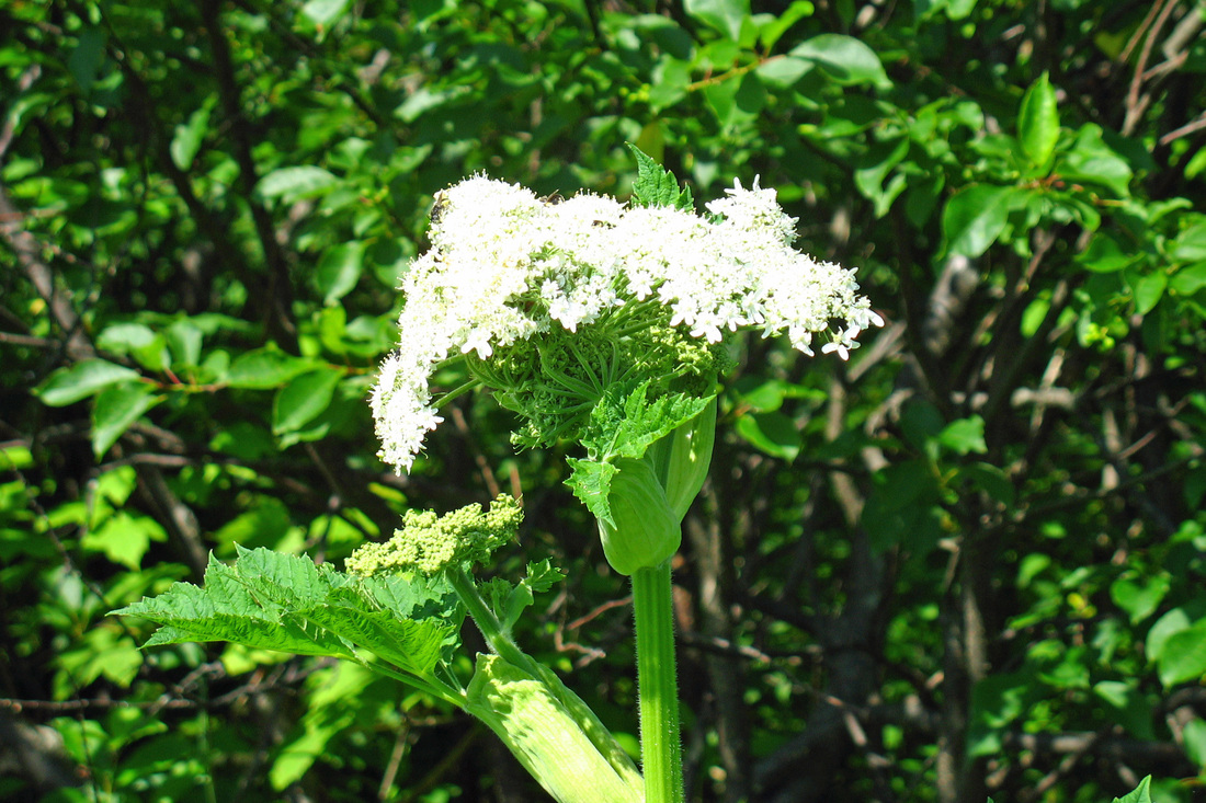
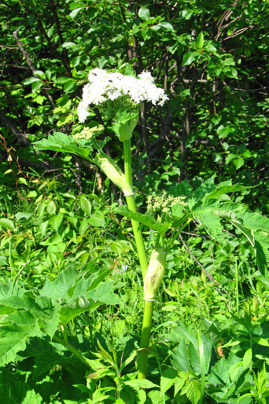
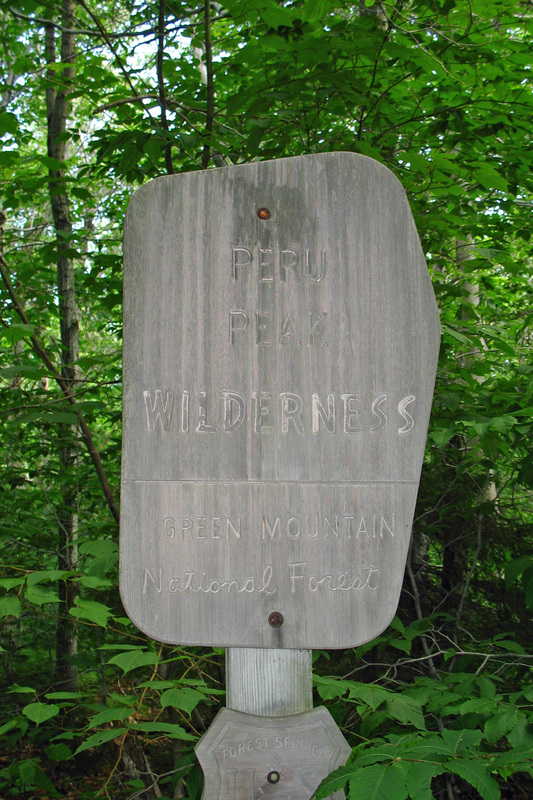
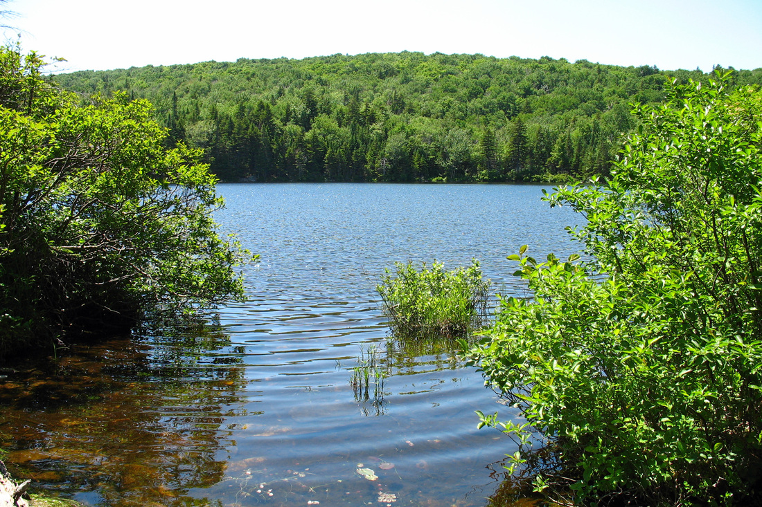
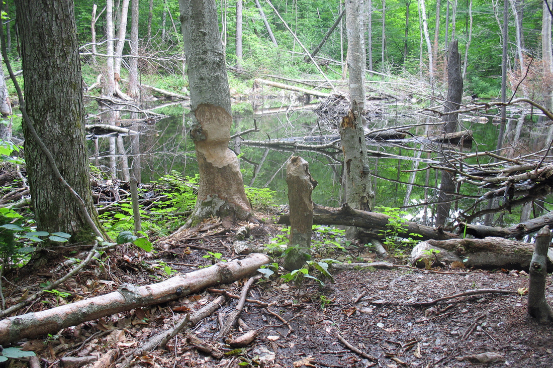
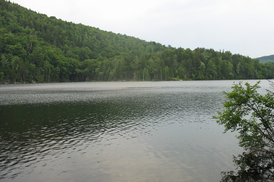
Continuing on I faced a good climb up Styles Peak which had a vista but it was way too buggy to linger. The ridge bumped along to Peru Peak which was noteworthy only in that it was the end of the ridge. I met GG and DJ again at Peru Peak shelter and we talked about different birds and other critters along the trail. They passed me for good as I was checking out Griffith Lake. I pushed on for Big Branch. A gradual climb up Baker Peak ended in a steep knife-edged pitch with great views, especially of Dorset Peak. The last 6.4 km were a gradual descent to Big Branch which offers excellent swimming only a few steps from the shelter. Today was rather a long day with 640 meters of climb and I'm feeling the effects. I'll probably make it a short day tomorrow.
Continuing on I faced a good climb up Styles Peak which had a vista but it was way too buggy to linger. The ridge bumped along to Peru Peak which was noteworthy only in that it was the end of the ridge. I met GG and DJ again at Peru Peak shelter and we talked about different birds and other critters along the trail. They passed me for good as I was checking out Griffith Lake. I pushed on for Big Branch. A gradual climb up Baker Peak ended in a steep knife-edged pitch with great views, especially of Dorset Peak. The last 6.4 km were a gradual descent to Big Branch which offers excellent swimming only a few steps from the shelter. Today was rather a long day with 640 meters of climb and I'm feeling the effects. I'll probably make it a short day tomorrow.
Thursday, 03 July 2008
I had good company at Big Branch last night: Bob is doing a SOBO section of the LT, Mouse is working his way north on an AT flip-flop, and Toots and Blurpple whom I met at the cabin (Upper Goose Pond) last week when they stopped in for lunch.
I took an easy day today since my feet were complaining for the last 6 km of yesterday's hike. The forecast is for T-storms this afternoon and night so that was additional incentive to roll in early somewhere. LRP isn't the nicest shelter to spend a day at but it should be dry enough. The pond is very nice but is half a km away. So I'll spend the afternoon reading, snacking, and sipping tea.
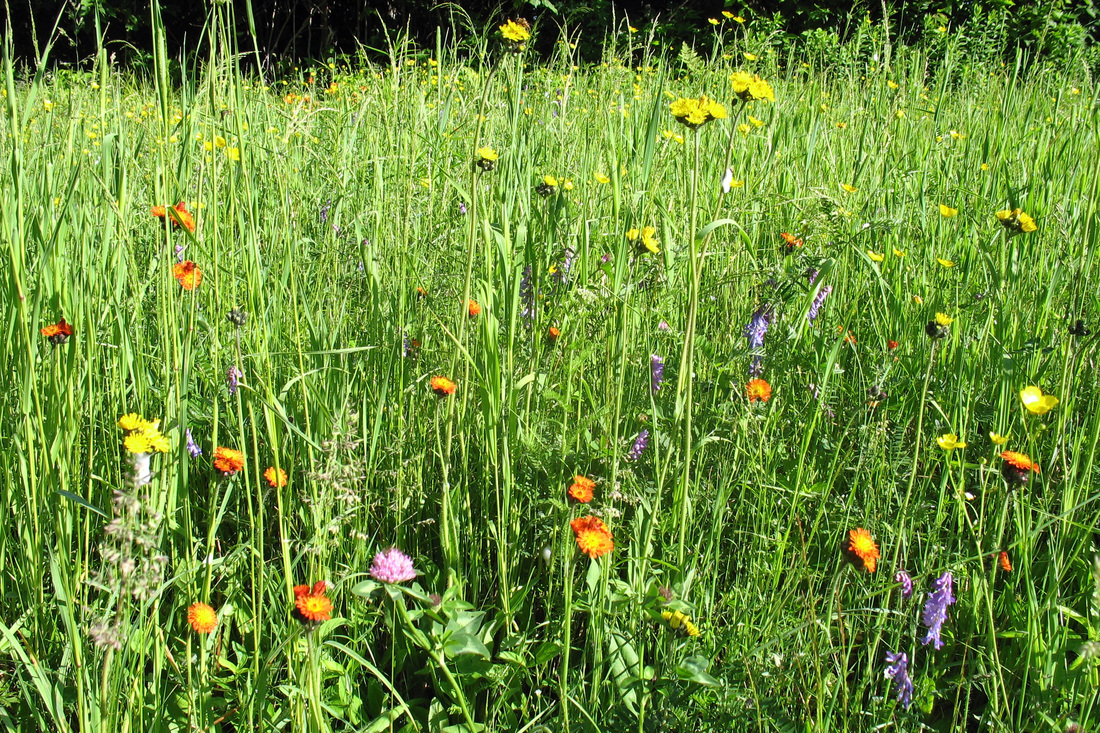
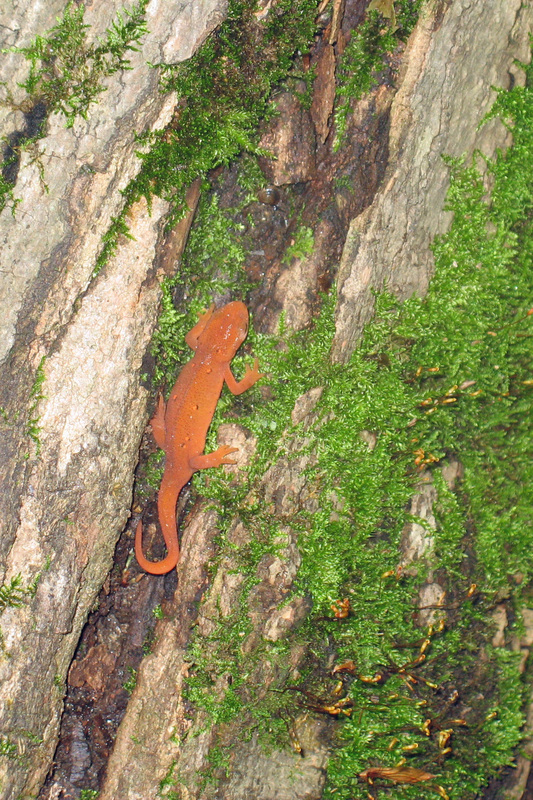
Yesterday I flushed a Ruffed Grouse while climbing the ski trail on Bromley. Later I saw what I think was a Hermit Thrush and got a picture of him. Today I say a single Red Eft-a pretty small one.
Today I had a tasty snack on the trail: Betty Lou's Organic Krispy Bite. Should be easy enough to make. Ingredients are: Brown rice syrup, Brown rice crisp (cereal), Peanut butter, Maple syrup, Agave syrup, "Natural flavors", and sea salt.
I just saw a cool bird: warbler-sized, black & white longitudinal stripes but head was black and bright yellow stripes with bright red-orange throat. Hopefully I can remember what it looked like when I ever come across a field guide.
**I checked it out later: Blackburnian Warbler. Nothing else looks like it.
I took an easy day today since my feet were complaining for the last 6 km of yesterday's hike. The forecast is for T-storms this afternoon and night so that was additional incentive to roll in early somewhere. LRP isn't the nicest shelter to spend a day at but it should be dry enough. The pond is very nice but is half a km away. So I'll spend the afternoon reading, snacking, and sipping tea.
Yesterday I flushed a Ruffed Grouse while climbing the ski trail on Bromley. Later I saw what I think was a Hermit Thrush and got a picture of him. Today I say a single Red Eft-a pretty small one.
Today I had a tasty snack on the trail: Betty Lou's Organic Krispy Bite. Should be easy enough to make. Ingredients are: Brown rice syrup, Brown rice crisp (cereal), Peanut butter, Maple syrup, Agave syrup, "Natural flavors", and sea salt.
I just saw a cool bird: warbler-sized, black & white longitudinal stripes but head was black and bright yellow stripes with bright red-orange throat. Hopefully I can remember what it looked like when I ever come across a field guide.
**I checked it out later: Blackburnian Warbler. Nothing else looks like it.
Friday, 04 July 2008
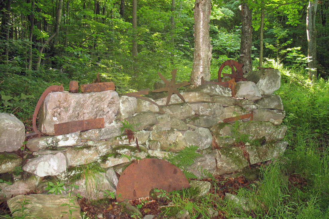
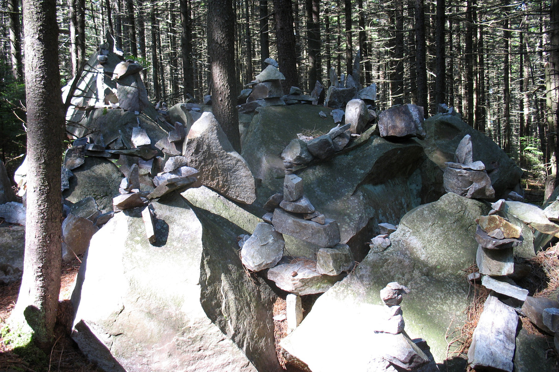
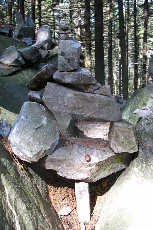
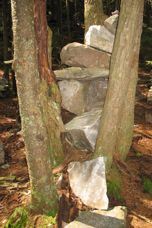
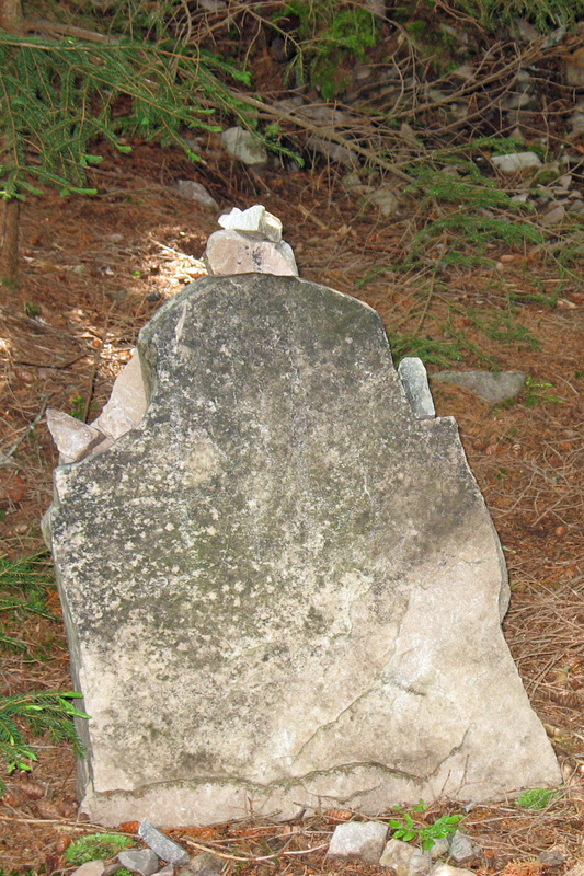
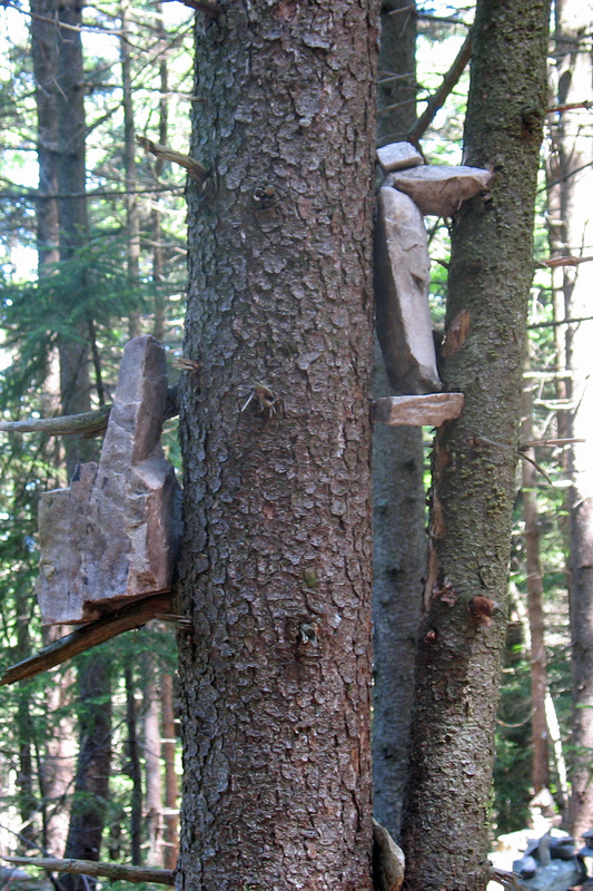
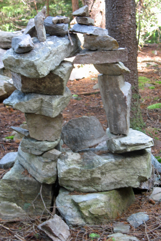
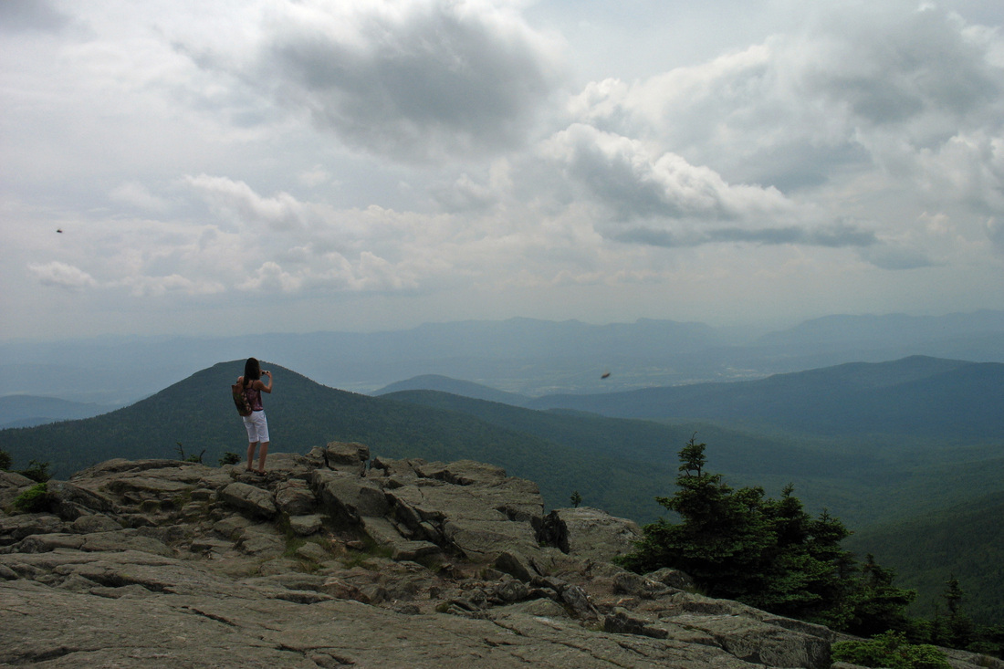
I had the shelter to myself again last night but was visited briefly by caretaker "Turtle" who lives at a tentsite about a km away. Got woken up by rain a few times but by morning the sky was clear and blue! It was beautiful hiking today-both the weather and the scenery. Early I passed a stone foundation with a number of rusted artifacts set on it. There was a wooden stand that appeared to have at one time held a plaque explaining what the artifact was. Unfortunately some one felt it necessary to rip the plaque off so I have no idea. The climb up White Rocks Mtn was fairly gradual and I'd been looking forward to this for some time. I'd read descriptions and seen pictures but the reality was far more striking. At and some distance beyond the summit in a quiet spruce-fir forest stood many small and medium sized rock cairns and sculptures. The only sound was the song of a Hermit Thrush. A hundred silent monuments to...? Perhaps nothing. This is a place I want to return to.
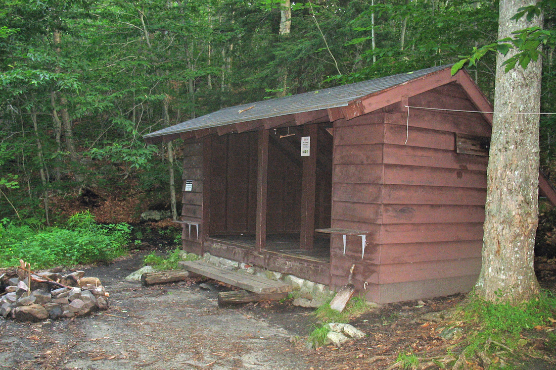
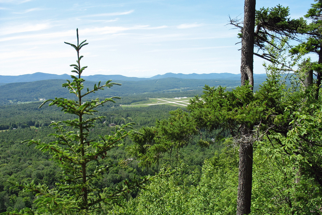
The descent to VT140 was uneventful and was followed by a climb up Bear Mtn that shouldn't have been bad but nearly destroyed me anyway. I was glad that Minerva Hinchey shelter was just over the summit as it was my intended home for the night. When I got there, though, the places was depressing. The shelter was old and porcupine-chewed and sat in a dark and not-pretty patch of woods. I chatted with another hiker, Tama and his doggie Aki. I tended my feet, which didn't look or feel too bad, checked the map and data, and decided to press on to the next shelter.
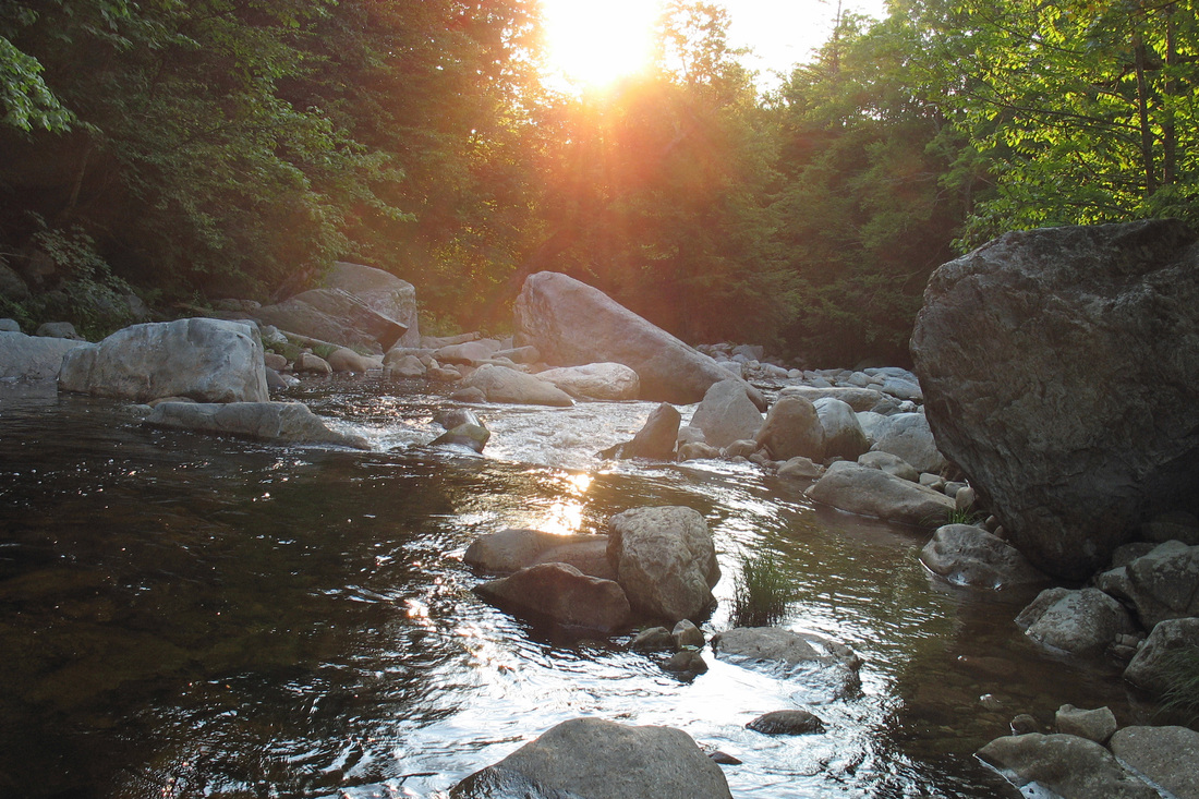
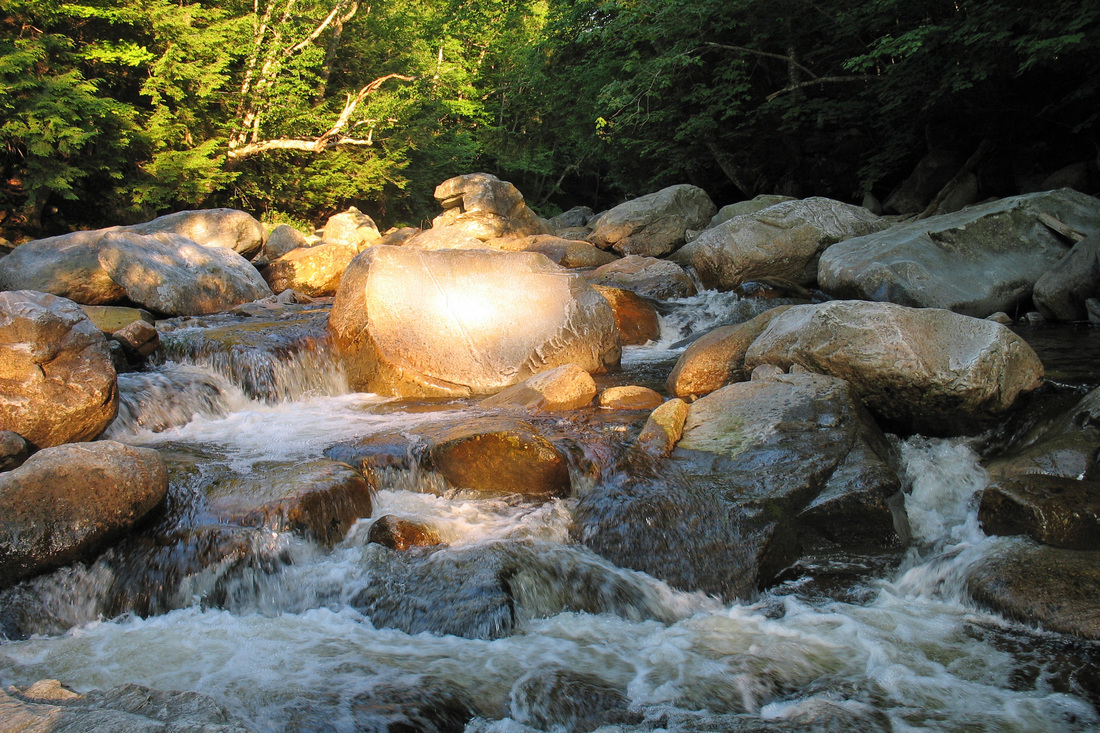
The next 4 km dropped me into Clarendon Gorge which was beautiful even the the bridge over it was pretty dicey. Just after crossing the gorge I came to VT103 where the book says a store and restaurant were only a few tenths of a mile to the west. I was dreaming of soda and potato chips (and new batteries for my camera) so down the road in the blazing sun I went only to find...store closed down. So back on the blazing hot road to pick up the trail again.
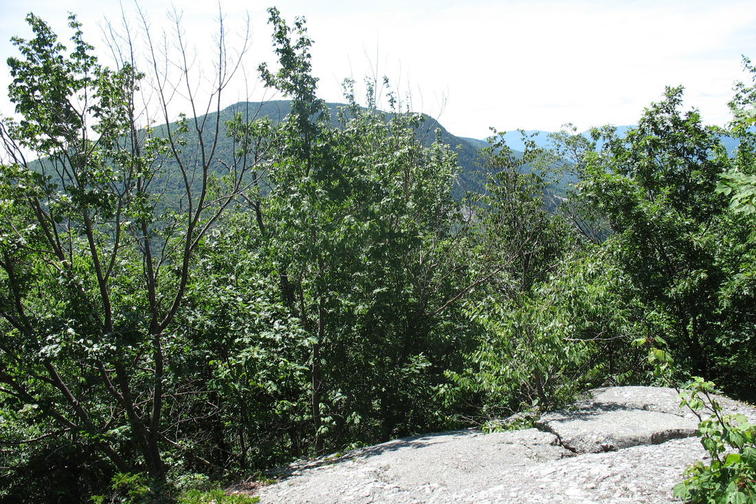
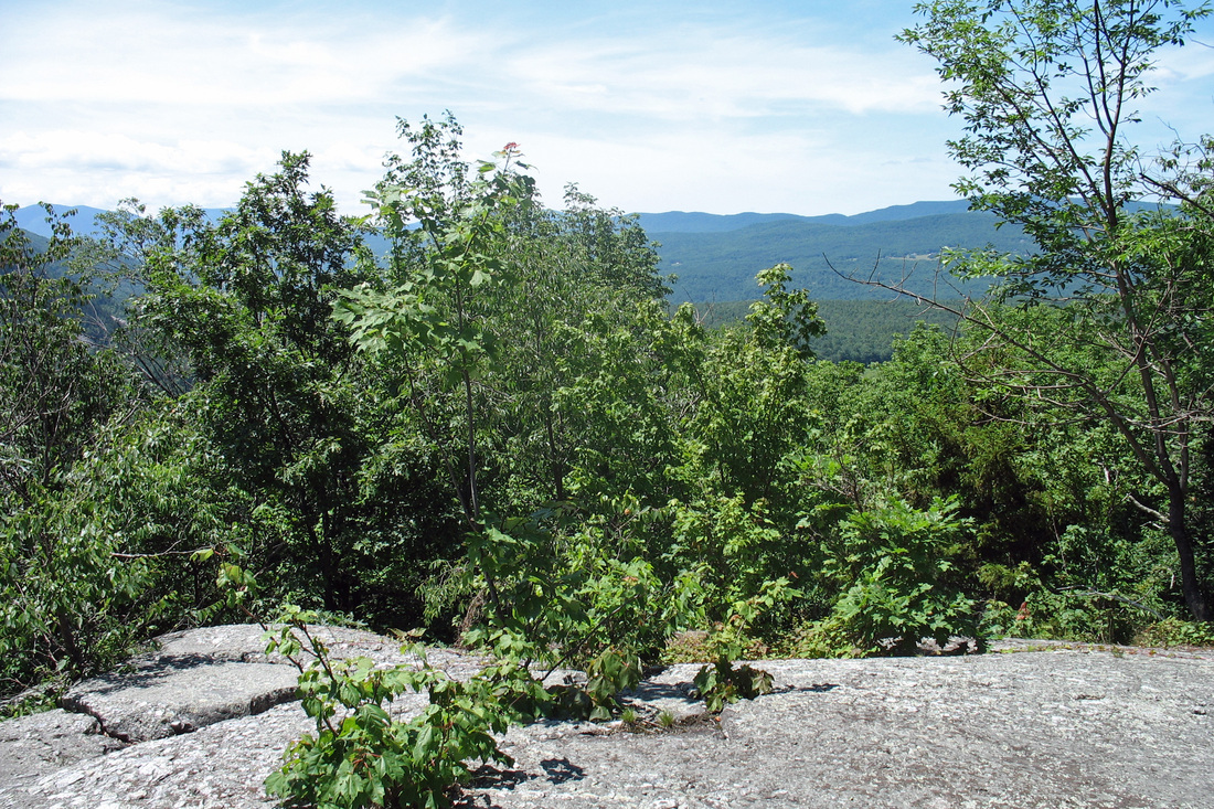
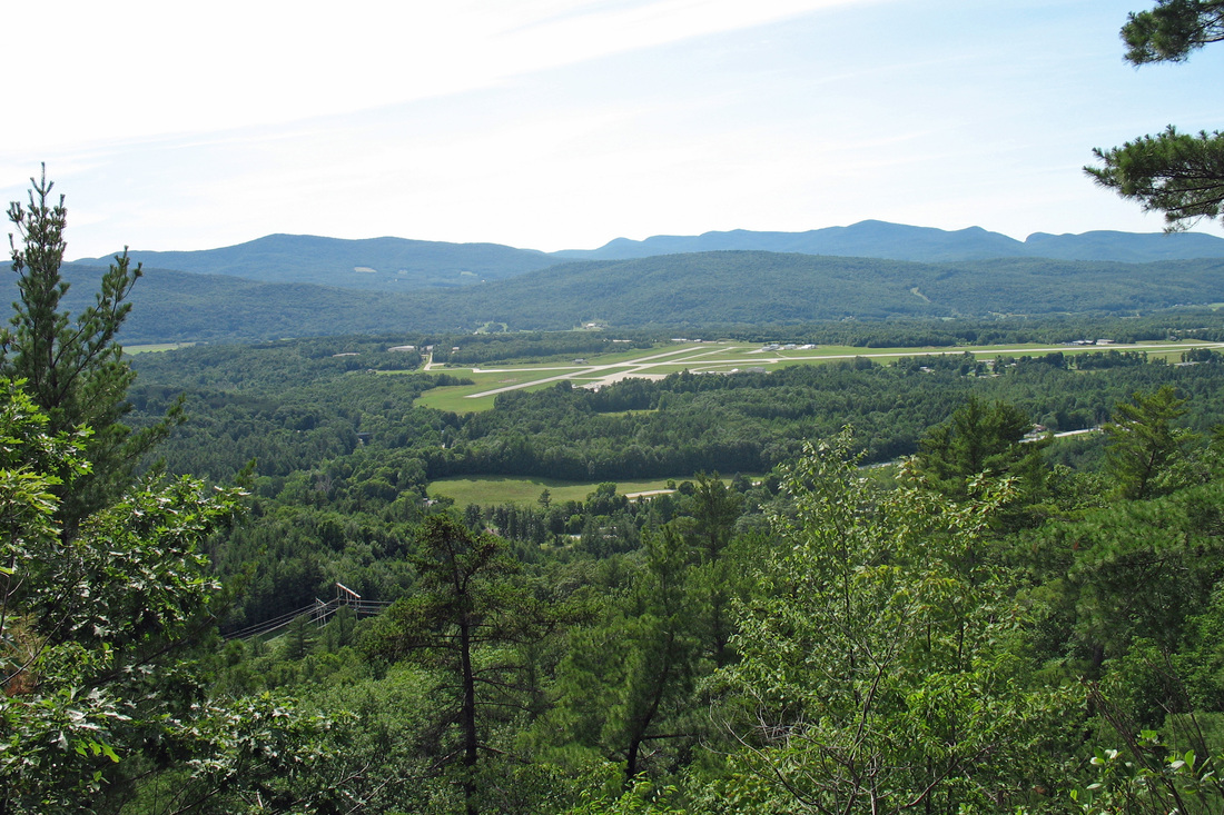
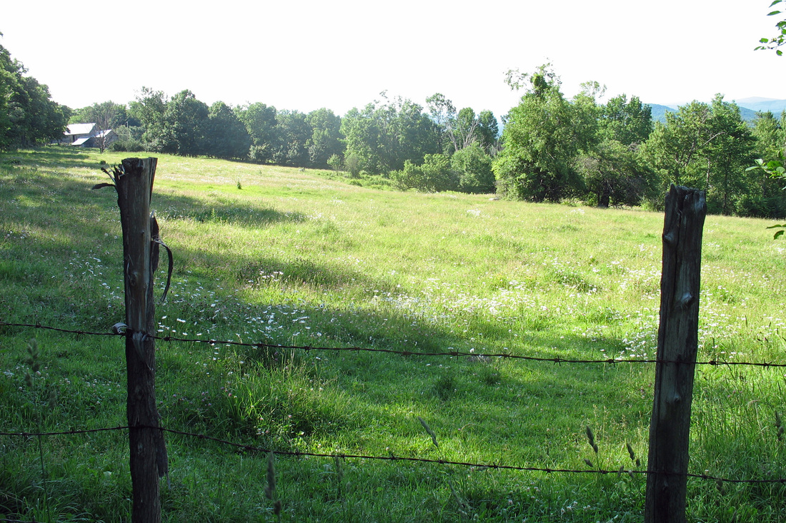
The reason why it's called a gorge is that its sides are STEEP. And now I got to climb up the other one. For some reason, though, I didn't find this haul as devastating as Bear Mtn. It was more interesting, anyway, since part of it was a boulder climb that required some handholds. Topping out there was a good view back over to the airport I'd seen from Bear Mtn's "Airport View". The descent to my real home for the night was short. I soon arrived at Clarendon shelter which, though old and weary, has not been eaten by porcies and sits in a lovely clearing with grass, potted plants, and a frigid stream right next to it. I'm sharing the shelter with Brie and Dan ("Rules don't apply") and a girls' camp is tarping next to us.
Today I saw two Ribbon Snakes, many Red Efts (some very tiny and several of which I moved off the path), some toads and an Eastern Wood Peewee. At camp I saw a male Scarlet Tanager and some Cedar Waxwings.
The descent to VT140 was uneventful and was followed by a climb up Bear Mtn that shouldn't have been bad but nearly destroyed me anyway. I was glad that Minerva Hinchey shelter was just over the summit as it was my intended home for the night. When I got there, though, the places was depressing. The shelter was old and porcupine-chewed and sat in a dark and not-pretty patch of woods. I chatted with another hiker, Tama and his doggie Aki. I tended my feet, which didn't look or feel too bad, checked the map and data, and decided to press on to the next shelter.
The next 4 km dropped me into Clarendon Gorge which was beautiful even the the bridge over it was pretty dicey. Just after crossing the gorge I came to VT103 where the book says a store and restaurant were only a few tenths of a mile to the west. I was dreaming of soda and potato chips (and new batteries for my camera) so down the road in the blazing sun I went only to find...store closed down. So back on the blazing hot road to pick up the trail again.
The reason why it's called a gorge is that its sides are STEEP. And now I got to climb up the other one. For some reason, though, I didn't find this haul as devastating as Bear Mtn. It was more interesting, anyway, since part of it was a boulder climb that required some handholds. Topping out there was a good view back over to the airport I'd seen from Bear Mtn's "Airport View". The descent to my real home for the night was short. I soon arrived at Clarendon shelter which, though old and weary, has not been eaten by porcies and sits in a lovely clearing with grass, potted plants, and a frigid stream right next to it. I'm sharing the shelter with Brie and Dan ("Rules don't apply") and a girls' camp is tarping next to us.
Today I saw two Ribbon Snakes, many Red Efts (some very tiny and several of which I moved off the path), some toads and an Eastern Wood Peewee. At camp I saw a male Scarlet Tanager and some Cedar Waxwings.
Saturday, 05 July 2008
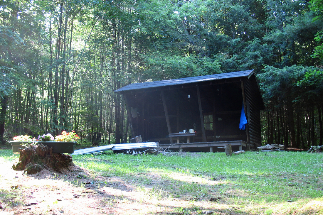
It's 20:00 and it looks like I have another shelter to myself. No one's even tenting. This shelter is fairly new and quite nice...I think it's a Tobiason post & beam as was Bromley. It's closely surrounded by raspberry and blackberry bushes which I suspect came in after the clearing for the shelter was created. I ended up going farther than anticipated today; I'd planned on a 10-mile day finishing on Killington and staying in Cooper Lodge. I got there to find that the "lodge" was a dump. Booze bottles, rude graffiti, and broken windows made it easy to move on an extra 4.5 miles to the next shelter.
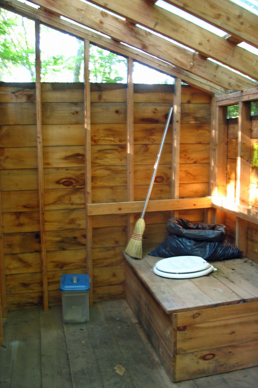
The weather was again excellent: blue skies, moderate temps, and a light breeze were made to order. I left camp at about 7:50 and immediately got lost. A maze of ATV trails confused me but soon I found a blaze and was on my way. (The ATV trails are, by the way, active: A rider rolled into the campsite last night around 21:30 but fortunately turned around and left straight away.) My first stop of the day was Beacon Hill which had a clearing and a utility tower. I sat in the sun on a flat rock and took my breakfast there. The rest of the morning was rolling terrain crossing several fields, small roads, and streams. By late morning I was very near the Secret Shelter so went there for a privy break and some lunch. It's a great shelter and one I would have loved to stay at but...oh well. The privy was spectacularly round.
Departing there I was not looking forward to passing Gov. Clement shelter because of its reputation for partying and assaults. As I approached it I saw one person - clearly a hiker - who was also finishing a lunch break. The hiker turned out to be Traveller who had spent a rainy Tuesday night at Upper Goose Pond with me last week. We hiked together up Killington, a 4-mile, 2000-ft climb, and chatted the miles away. We stopped only once about halfway up when a stream afforded us a nice cool-down break. As we climbed it clouded over somewhat but it kept the temp down and didn't rain so I didn't complain. High on the mountain I heard a couple of Bicknell's Thrushes which surprised me since it was mid-day. We reached the height of land 2:15 after we began climbing from G.C. shelter and were happy with our time. After lamenting the condition of Cooper Lodge Traveller let me use his cell to call Kevin, then he proceeded down to one of the lower shelters while I went up the 02 "straight up" spur to the summit, since it is a 4K peak I haven't climbed yet. I then went "straight back down" to Cooper, then I too proceeded northward and downward (although half the descent seemed to involve climbing - I don't know how that works). My feet were not happy with the extra mileage but this is a much nicer place to spend the night. On the way down (up?) I passed elvios lincoln from Views From The Top. A bit later on I saw a porcupine...Really Close. It could easily have whacked me but fortunately opted to "jump" off the trail at the last moment. That's what drew my attention to her. I stopped and looked at her for a few seconds but she seemed to be having second thoughts about whacking me so I stepped away and she waddled off. She was cute.
Tonight, although I have no human companions, I've had several Hermit Thrushes, a Black-throated Blue Warbler, and an Ovenbird to serenade me.
Tomorrow morning it's 2 miles to RT4 and a night at the Inn at Long Trail (hopefully)...a real bed and a shower and laundry and a beer or two await.
Sunday, 06 July 2008
Out of the shelter at 8:01 for the quick descent (with a couple of climbs thrown in just for kicks) to the highway. I saw a Garter Snake just before getting to the road. A 1-mile uphill road walk took only 20 minutes. I saw Tama & Aki at the Inn and found Traveler having checked in already. After showering and laundry I took The Bus into Rutland for lunch and errands to find that Rutland is pretty much closed on weekends. I was able to get what I needed at Price Chopper. I ate supper at the Inn with Traveler. It seems to be a quiet night at the Inn...not many folks here. I'll take breakfast here before heading to Rolston Rest tomorrow.
Monday, 07 July 2008
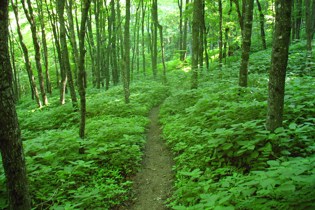
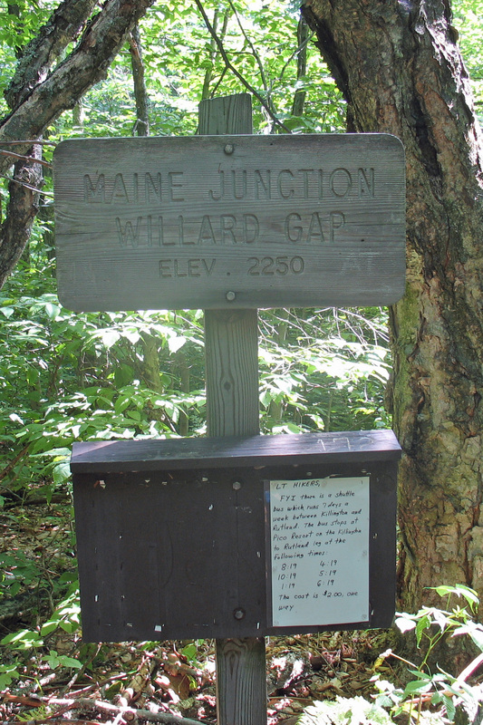
I took a leisurely breakfast of oatmeal, coffee, peanut butter toast and OJ at the Inn this morning before packing up and hitting the trail. It was a muggy morning but the hike up to the ridge was pleasant. I reached Maine Junction pretty early, bade farewell to the AT and headed north toward Canada, planning to stop at Rolston Rest for the night. I rolled in a little after noon and broke out some lunch. The shelter was nice but a lot of trash had been left and had attracted a lot of flies. Since it was early and I was feeling good I decided to to leave the flies behind and move to the next shelter which was 8 miles away. Despite warnings that the LT north of Maine Junction was much more obscure I found the trail to be comparable to the sections I'd hiked in previous days. Today's section is also reported to be thick with nettles. I don't know what they look like but I must have successfully avoided them since nothing stung me.
There were few landmarks today to help me track my progress. The terrain was rolling and the trail was a long green tunnel. At around the 8-mile mark I started not to feel well and was regretting my decision to go past Rolston Rest. My feet were hurting and I was hot, nauseous, and dizzy. Finally I came across the Green Road, a rare position marker, where I had four miles more hiking to go. I was feeling worse and thinking I might need to pitch my tent. Both fee were getting really bad and it was working its way up my leg. I stopped for a long break: snack, water, foot fix. I tried lacing my boots differently to take pressure off the problem areas. I felt a lot better after that so moved on but my feet weren't really better.
At Telephone Gap I spooked a bear! I never got a good look at her. From here I had 3 km to go and fortunately most of it was gradually uphill, as downhill was worst on my feet and knee. The last 3 km took a long time but I finally reached the side trail to the shelter. The David Logan shelter is a bit old and weary but has a good design - table between bunk beds - and the "porch" has a chicken-wire wall to keep the porcupines out. The setting is beautiful and the spring is refreshingly frigid. Another hiker, Coach K, is in for his second night of a week-long northbound section. As he had a phone and good reception I opted to call home and give my feet a break before continuing. Hot and muggy tonight - not good sleeping.
Tuesday, 08 July 2008
I tried to call home this morning to have Kevin pick me up at Brandon Gap. It would be more than twice as far as taking the side trail but it would involve less descent and give me an easier way to resume my hike. I missed him so I headed down the New Boston Trail as we had arranged last night. At least I'm getting a start on my LT side-to-side. This trail was uneventful, mostly grown over logging road and then 4WD road. I flushed three Ruffed Grouse and passed a group of horseback riders. The trail was well signed for snowmobilers so it was easy to find my way out. Once I got to the pavement I continued walking until I came to a comfortable place to wait - someone's extended yard which was mowed and surrounded by trees and which gave me a good view of the road. While I waited I was approached rather closely by two White Tail does.